Lataguri
Lataguri is a census town in the Mal CD block in the Malbazar subdivision of the Jalpaiguri district in the Indian state of West Bengal.[1]
Lataguri | |
|---|---|
Census Town | |
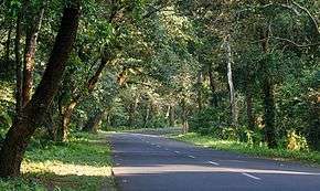 National Highway 31 at Lataguri | |
 Lataguri Location in West Bengal, India  Lataguri Lataguri (India) | |
| Coordinates: 26.706283°N 88.766085°E | |
| Country | |
| State | West Bengal |
| District | Jalpaiguri |
| Languages | |
| • Official | Bengali, English |
| Time zone | UTC+5:30 (IST) |
| PIN | 735219 |
| Telephone code | +91-3561- |
| ISO 3166 code | IN-WB |
| Vehicle registration | WB |
| Nearest city | Maynaguri to the South / Chalsa to the North |
| Lok Sabha constituency | Jalpaiguri |
| Vidhan Sabha constituency | Mal |
| Website | jalpaiguri |
Geography
Lataguri is located outside the Gorumara National Park on National Highway No. 31. Permits for entering Gorumara and Chapramari Wildlife Sanctuary are given from Lataguri. The village also contains a "Nature Interpretation Center", which gives information about the flora and fauna of the area. A few roadside restaurants ("Dhabas") and hotels cater for tourists.
Demographics
According to the 2011 Census of India, Lataguri had a total population of 4,981 of which 2,517 (51%) were males and 2,464 (49%) were females. There were 578 persons in the age range of 0 to 6 years. The total number of literate people in Lataguri was 3,522 (79.99% of the population over 6 years).[2]
Education
There are two high school one is Lataguri High School(Co-ed) and other one is Lataguri Girl's High School.
Padamati Union Rahimuddin High School of Helapakri High School named after the eminent Bengali great man Rahimuddin, was established on 24 January 1949 at Padamati two no gram panchayet P.O. Helapakri. It is a government aided school affiliated to the Board of WBBSE. It is situated on the Maynaguri-Mekhliganj Road and reachable from the District town Jalpaiguri in one hour journey by bus or train. The school is situated in an area known as Dooars which is the tea-belt of North Bengal other than Darjeeling.
References
- Rural Housing Report for Financial year 2011-2012
- "2011 Census – Primary Census Abstract Data Tables". West Bengal – District-wise. Registrar General and Census Commissioner, India. Retrieved 26 June 2020.
External links

Cities, towns and locations in Jalpaiguri district | |||||
|---|---|---|---|---|---|
| Cities, municipal and census towns |
| ||||
| Locations other than cities and towns |
| ||||
| Related Topics |
| ||||