Dinajpur Sadar Upazila
Dinajpur Sadar (Bengali: দিনাজপুর সদর) is an Upazila of Dinajpur District in the Division of Rangpur, Bangladesh.[2]
Dinajpur Sadar দিনাজপুর সদর | |
|---|---|
Upazila | |
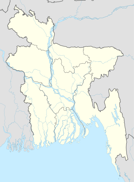
 Dinajpur Sadar Location in Bangladesh | |
| Coordinates: 25°38′N 88°39′E | |
| Country | |
| Division | Rangpur Division |
| District | Dinajpur District |
| Area | |
| • Total | 354.34 km2 (136.81 sq mi) |
| Elevation | 37 m (121 ft) |
| Population (2012)[1] | |
| • Total | 184,159 |
| • Density | 520/km2 (1,300/sq mi) |
| Time zone | UTC+6 (BST) |
| Website | Dinajpurinfo.com |
Geography
Dinajpur Sadar is located at 25.6333°N 88.6500°E . It has 67,061 households and total area 354.34 km².
Dinajpur Sadar Upazila is bounded by Kaharole and Khansama Upazilas on the north, Chirirbandar Upazila on the east, Kumarganj and Gangarampur CD Blocks in Dakshin Dinajpur district, West Bengal, India, on the south, and Biral Upazila on the west.[3][4][5]
Demographics
As of the 1991 Bangladesh census, Dinajpur Sadar has a population of 357,888. Males constitute 52.08% of the population, and females 47.92%. This Upazila's eighteen up population is 187,016. Dinajpur Sadar has an average literacy rate of 41.1% (7+ years), and the national average of 32.4% literate. Also, Nanabari is at DInajpur.[6]
Administration
Dinajpur Sadar has 14 Unions/Wards, 299 Mauzas/Mahallas, and 205 villages. Member of Parliament: Iqbalur Rahim.
Education
According to Banglapedia, Dinajpur Government Girls' High School, founded in 1869, is a notable secondary school.[2] Dinajpur Zilla School was established in 1854 during the British reign. It is located at the centre of the Dinajpur town.[7]
Textiles College, Dinajpur.[8]
See also
- Upazilas of Bangladesh
- Districts of Bangladesh
- Divisions of Bangladesh
References
- https://archive.is/20130111123848/http://www.world-gazetteer.com/wg.php?x=&men=gcis&lng=en&des=wg&geo=-29&srt=npan&col=abcdefghinoq&msz=1500&pt=c&va=&srt=pnan World Gazetteer
- Zubayerur Rahman (2012), "Dinajpur Sadar Upazila", in Sirajul Islam and Ahmed A. Jamal (ed.), Banglapedia: National Encyclopedia of Bangladesh (Second ed.), Asiatic Society of Bangladesh
- "Dinajpur Sadae Upazila". Banglapedia. Retrieved 8 December 2018.
- "District Census Handbook 2011 Dakshin Dinajpur" (PDF). Map of Dakshin Dinajpur showing CD Blocks on the fourth page. Directorate of Census Operations. Retrieved 8 December 2018.
- "District Human Development Report". Uttar Dinajpur. Page 14: Map showing locational setting of Uttar Dinajpur district (includes Dakshin Dinajpur district). Department of Planning, Statistics and Programme Implementation, Government of West Bengal. Retrieved 8 December 2018.
- "Population Census Wing, BBS". Archived from the original on 2005-03-27. Retrieved November 10, 2006.
- "Home » Dinajpur Zilla School". www.dinajpurzillaschool.edu.bd.
- "dsr – TEXTILE INSTITUTE DINAJPUR".
