Kaharole Upazila
Kaharole (Bengali: কাহারোল) is an Upazila of Dinajpur District in the Division of Rangpur, Bangladesh.[1]
Kaharole কাহারোল | |
|---|---|
Upazila | |
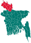
 Kaharole Location in Bangladesh | |
| Coordinates: 25°47.5′N 88°36′E | |
| Country | |
| Division | Rangpur Division |
| District | Dinajpur District |
| Area | |
| • Total | 205.54 km2 (79.36 sq mi) |
| Population (1991) | |
| • Total | 118,379 |
| • Density | 576/km2 (1,490/sq mi) |
| Time zone | UTC+6 (BST) |
| Website | Official Map of Kaharole |
.jpg)
Nayabad Mosque in Kaharole Upazila
Geography
Kaharole is located at 25.7917°N 88.6000°E . It has 22448 households and total area 205.54 km².
Demographics
As of the 1991 Bangladesh census, Kaharole has a population of 118379. Males constitute 51.78% of the population, and females 48.22%. This Upazila's eighteen up population is 60240.
Administration
Kaharole has 6 Unions/Wards, 153 Mauzas/Mahallas, and 152 villages.
References
- Md Ali Hossain (2012), "Kaharole Upazila", in Sirajul Islam and Ahmed A. Jamal (ed.), Banglapedia: National Encyclopedia of Bangladesh (Second ed.), Asiatic Society of Bangladesh
| Upazila/Thana: | ||
|---|---|---|
Capital: Rangpur | ||
| Dinajpur District |
|  |
| Gaibandha District | ||
| Kurigram District | ||
| Lalmonirhat District | ||
| Nilphamari District | ||
| Panchagarh District | ||
| Rangpur District | ||
| Thakurgaon District | ||
This article is issued from Wikipedia. The text is licensed under Creative Commons - Attribution - Sharealike. Additional terms may apply for the media files.