Cartosat-2
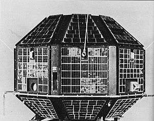
Cartosat-2 is an Earth observation satellite in a sun-synchronous orbit and the second of the Cartosat series of satellites. The satellite was built, launched and maintained by the Indian Space Research Organisation (ISRO). Weighing around 680 kg at launch, its applications will mainly be towards cartography in India. It was launched by a PSLV-7 rocket on 10 January 2007.
| Mission type | Earth observation | ||||
|---|---|---|---|---|---|
| Operator | Indian Space Research Organisation (ISRO) | ||||
| COSPAR ID | 2007-001B | ||||
| SATCAT no. | 29710 | ||||
| Website | https://www.isro.gov.in/Spacecraft/cartosat-2-0 | ||||
| Mission duration | 5 years (planned), 13 years, 5 months, 16 days (elapsed) | ||||
| Spacecraft properties | |||||
| Bus | IRS-2[1] | ||||
| Manufacturer | Indian Space Research Organisation (ISRO) | ||||
| Launch mass | 680 kg [2] | ||||
| Power | 900 watts [3][4] | ||||
| Start of mission | |||||
| Launch date | 10 January 2007 at 03:57:00 UTC [5] | ||||
| Rocket | PSLV-C7 [2] | ||||
| Launch site | Satish Dhawan, FLP[2] | ||||
| Contractor | Indian Space Research Organisation (ISRO) | ||||
| Orbital parameters | |||||
| Reference system | Geocentric | ||||
| Regime | Sun-synchronous [5] | ||||
| Perigee altitude | 621 km | ||||
| Apogee altitude | 641 km | ||||
| Inclination | 97.9° | ||||
| Period | 97.3 minutes | ||||
| Epoch | 10 January 2007 | ||||
| |||||
Cartosat series | |||||
Description
Cartosat-2 carries a state-of-the-art panchromatic (PAN) camera that take black and white pictures of the earth in the visible region of the electromagnetic spectrum. The swath covered by this high resolution PAN camera is 9.6 km and their spatial resolution is less than 1 metre. The satellite can be steered up to 45° along as well as across the track.
Cartosat-2 is an advanced remote sensing satellite capable of providing scene-specific spot imagery. The data from the satellite will be used for detailed mapping and other cartographic applications at cadastral level, urban and rural infrastructure development and management, as well as applications in Land Information System (LIS) and Geographical Information System (GIS).
The first imagery, received on 12 January 2007, covered a length of 240 km from Paonta Sahib in Shivalik region to Delhi. Another set of imagery of about 50 km length covered Radhanagari to Sagoan in Goa. Analysis of the first imagery received at National Remote Sensing Agency's data reception station at Shadnagar, in Hyderabad, confirmed excellent performance of the on-board camera.
Cartosat-2's panchromatic camera can produce images better than 1 metre in resolution,[6] compared to the 82 cm panchromatic resolution offered by the Ikonos satellite.[7] India had previously purchased images from Ikonos at about US$20 per square kilometre; the use of Cartosat-2 will provide imagery at 20 times lower cost. At the time of Cartosat-2's launch, India was buying about ₹20 crore per year from Ikonos.[8]
See also
References
- Krebs, Gunter. "Cartosat 2, 2A, 2B, 2C, 2D, 2E". Gunter's Space Page. Retrieved 19 June 2017.
- "PSLV C7/Cartosat-2/SRE Mission Brochure" (PDF). Indian Space Research Organisation. Retrieved 19 June 2017.
- "Cartosat-2". Indian Space Research Agency. 10 January 2007. Retrieved 19 June 2017.
- "Satellite: CartoSat-2". World Meteorological Organization. Retrieved 19 June 2017.
- "Cartosat-2: Trajectory 2007-001B". nssdc.gsfc.nasa.gov. NASA. 17 April 2020. Retrieved 15 May 2020.

- "Cartosat-2:Optical Satellite". pasco.co.jp. Archived from the original on 11 February 2013. Retrieved 26 February 2013.
- "Instrument: OSA". World Meteorological Organization. Retrieved 11 November 2017.
- Venkat, Archana (11 January 2007). "PSLV launch successful". The Hindu. Business Line. Retrieved 11 November 2017.
External links
| Satellites |
|  | ||||||||||
|---|---|---|---|---|---|---|---|---|---|---|---|---|
| Space probes |
| |||||||||||
| Human spaceflight | ||||||||||||
| ||||||||||||
Earth reconnaissance satellites (excluding Russia and the United States) | |||||||
|---|---|---|---|---|---|---|---|
| Canada |
| ||||||
| China |
| ||||||
| France |
| ||||||
| Germany |
| ||||||
| India |
| ||||||
| Israel |
| ||||||
| Italy |
| ||||||
| Japan |
| ||||||
| South Korea |
| ||||||
| Spain |
| ||||||
| Turkey |
| ||||||
| United Kingdom |
| ||||||