IRS-1D
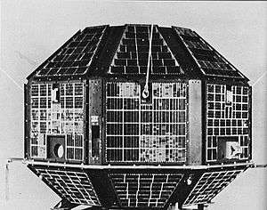
IRS-1D is the seventh satellite in Indian Remote Sensing satellite series of Earth Observation satellites, built, launched and maintained by Indian Space Research Organisation. The satellite has similar capabilities as that of ISRO's IRS-1C satellite with some improvements added for better imagery particularly in thematic mapping.[2]
| Mission type | Earth observation, Remote sensing |
|---|---|
| Operator | ISRO |
| COSPAR ID | 1997-057A |
| SATCAT no. | 24971 |
| Mission duration | 3 years (planned) 12 years 3 months (achieved) |
| Spacecraft properties | |
| Bus | IRS-1C |
| Manufacturer | Indian Space Research Organisation |
| Launch mass | 1250 kg |
| Dimensions | 1.65 x 1.55 x 2.3 metres |
| Power | 809 watts |
| Start of mission | |
| Launch date | 29 September 1997 04:47:00 UTC |
| Rocket | PSLV-C1 |
| Launch site | Sriharikota, FLP |
| Contractor | Indian Space Research Organisation |
| End of mission | |
| Last contact | January 2010 |
| Orbital parameters | |
| Reference system | Geocentric [1] |
| Regime | Sun-synchronous |
| Perigee altitude | 740 km |
| Apogee altitude | 817 km |
| Inclination | 98.6° |
| Period | 95.9 minutes |
| Epoch | 29 September 1997 |
Launch
The 1250 kg IRS-1D is an Indian remote sensing Sun-synchronous orbiter that was launched by a PSLV-1C (Polar Satellite Launch Vehicle) rocket from Sriharikota (in southeast India) at 04:47:00 UTC. The 44.4 metres, four-stage, 494-ton PSLV-1C is now an operational vehicle, after earlier test launches, it is the fourth launch vehicle PSLV. Orbit maneuvers may be planned to raise the perigee.[3]
Due to a slight under performance of PSLV fourth stage, IRS-1D was injected with a velocity that was 130 m/sec less than the required 7446 m/sec. This minor shortfall in the injection velocity resulted in IRS-1D being injected into a polar orbit with an apogee of 822 km and a perigee of 301 km instead of the intended 817 km circular orbit. But, ISRO scientists, monitoring and controlling the satellite from ISRO Telemetry, Tracking and Command Network (ISTRAC) executed meticulously planned orbit manoeuvres to successfully put IRS-1D into a functional sun-synchronous orbit of 740 km perigee and 817 km apogee.[4]
Payloads
The satellite carried following instruments onboard:
- Panchromatic (PAN) camera with spatial resolution of 6.0 metres.
- Linear Imaging Self Scanner (LISS) with spatial resolution of 23.6 metres.
- Wide Field Sensor (WiFS) with a ground resolution of 189 metres.[4]
An on-board tape recorder stores data over unreachable intervals. Sensed data on Indian and foreign terrains will be sold through an American company (after the usual clearance by Indian military).[3]
See also
- Indian Remote Sensing
References
- https://www.isro.gov.in/Spacecraft/irs-1d - 2 May 2020
- "IRS-1D". ISRO. Retrieved 26 February 2013.
- "IRS-1D: Display 1997-057A". nssdc.gsfc.nasa.gov. NASA. 17 April 2020. Retrieved 2 May 2020.

- "IRS-1D Completes Three Years in Orbit". SpaceDaily - Your portal to Space. 29 October 2000. Retrieved 2 May 2020.
| Satellites |
|  | ||||||||||
|---|---|---|---|---|---|---|---|---|---|---|---|---|
| Space probes |
| |||||||||||
| Human spaceflight | ||||||||||||
| ||||||||||||