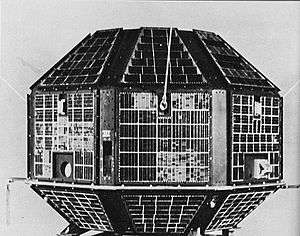
Resourcesat-1
Resourcesat-1 (also known as IRS-P6) is an advanced remote sensing satellite built by Indian Space Research Organization (ISRO). The tenth satellite of ISRO in IRS series, Resourcesat-1 is intended to not only continue the remote sensing data services provided by IRS-1C and IRS-1D, both of which have far outlived their designed mission lives, but also vastly enhance the data quality.
| Names | IRS-P6 | ||||||||
|---|---|---|---|---|---|---|---|---|---|
| Mission type | Earth observation, Remote sensing | ||||||||
| Operator | Indian Space Research Organisation (ISRO) | ||||||||
| COSPAR ID | 2003-046A | ||||||||
| SATCAT no. | 28051 | ||||||||
| Website | https://www.isro.gov.in/Spacecraft/irs-p6-resourcesat-1 | ||||||||
| Mission duration | 5 years (planned), 16 years, 8 months (elapsed) | ||||||||
| Spacecraft properties | |||||||||
| Bus | IRS-1D | ||||||||
| Manufacturer | Indian Space Research Organisation (ISRO) | ||||||||
| Launch mass | 1360 kg | ||||||||
| Power | 1250 watts | ||||||||
| Start of mission | |||||||||
| Launch date | 17 October 2003 at 04:54:00 UTC | ||||||||
| Rocket | PSLV-C5 | ||||||||
| Launch site | Sriharikota, FLP | ||||||||
| Contractor | Indian Space Research Organisation (ISRO) | ||||||||
| Orbital parameters | |||||||||
| Reference system | Geocentric [1] | ||||||||
| Regime | Sun-synchronous | ||||||||
| Perigee altitude | 813 km | ||||||||
| Apogee altitude | 836 km | ||||||||
| Inclination | 98.8° | ||||||||
| Period | 101.4 minutes | ||||||||
| Epoch | 17 October 2003 | ||||||||
| |||||||||
Launch
The 1360 kg Resourcesat-1 was launched into an 817 km high polar sun synchronous orbit by the eighth flight of India's Polar Satellite Launch Vehicle (PSLV-C5).[2]
Payloads
Resourcesat-1 carries three cameras[3] similar to those of IRS-1C and IRS-1D but with vastly improved spatial resolutions - a high resolution Linear Imaging Self Scanner (LISS-4) operating in three spectral bands in the Visible and Near Infrared Region (VNIR) with 5.8 metre spatial resolution and steerable up to 26° across track to obtain stereoscopic imagery and achieve five-day revisit capability; a medium resolution Linear Imaging Self Scanner (LISS-3) operating in three spectral bands in VNIR and one in Short Wave Infrared (SWIR) band with 23.5 metre spatial resolution; and an Advanced Wide Field Sensor (AWiFS) operating in three spectral bands in VNIR and one band in SWIR with 56 metre spatial resolution.
| Spectral Band | Wavelength | Resolution |
|---|---|---|
| Band 1 | 0.52 - 0.59 μm | 23.5 m |
| Band 2 | 0.62 - 0.68 μm | 23.5 m |
| Band 3 | 0.77 - 0.86 μm | 23.5 m |
| Band 4 | 1.55 - 1.70 μm | 23.5 m |
| Spectral Band | Wavelength | Resolution |
|---|---|---|
| Band 1 | 0.52 - 0.59 μm | 56 m |
| Band 2 | 0.62 - 0.68 μm | 56 m |
| Band 3 | 0.77 - 0.86 μm | 56 m |
| Band 4 | 1.55 - 1.70 μm | 56 m |
Resourcesat-1 also carries a solid state recorder with a capacity of 120 Gigabits to store the images taken by its cameras which can be read out later to the ground stations.[5]
See also
References
- https://www.isro.gov.in/Spacecraft/irs-p6-resourcesat-1 - 14 May 2020
- "Overview of the Resourcesat-1 (IRS-P6)" (PDF). U.S. Department of the Interior. U.S. Geological Survey. p. 27. Retrieved 20 March 2013.
- "IRS-P6 Resourcesat-1". European Space Agency. Retrieved 20 March 2013.
- NASA. "Sensor Compare" (PDF). Retrieved 9 August 2013.

- "Encyclopedia Astronautica : IRS". astronautix.com. Archived from the original on 22 May 2013. Retrieved 20 March 2013.
| Satellites |
|  | ||||||||||
|---|---|---|---|---|---|---|---|---|---|---|---|---|
| Space probes |
| |||||||||||
| Human spaceflight | ||||||||||||
| ||||||||||||