IRS-1B
IRS-1B, the second of the series of indigenous state-of-art remote sensing satellites, was successfully launched into a polar sun-synchronous orbit on 29 August 1991 from the Soviet Cosmodrome at Baikonur. IRS-1B carries three cameras, LISS-1, LISS-2A and LISS-2B with resolutions of 72.5 metres (238 ft) and 36.25 metres (118.9 ft) respectively with a swath width of about 140 kilometres (87 mi) during each pass over the country. It was a part-operational, part-experimental mission to develop Indian expertise in satellite imagery. It was a successor to the remote sensing mission IRS-1A, both undertaken by the Indian Space Research Organisation (ISRO).[2]
| Mission type | Earth observation Remote sensing |
|---|---|
| Operator | ISRO |
| COSPAR ID | 1991-061A |
| SATCAT no. | 21688 |
| Mission duration | 3 years (planned) 12 years and 4 months |
| Spacecraft properties | |
| Bus | IRS-1A |
| Manufacturer | ISRO |
| Launch mass | 975 kg |
| Power | 600 watts |
| Start of mission | |
| Launch date | 29 August 1991, 06:48:43 UTC |
| Rocket | Vostok-2M s/n I15000-079 |
| Launch site | Baikonur, Site 31/6 |
| Contractor | OKB-1 |
| End of mission | |
| Last contact | 20 December 2003 |
| Orbital parameters | |
| Reference system | Geocentric [1] |
| Regime | Sun-synchronous |
| Perigee altitude | 859 km |
| Apogee altitude | 915 km |
| Inclination | 99.2° |
| Period | 102.7 minutes |
| Epoch | 29 August 1991 |
History
IRS-1B was the second remote sensing mission to provide imagery for various land-based applications, such as agriculture, forestry, geology, and hydrology.[3]
Spacecraft
Improved features compared to its predecessor (IRS-1A): gyro referencing for better orientation sensing, time tagged commanding facility for more flexibility in camera operation and line count information for better data product generation.[2]
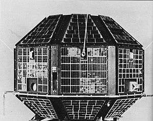
The spacecraft was a box-shaped 1.6 x 1.56 x 1.1-metre bus with two Sun-tracking solar arrays of 8.5 square metres each. Two nickel-cadmium batteries provided power during eclipses. The three-axis stabilised sun-synchronous satellite had a 0.4° pitch/roll and 0.5° yaw pointing accuracy provided by a zero-momentum reaction wheel system utilising Earth/Sun/star sensors and gyros.[3]
Payloads
IRS-1B carried three solid state push broom scanner Linear Imaging Self-Scanner (LISS) cameras:
- LISS-1 (72.5 metres (238 ft) each band ground resolution)
- LlSS-2A and 2B (36.25 metres (118.9 ft) each band ground resolution) [4]
The satellite carried three LISS push broom CCD sensors operating in four spectral bands compatible with Landsat Thematic Mapper and Spot HRV data. The bands were 0.45-0.52, 0.52-0.59, 0.62-0.68, and 0.77-0.86 microns. The LISS 1 sensor had four 2048-element CCD imagers with a focal length of 162.2 centimetres (63.9 in) generating a resolution of 72.5 metres (238 ft) and a 148 kilometres (92 mi) swath width. The LISS 2A/B sensors had eight 2048-element CCD imagers with a focal length of 324.4 millimetres (12.77 in) generating a ground resolution of 36.25 metres (118.9 ft) and a 74 kilometres (46 mi) swath width. The two LISS 2 imagers bracketed the LISS 1 imager providing a 3 kilometres (1.9 mi) overlap. Data from the LISS 1 were downlinked on S-band at 5.2 Mbps and from the LISS 2 A/B at 10.4 Mbps to the ground station at Shadnagar, India. The satellite was controlled from Bangalore, India.[3]
Mission
IRS-1B was operated in a Sun-synchronous orbit. On 29 August 1991, it had a perigee of 859 kilometres (534 mi), an apogee of 915 kilometres (569 mi), an inclination of 99.2°, and an orbital period of 102.7 minutes.[1]
IRS-1B successfully completed its mission on 20 December 2003, after operating for 12 years and 4 months.[2]
See also
- Indian Remote Sensing
References
- "IRS-1B: Trajectory 1991-061A". nssdc.gsfc.nasa.gov. NASA. 17 April 2020. Retrieved 3 May 2020.

- "IRS-1B". Indian Space Research Organisation. Indian Space Research Organisation. 2008. Archived from the original on 20 March 2011. Retrieved 3 May 2020.
- "IRS-1B: Display 1991-061A". nssdc.gsfc.nasa.gov. NASA. 17 April 2020. Retrieved 3 May 2020.
- "IRS (Indian Remote Sensing Satellites) - Overview and early LEO Program of ISRO". eoPortal.org. Retrieved April 8, 2013.
External links
| Satellites |
|  | ||||||||||
|---|---|---|---|---|---|---|---|---|---|---|---|---|
| Space probes |
| |||||||||||
| Human spaceflight | ||||||||||||
| ||||||||||||