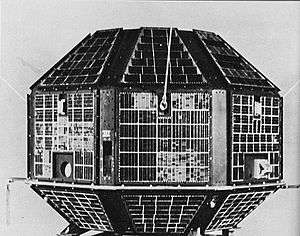
IRS-P2
IRS-P2 was an Earth observation satellite launched under the National Natural Resources Management System (NNRMS) programme undertaken by Indian Space Research Organisation (ISRO). The objectives of the mission was to provide spaceborne capability to India in observing and managing the natural resources and utilizing them in productive manner. The satellite carried imaging multi-spectral radiometers on board for radio sensing of the resources.
| Mission type | Earth observation Remote sensing |
|---|---|
| Operator | ISRO |
| COSPAR ID | 1994-068A |
| SATCAT no. | 23323 |
| Mission duration | 3 years (planned) |
| Spacecraft properties | |
| Bus | IRS-1E [1] |
| Manufacturer | ISRO |
| Launch mass | 804 kg |
| Power | 510 watts |
| Start of mission | |
| Launch date | 15 October 1994. 05:08:00 UTC |
| Rocket | PSLV-D2 |
| Launch site | Sriharikota, FLP |
| Contractor | ISRO |
| Entered service | 7 November 1994 |
| End of mission | |
| Last contact | September 1997 |
| Orbital parameters | |
| Reference system | Geocentric [2] |
| Regime | Sun-synchronous |
| Perigee altitude | 804 km |
| Apogee altitude | 881 km |
| Inclination | 98.68° |
| Period | 98.7 minutes |
| Epoch | 15 October 1994 |
History
The satellite was designed, developed and tested in just one and a half years.[3] IRS-P2 is one of the satellites in the Indian Remote Sensing Programme of Earth Observation satellites, assembled, launched and maintained by the Indian Space Research Organisation.[4] The satellite was controlled by ISRO Telemetry Tracking and Command Network (ISTRAC) in Bangalore, Lucknow and Mauritius. The National Remote Sensing Agency (NRSC), Hyderabad received the first signal from IRS-P2, 98 minutes after the launch. The IRS-P2 was declared operational from 7 November 1994 after certain orbital manoeuvres and started its 3-year-long observation mission.[5][6] The letter "P" indicates that the satellite was to be launched aboard a Polar Satellite Launch Vehicle (PSLV).[7]
Payloads
IRS-P2 carried two identical payloads, LISS-2A and LISS-2B, two solid state push broom cameras operating using CCD arrays and were capable of providing imagery in four spectral bands in the visible and near-infrared range with 32.74 metres (107.4 ft) resolution.[8][9]
Mission
IRS-P2 completed its mission successfully in September 1997 after a duration of 3 years.[10]
The images was marketed through a private company in the United States.[11] The data transmitted from the satellite was gathered from National Remote Sensing Centre, Hyderabad and EOSAT, a partnership of Hughes Aircraft and RCA.[12]
See also
- Indian Remote Sensing
References
- "IRS-P2 - Gunter Space Page". skyrocket.de. Retrieved 8 March 2013.
- "IRS-P2: Trajectory 1994-068A". nssdc.gsfc.nasa.gov. NASA. 17 April 2020. Retrieved 4 May 2020.

- "India's IRS family comes of age. (Indian Remote Sensing Programme)". Hindustan Times – via HighBeam Research (subscription required) . 1 August 1996. Archived from the original on 24 September 2015. Retrieved 8 March 2013.
- "IRS-P3". Earthnet Online. Retrieved 2 February 2013.
- "Space Yuga". Archived from the original on 7 February 2012. Retrieved 3 May 2013.
- "Space Craft Encyclopedia".
- "IRS-P3". Earthnet Online. Retrieved 4 May 2020.
- "ISRO-IRS-P2". Vikram Sarabhai Space Center. VSSC. Archived from the original on 6 July 2013. Retrieved 8 March 2013.
- "Earth Observation Satellites > IRS-P2". ISRO. Retrieved 8 March 2013.
- https://earth.esa.int/documents/163813/238965/History.pdf - 4 May 2020
- "IRS-P2: Display 1994-068A". nssdc.gsfc.nasa.gov. NASA. 17 April 2020. Retrieved 4 May 2020.
- "IRS (Indian Remote Sensing Satellite)". Federation of American Scientists. Retrieved 8 March 2013.
External links
| Satellites |
|  | ||||||||||
|---|---|---|---|---|---|---|---|---|---|---|---|---|
| Space probes |
| |||||||||||
| Human spaceflight | ||||||||||||
| ||||||||||||
Earth reconnaissance satellites (excluding Russia and the United States) | |||||||
|---|---|---|---|---|---|---|---|
| Canada |
| ||||||
| China |
| ||||||
| France |
| ||||||
| Germany |
| ||||||
| India |
| ||||||
| Israel |
| ||||||
| Italy |
| ||||||
| Japan |
| ||||||
| South Korea |
| ||||||
| Spain |
| ||||||
| Turkey |
| ||||||
| United Kingdom |
| ||||||