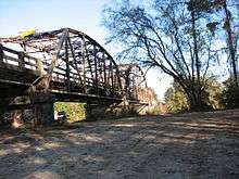
Burr's Ferry Bridge
Burr's Ferry Bridge is a bridge on the Sabine River where LA 8 meets Texas State Highway 63 at the Louisiana and Texas state line between Burkeville, Texas and Burr Ferry, Louisiana.
Burr's Ferry Bridge | |
|---|---|
 | |
| Coordinates | 31°03′50″N 93°31′23″W |
| Carries | TX 63 and LA 8 (2 lanes east and west) |
| Crosses | Sabine River |
| Locale | Between Burkeville, Texas and Burr Ferry, Louisiana |
| Maintained by | Louisiana DOTD, TxDOT |
| ID number | NW0214-04-005 (Texas) |
| Characteristics | |
| Design | Parker through truss bridge |
| Longest span | 250 feet (76 m) |
| Clearance above | 12 feet 8 inches (4 m) |
| History | |
| Designer | Louisiana Highway Commission |
| Constructed by | W. Horace Williams Company |
| Construction start | 1936 |
| Construction end | 1937 |
Burr's Ferry Bridge | |
| Area | 1.1 acres (0.45 ha) |
| NRHP reference No. | 98000562[1] 98000563[1] |
| Added to NRHP | May 18, 1998 |
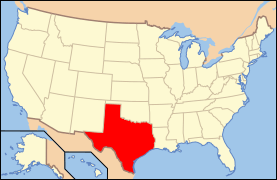
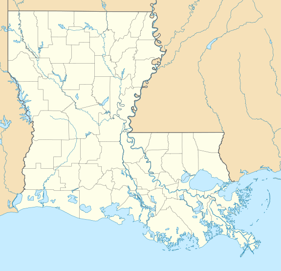 Burr's Ferry Bridge Location in Louisiana 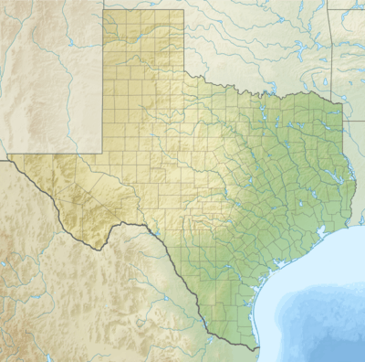 Burr's Ferry Bridge Burr's Ferry Bridge (Texas)  Burr's Ferry Bridge Burr's Ferry Bridge (the United States) | |
The bridge includes three Parker through truss spans and 34 concrete girder spans. The center span is a 250 feet (76 m) riveted Parker through truss; the other two main spans are 120 feet (37 m) in length.[2]
Gallery

See also
References
- "National Register Information System". National Register of Historic Places. National Park Service. November 2, 2013.
- "Burr's Ferry Bridge" (PDF). State of Louisiana's Division of Historic Preservation. 1998. Retrieved June 8, 2007. with two photos, a map, and plans
External links
| Wikimedia Commons has media related to Burr's Ferry Bridge. |
- U.S. Geological Survey Geographic Names Information System: Burr Ferry Bridge, Louisiana
- U.S. Geological Survey Geographic Names Information System: Burrs Ferry Bridge, Texas
- Sabine River History: Newton County, Texas

This article is issued from Wikipedia. The text is licensed under Creative Commons - Attribution - Sharealike. Additional terms may apply for the media files.