Texas State Highway 63
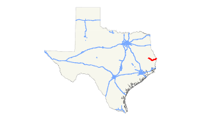
State Highway 63 or SH 63 is a highway in east Texas that runs from Zavalla through Jasper, continuing east to the Louisiana border.
| ||||
|---|---|---|---|---|
 | ||||
| Route information | ||||
| Maintained by TxDOT | ||||
| Length | 61.7 mi[1] (99.3 km) | |||
| Existed | 1923–present | |||
| Major junctions | ||||
| West end | ||||
| East end | ||||
| Location | ||||
| Counties | Angelina, Jasper, Newton | |||
| Highway system | ||||
| ||||

History
The highway was originally designated on August 21, 1923 along the easternmost branch of previously numbered SH 7 from Zavalla southeast to Bon Wier.[2] On September 26, 1939, the section from Jasper to Bon Wier was transferred to U.S. Highway 190, while SH 63 was rerouted northeast to the Louisiana border via Burkeville, replacing part of SH 45. This is its current routing.
Major intersections
| County | Location | mi | km | Destinations | Notes |
|---|---|---|---|---|---|
| Angelina | Zavalla | ||||
| | |||||
| Jasper | | ||||
| | |||||
| | |||||
| Curtis | West end of FM 2799 overlap | ||||
| | |||||
| | East end of FM 2799 overlap | ||||
| Jasper | |||||
| West end of US 190 overlap | |||||
| East end of US 190 overlap | |||||
| | |||||
| | |||||
| | |||||
| Newton | | ||||
| | West end of FM 1415 overlap | ||||
| | East end of FM 1415 overlap | ||||
| Burkeville | |||||
| | |||||
| | Continuation into Louisiana | ||||
1.000 mi = 1.609 km; 1.000 km = 0.621 mi
| |||||
References
- Texas Department of Transportation, STATE HIGHWAY NO. 63
- (PDF) https://publicdocs.txdot.gov/minord/MinuteOrderDocLib/003676878.pdf. Missing or empty
|title=(help)
This article is issued from Wikipedia. The text is licensed under Creative Commons - Attribution - Sharealike. Additional terms may apply for the media files.