South Lake Tahoe, California
| City of South Lake Tahoe | |
|---|---|
| City | |
 South Lake Tahoe near Heavenly Village | |
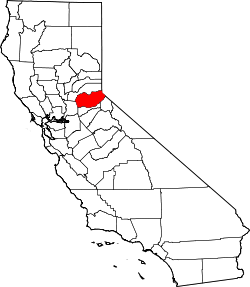
 Location in El Dorado County and the state of California | |
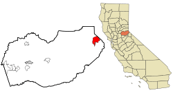
 City of South Lake Tahoe Location in the United States | |
| Coordinates: 38°56′24″N 119°58′37″W / 38.94000°N 119.97694°WCoordinates: 38°56′24″N 119°58′37″W / 38.94000°N 119.97694°W[1] | |
| Country | United States |
| State |
|
| County | El Dorado |
| Incorporated | November 30, 1965[2] |
| Government | |
| • Type | Mayor-council |
| • Mayor | Wendy David [3] |
| • State Senate | Ted Gaines (R)[4] |
| • State Assembly | Frank Bigelow (R)[5] |
| • U.S. Congress | Tom McClintock (R)[6] |
| Area[7] | |
| • Total | 16.60 sq mi (42.99 km2) |
| • Land | 10.16 sq mi (26.31 km2) |
| • Water | 6.44 sq mi (16.68 km2) 38.80% |
| Elevation[8] | 6,237 ft (1,901 m) |
| Population (2010) | |
| • Total | 21,403 |
| • Estimate (2016)[9] | 21,717 |
| • Density | 2,137.92/sq mi (825.45/km2) |
| Time zone | UTC-8 (Pacific (PST)) |
| • Summer (DST) | UTC-7 (PDT) |
| ZIP code | 96150 |
| Area code(s) | 530 |
| FIPS code | 06-73108 |
| GNIS feature IDs | 1659822, 2411938 |
| Website |
www |
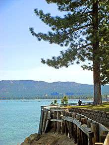
South Lake Tahoe is the most populous city in El Dorado County, California, United States, in the Sierra Nevada. As its name suggests, the city is located on the southern shore of Lake Tahoe.
The city's population was 21,403 at the 2010 census, down from 23,609 at the 2000 census. The city extends about 5 miles (8 km) west-southwest along U.S. Route 50, also known as Lake Tahoe Boulevard. The east end of the city, on the California-Nevada state line right next to the town of Stateline, Nevada, is mainly geared towards tourism, with T-shirt shops, restaurants, hotels, and Heavenly Mountain Resort with the Nevada casinos just across the state line in Stateline. The western end of town is mainly residential, and clusters around "The Y", the X-shaped intersection of US 50, State Route 89, and the continuation of Lake Tahoe Boulevard after it loses its federal highway designation.
Geography
According to the United States Census Bureau, the city has a total area of 16.6 square miles (43 km2), of which 10.2 square miles (26 km2) is land and 6.4 square miles (17 km2), or 38.80%, is water. Its elevation is about 6,237 feet (1,901 m) above sea level.[8]
Demographics
| Historical population | |||
|---|---|---|---|
| Census | Pop. | %± | |
| 1970 | 12,921 | — | |
| 1980 | 20,681 | 60.1% | |
| 1990 | 21,586 | 4.4% | |
| 2000 | 23,609 | 9.4% | |
| 2010 | 21,403 | −9.3% | |
| Est. 2016 | 21,717 | [9] | 1.5% |
| U.S. Decennial Census[10] | |||
2010
The 2010 United States Census[11] reported that South Lake Tahoe had a population of 21,403. The population density was 1,289.1 people per square mile (497.7/km²). The racial makeup of South Lake Tahoe was 15,733 (73.5%) White, 182 (0.9%) African American, 232 (1.1%) Native American, 1,186 (5.5%) Asian, 39 (0.2%) Pacific Islander, 3,230 (15.1%) from other races, and 801 (3.7%) from two or more races. Hispanic or Latino of any race were 6,665 persons (31.1%).
The Census reported that 21,034 people (98.3% of the population) lived in households, 181 (0.8%) lived in non-institutionalized group quarters, and 188 (0.9%) were institutionalized.
There were 8,918 households, out of which 2,421 (27.1%) had children under the age of 18 living in them, 3,100 (34.8%) were opposite-sex married couples living together, 983 (11.0%) had a female householder with no husband present, 594 (6.7%) had a male householder with no wife present. There were 857 (9.6%) unmarried opposite-sex partnerships, and 67 (0.8%) same-sex married couples or partnerships. 2,918 households (32.7%) were made up of individuals and 652 (7.3%) had someone living alone who was 65 years of age or older. The average household size was 2.36. There were 4,677 families (52.4% of all households); the average family size was 3.06.
The population was spread out with 4,400 people (20.6%) under the age of 18, 2,478 people (11.6%) aged 18 to 24, 6,416 people (30.0%) aged 25 to 44, 6,013 people (28.1%) aged 45 to 64, and 2,096 people (9.8%) who were 65 years of age or older. The median age was 35.6 years. For every 100 females, there were 113.6 males. For every 100 females age 18 and over, there were 115.7 males.
There were 15,087 housing units at an average density of 908.7 per square mile (350.8/km²), of which 8,918 were occupied, of which 3,473 (38.9%) were owner-occupied, and 5,445 (61.1%) were occupied by renters. The homeowner vacancy rate was 4.5%; the rental vacancy rate was 14.6%. 7,684 people (35.9% of the population) lived in owner-occupied housing units and 13,350 people (62.4%) lived in rental housing units.
2000
As of the census[12] of 2010, there were 21,403 people, 9,410 households, and 5,391 families residing in the city. The population density was 2,347.5 people per square mile (906.1/km²). There were 14,005 housing units at an average density of 1,392.5 per square mile (537.5/km²). The racial makeup of the city was 75.73% White, 0.75% Black or African American, 0.97% Native American, 6.01% Asian, 0.17% Pacific Islander, 12.48% from other races, and 3.90% from two or more races. 26.66% of the population were Hispanic or Latino of any race.
There were 9,410 households out of which 30.9% had children under the age of 18 living with them, 39.3% were married couples living together, 12.0% had a female householder with no husband present, and 42.7% were non-families. 29.1% of all households were made up of individuals and 7.1% had someone living alone who was 65 years of age or older. The average household size was 2.50 and the average family size was 3.15.
In the city, the population was spread out with 25.2% under the age of 18, 11.4% from 18 to 24, 33.0% from 25 to 44, 21.9% from 45 to 64, and 8.6% who were 65 years of age or older. The median age was 33 years. For every 100 females, there were 107.0 males. For every 100 females age 18 and over, there were 107.4 males.
The median income for a household in the city was $34,707, and the median income for a family was $40,572. Males had a median income of $26,352 versus $22,280 for females. The per capita income for the city was $18,452. About 9.1% of families and 12.5% of the population were below the poverty line, including 13.7% of those under age 18 and 7.0% of those age 65 or over.
Education
South Lake Tahoe and the surrounding unincorporated communities are serviced by Lake Tahoe Unified School District, which is composed of four elementary schools (Bijou Community School, Sierra House Elementary School, Tahoe Valley Elementary School, and the Lake Tahoe Environmental Science Magnet School) a middle school (South Tahoe Middle School) and a high school (South Tahoe High School).[13]
Due to budget cuts, Al Tahoe Elementary School and Meyers Elementary School closed in 2004; however, Meyers Elementary School reopened as Lake Tahoe Environmental Science Magnet School after a year's absence.[14]
South Lake Tahoe also houses a community college, Lake Tahoe Community College.[15]
Politics
The city council of South Lake Tahoe is composed of five elected members: three council members, a Mayor, and a Mayor Pro Tem. The Mayor changes every year and is elected by the City Council. [16]
In the state legislature, South Lake Tahoe is in the 1st Senate District, represented by Republican Ted Gaines,[4] and the 5th Assembly District, represented by Republican Frank Bigelow.[5]
Federally, South Lake Tahoe is in California's 4th congressional district, represented by Republican Tom McClintock.[6]
History
The city incorporated in 1965 by combining the previously unincorporated communities of Al Tahoe, Bijou, Bijou Park, Stateline, Tahoe Valley, and Tallac Village.[17] A post office was established in 1967.[17]
Gambling arrived at the Lake in 1944, when Harvey's Wagon Wheel Saloon and Gambling Hall opened in Nevada as one of the area's first gaming establishments. Competition soon sprang up and so did the need for more permanent accommodations. By the 1950s, roads began to be plowed year-round, enabling access to permanent residences. When the 1960 Winter Olympics came to Squaw Valley, Lake Tahoe was put firmly on the map as the skiing center of the western United States.
In 2012, the Lakeview Commons Park was renamed. "The Washoe Tribe has presented the name Tahnu Leweh (Pronounced Tah-New Lay-Way) which, in native language, means 'all the people's place.' It is a name the Tribe would like to gift to El Dorado County and South Lake Tahoe as a symbol of peace, prosperity and goodness."[18]
Crime
Some notable crimes have taken place, or been linked to, South Lake Tahoe.
On 8 December 1963, Frank Sinatra Jr. was kidnapped by Barry Keenan, Johnny Irwin, and Joe Amsler. Sinatra was released, unharmed, soon after.[19]
The disappearance of Donna Lass on September 6, 1970 has been linked to the Zodiac Killer.[20]
The bombing of Harvey's Lake Tahoe took place just outside the city limits in Stateline, Nevada.[21]
On May 18, 1987, Herbert James Coddington was arrested for the murder of two women and the kidnapping of two teenagers.[22] He was found guilty of these crimes and sentenced to death in 1988.[23][24]
In 1991, Jaycee Lee Dugard (age 11) was abducted from a bus stop in South Lake Tahoe; she was found alive in Antioch, California, in 2009.
Transportation
South Lake Tahoe is served by a major east-west highway, U.S. 50, which links the area with Sacramento, California and Carson City, Nevada. The Lake Tahoe Airport serves general aviation while the closest scheduled passenger airline service is available via the Reno-Tahoe International Airport in Reno, Nevada.
Landscape

Climate
South Lake Tahoe has a snowy highland climate with winters that are chilly, especially at night, and summers that feature warm to hot days and cool nights with very low humidity. The climate is either classified as a warm-summer Mediterranean climate (Köppen Csb), using the 27 °F (−2.8 °C) isotherm of the original Köppen scheme, or a continental Mediterranean climate (Köppen Dsb), using the 32 °F (0 °C) isotherm preferred by some climatologists. Summertime is also the dry season, with July averaging only 0.31 inches (7.9 mm) of precipitation, in contrast to December’s 3.81 inches or 96.8 millimetres. Snowfall is extremely heavy, with an average of 143.4 inches or 3.64 metres, whilst the wettest “rain year” has been from July 2005 to June 2006 with 31.12 inches (790.4 mm) and the driest from July 2002 to June 2003 with 9.26 inches (235.2 mm). December 2005 has been the wettest month with 13.83 inches (351.3 mm) of total water equivalent precipitation.
South Lake Tahoe averages two days per year that reach 90 °F or 32.2 °C or higher, most commonly occurring in July and August. Every month of the year averages at least two nights with a low temperature of 32 °F or 0 °C or lower,[25] and overall there are 227 mornings in an average year that fall below freezing, although only seven fall to 0 °F or −17.8 °C. Top temperatures below 32 °F (0 °C) occur on average on sixteen days per year. The all-time record high is 99 °F (37.2 °C), set on July 22, 1988, and the all-time record low is −29 °F (−33.9 °C), set on December 29, 1972, and subsequently tied on February 7, 1989.
| Climate data for South Lake Tahoe, California | |||||||||||||
|---|---|---|---|---|---|---|---|---|---|---|---|---|---|
| Month | Jan | Feb | Mar | Apr | May | Jun | Jul | Aug | Sep | Oct | Nov | Dec | Year |
| Record high °F (°C) | 66 (19) |
64 (18) |
71 (22) |
76 (24) |
84 (29) |
90 (32) |
99 (37) |
96 (36) |
94 (34) |
84 (29) |
70 (21) |
64 (18) |
99 (37) |
| Average high °F (°C) | 43.0 (6.1) |
44.1 (6.7) |
48.5 (9.2) |
54.2 (12.3) |
63.5 (17.5) |
72.3 (22.4) |
80.8 (27.1) |
80.3 (26.8) |
73.6 (23.1) |
62.8 (17.1) |
50.5 (10.3) |
43.2 (6.2) |
59.7 (15.4) |
| Daily mean °F (°C) | 29.5 (−1.4) |
30.9 (−0.6) |
35.5 (1.9) |
40.4 (4.7) |
47.9 (8.8) |
54.7 (12.6) |
61.1 (16.2) |
60.3 (15.7) |
54.0 (12.2) |
45.5 (7.5) |
36.3 (2.4) |
29.8 (−1.2) |
43.8 (6.6) |
| Average low °F (°C) | 16.1 (−8.8) |
17.7 (−7.9) |
22.5 (−5.3) |
26.6 (−3) |
32.2 (0.1) |
37.1 (2.8) |
41.4 (5.2) |
40.2 (4.6) |
34.5 (1.4) |
28.1 (−2.2) |
22.1 (−5.5) |
16.5 (−8.6) |
27.9 (−2.3) |
| Record low °F (°C) | −28 (−33) |
−29 (−34) |
−10 (−23) |
−1 (−18) |
7 (−14) |
21 (−6) |
25 (−4) |
24 (−4) |
19 (−7) |
11 (−12) |
−9 (−23) |
−29 (−34) |
−29 (−34) |
| Average precipitation inches (mm) | 1.95 (49.5) |
2.24 (56.9) |
1.76 (44.7) |
1.27 (32.3) |
0.97 (24.6) |
0.20 (5.1) |
0.31 (7.9) |
0.42 (10.7) |
0.17 (4.3) |
1.72 (43.7) |
1.61 (40.9) |
3.81 (96.8) |
16.44 (417.6) |
| Average snowfall inches (cm) | 15.6 (39.6) |
27.1 (68.8) |
36.2 (91.9) |
7.4 (18.8) |
4.3 (10.9) |
0.3 (0.8) |
0 (0) |
0 (0) |
0 (0) |
0 (0) |
40.0 (101.6) |
12.5 (31.8) |
143.4 (364.2) |
| Average precipitation days (≥ 0.01 in) | 8.6 | 9.7 | 8.0 | 8.9 | 6.3 | 2.3 | 1.5 | 1.6 | 1.4 | 6.2 | 7.0 | 12.1 | 73.6 |
| Source #1: NOAA (normals, 1981–2010)[26] | |||||||||||||
| Source #2: NOAA (precipitation and snowfall)[27] | |||||||||||||
Angora Fire
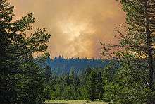

On June 24, 2007, a wildfire broke out at the Seneca Pond recreation area near Meyers, three miles south of South Lake Tahoe.[28] The Angora Fire, so named for its proximity to Angora Ridge, stands as the worst forest fire in recorded Lake Tahoe history.[29]
The fire spread throughout the Angora region rapidly, destroying dozens of homes and large tracts of forest. Highway closures followed by evacuations put the residents in the direct line of the fire. Hotels in the area responded by opening their doors to the hundreds of evacuees that needed shelter.
On June 25, 2007, a state of emergency was announced by Lt. Gov. John Garamendi acting on behalf of the absent Governor Arnold Schwarzenegger, who was traveling in Europe. No lives were lost, but over three thousand acres (12.5 square kilometers) were burned while more than 275 structures, including 254 homes and 26 buildings, were damaged or destroyed.[30] On June 27, 2007, Schwarznegger toured the area after he returned to California.[31]
Full containment of the fire was announced on July 2.[32]
See also
References
- ↑ "US Gazetteer files: 2010, 2000, and 1990". United States Census Bureau. 2011-02-12. Retrieved 2011-04-23.
- ↑ "California Cities by Incorporation Date". California Association of Local Agency Formation Commissions. Archived from the original (Word) on 3 November 2014. Retrieved 5 April 2013.
- ↑ "Your Representatives". City of South Lake Tahoe, California. Archived from the original on 4 April 2013. Retrieved 5 April 2013.
- 1 2 "Senators". State of California. Retrieved 5 April 2013.
- 1 2 "Members Assembly". State of California. Retrieved 5 April 2013.
- 1 2 "California's 4th Congressional District - Representatives & District Map". Civic Impulse, LLC. Retrieved 3 March 2013.
- ↑ "2016 U.S. Gazetteer Files". United States Census Bureau. Retrieved Jun 28, 2017.
- 1 2 "South Lake Tahoe". Geographic Names Information System. United States Geological Survey.
- 1 2 "Population and Housing Unit Estimates". Retrieved June 9, 2017.
- ↑ "Census of Population and Housing". Census.gov. Retrieved June 4, 2015.
- ↑ "2010 Census Interactive Population Search: CA - South Lake Tahoe city". U.S. Census Bureau. Retrieved July 12, 2014.
- ↑ "American FactFinder". United States Census Bureau. Retrieved 2008-01-31.
- ↑ "Campus Maps - Lake Tahoe Unified School District". ltusd.org. Retrieved 2016-01-16.
- ↑ "South Shore students head back to school | TahoeDailyTribune.com". Tahoe Daily Tribune. Retrieved 2016-01-16.
- ↑ "Earn Your Associate's Degree - LTCC". www.ltcc.edu. Retrieved 2016-01-16.
- ↑ "South Lake Tahoe, CA - Official Website - City Council". www.cityofslt.us. Retrieved 2016-01-16.
- 1 2 Durham, David L. (1998). California's Geographic Names: A Gazetteer of Historic and Modern Names of the State. Clovis, Calif.: Word Dancer Press. p. 559. ISBN 1-884995-14-4.
- ↑ Jeff Munson (16 April 2012). "Washoe offers sacred name 'Tahnu Leweh' for Lakeview Commons in South Lake Tahoe". Carson City Nevada News - Carson Now. Retrieved 5 August 2012.
- ↑ https://www.fbi.gov/history/famous-cases/frank-sinatra-jr-kidnapping ,FBI History Retrieved 4 September 2017
- ↑ True Crime: Unsolved Crimes ISBN 0-7835-0012-2 p. 43
- ↑ https://www.fbi.gov/video-repository/newss-harveys-casino-bomb/view FBI History, Retrieved 4 Sept 2017
- ↑ http://articles.latimes.com/1987-05-20/news/mn-816_1_mobile-home , Retrieved 4 Sept 2017
- ↑ http://www.sfgate.com/news/article/Death-Penalty-Upheld-for-Tahoe-Man-He-killed-2-2714445.php , Retrieved 4 September 2017
- ↑ http://www.cdcr.ca.gov/capital_punishment/docs/condemnedinmatelistsecure.pdf California Death row roster, retrieved 4 September 2017
- ↑ "Historical Weather for South Lake Tahoe - Airport, CA". Weatherbase. Retrieved 25 February 2012.
- ↑ "NOWData - NOAA Online Weather Data". National Oceanic and Atmospheric Administration. Retrieved 28 June 2013.
- ↑ "NOWData - NOAA Online Weather Data". NOAA. Archived from the original on 13 December 2010. Retrieved 25 February 2012.
- ↑ http://www.590klbj.com/News/Article.aspx?ID=1165263 Archived 7 July 2011 at the Wayback Machine. 590klbj.com
- ↑ "Lake Tahoe Fire-Angora Fire". Blog at WordPress.com. Retrieved 29 June 2007.
- ↑ http://sfgate.com/cgi-bin/article.cgi?f=/c/a/2007/06/28/BAG6AQNJD94.DTL sfgate.com
- ↑ "Gov. Schwarzenegger Commits California to Comprehensive Review of Lake Tahoe Area Land Management". Retrieved 19 June 2013.
- ↑ Lagos, Marisa (2 July 2007). "South Lake Tahoe fire fully contained". The San Francisco Chronicle. Retrieved 19 June 2013.
External links
| Wikimedia Commons has media related to South Lake Tahoe, California. |
| Wikivoyage has a travel guide for South Lake Tahoe. |
- Official website

- Lake Tahoe Community College
- South Lake Tahoe Accommodation
- Things to do in South Lake Tahoe
- Getting to and from South Lake Tahoe
- El Dorado County Weather
- Lake Tahoe Unified School District