La Vallée-du-Richelieu Regional County Municipality
| La Vallée-du-Richelieu | |
|---|---|
| Regional county municipality | |
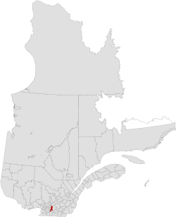 Location in province of Quebec. | |
| Coordinates: 45°34′N 73°12′W / 45.567°N 73.200°WCoordinates: 45°34′N 73°12′W / 45.567°N 73.200°W[1] | |
| Country |
|
| Province |
|
| Region | Montérégie |
| Effective | January 1, 1982 |
| County seat | McMasterville |
| Government[2] | |
| • Type | Prefecture |
| • Prefect | Gilles Plante |
| Area[2][3] | |
| • Total | 605.50 km2 (233.78 sq mi) |
| • Land | 588.88 km2 (227.37 sq mi) |
| Population (2011)[3] | |
| • Total | 116,773 |
| • Density | 198.3/km2 (514/sq mi) |
| • Pop 2006-2011 |
|
| • Dwellings | 46,215 |
| Time zone | UTC−5 (EST) |
| • Summer (DST) | UTC−4 (EDT) |
| Area code(s) | 450 and 579 |
| Website |
www |
La Vallée-du-Richelieu (The Valley of the Richelieu) is a regional county municipality in the Montérégie region in southwestern Quebec, Canada. Its seat is McMasterville.
It surrounds the Richelieu River as the river flows north from Lake Champlain in the United States to the Saint Lawrence River northeast of Montreal at Sorel-Tracy, Quebec. Dramatically different from the mountainous terrain to the south, the river valley is a vast plain that has been developed with extensive farmlands.
In the 21st century, the Richelieu River is very popular for both U.S. and Canadian recreational boaters, providing a connection that can bring boaters all the way from the outlet of the Saint Lawrence River to New York Harbor. A number of old fortifications exist dating back to the 17th century; they were built by the French in an effort to try to prevent the Iroquois from using the river as a way to attack the French settlers in the area. Fort Richelieu is at the mouth of the Richelieu River. Fort St. Louis (now Fort Chambly) at Chambly, Fort Sainte-Thérèse, and Fort Saint-Jean at Saint-Jean-sur-Richelieu, are on the way. Fort St. Anne Isle La Motte, Vermont in Lake Champlain is near the river's source. The region is informally known as la Vallée-des-Forts.
Subdivisions
There are 13 subdivisions within the RCM:[2]
Demographics
Population
| Canada census – La Vallée-du-Richelieu Regional County Municipality community profile | |||
|---|---|---|---|
| 2011 | 2006 | ||
| Population: | 116,773 (+9.4% from 2006) | 106,762 (-11.0% from 2001) | |
| Land area: | 588.88 km2 (227.37 sq mi) | 588.89 km2 (227.37 sq mi) | |
| Population density: | 198.3/km2 (514/sq mi) | 181.3/km2 (470/sq mi) | |
| Median age: | 39.5 (M: 38.9, F: 40.0) | 38.7 (M: 38.1, F: 39.2) | |
| Total private dwellings: | 46,215 | 41,531 | |
| Median household income: | $74,521 | $65,468 | |
| References: 2011[4] 2006[5] earlier[6] | |||
| Historical Census Data - La Vallée-du-Richelieu Regional County Municipality, Quebec[7] | |||||||||||||||||||||||||||||
|---|---|---|---|---|---|---|---|---|---|---|---|---|---|---|---|---|---|---|---|---|---|---|---|---|---|---|---|---|---|
|
|
| |||||||||||||||||||||||||||
Language
| Canada Census Mother Tongue - La Vallée-du-Richelieu Regional County Municipality, Quebec[7] | ||||||||||||||||||
|---|---|---|---|---|---|---|---|---|---|---|---|---|---|---|---|---|---|---|
| Census | Total | French |
English |
French & English |
Other | |||||||||||||
| Year | Responses | Count | Trend | Pop % | Count | Trend | Pop % | Count | Trend | Pop % | Count | Trend | Pop % | |||||
2011 |
115,690 |
108,230 | 93.55% | 4,060 | 3.51% | 925 | 0.80% | 2,475 | 2.14% | |||||||||
2006 |
105,870 |
98,870 | 93.39% | 4,035 | 3.81% | 595 | 0.56% | 2,370 | 2.24% | |||||||||
2001 |
118,635 |
108,215 | 91.22% | 6,950 | 5.86% | 1,050 | 0.88% | 2,420 | 2.04% | |||||||||
1996 |
112,920 |
102,310 | n/a | 90.60% | 7,145 | n/a | 6.33% | 965 | n/a | 0.85% | 2,500 | n/a | 2.21% | |||||
Transportation
Access Routes
Highways and numbered routes that run through the municipality, including external routes that start or finish at the county border:
See also
References
- ↑ Reference number 141084 of the Commission de toponymie du Québec (in French)
- 1 2 3 Geographic code 570 in the official Répertoire des municipalités (in French)
- 1 2 "(Code 2457) Census Profile". 2011 census. Statistics Canada. 2012.
- ↑ "2011 Community Profiles". Canada 2011 Census. Statistics Canada. July 5, 2013. Retrieved 2014-02-08.
- ↑ "2006 Community Profiles". Canada 2006 Census. Statistics Canada. March 30, 2011. Retrieved 2014-02-08.
- ↑ "2001 Community Profiles". Canada 2001 Census. Statistics Canada. February 17, 2012.
- 1 2 Statistics Canada: 1996, 2001, 2006, 2011 census
External links
Adjacent Counties & Equivalent Territories | ||||||||||
|---|---|---|---|---|---|---|---|---|---|---|
| ||||||||||