Repentigny, Quebec
| Repentigny | ||
|---|---|---|
| City | ||
| Ville de Repentigny | ||
_1.JPG) Grenier Flour Mill | ||
| ||
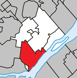 Location within L'Assomption RCM. | ||
 Repentigny Location in central Quebec. | ||
| Coordinates: 45°44′N 73°28′W / 45.733°N 73.467°WCoordinates: 45°44′N 73°28′W / 45.733°N 73.467°W[1] | ||
| Country |
| |
| Province |
| |
| Region | Lanaudière | |
| RCM | L'Assomption | |
| Founded | 1670 | |
| Constituted | June 1, 2002 | |
| Government[2] | ||
| • Mayor | Chantal Deschamps | |
| • MP | Monique Pauzé (BQ) | |
| • MNAs |
François Legault (CAQ) Lise Lavallée (CAQ) | |
| Area[2][3] | ||
| • Total | 71.25 km2 (27.51 sq mi) | |
| • Land | 60.89 km2 (23.51 sq mi) | |
| Population (2016)[4] | ||
| • Total | 84,965 | |
| • Density | 1,395.4/km2 (3,614/sq mi) | |
| • Pop 2011–2016 |
| |
| • Dwellings | 33,876 | |
| Time zone | UTC−5 (EST) | |
| • Summer (DST) | UTC−4 (EDT) | |
| Postal code(s) | J5Y, J5Z, J6A | |
| Area code(s) | 450 and 579 | |
| Highways |
| |
| Website |
www | |

Repentigny is an off-island suburb of Montreal, Quebec, Canada. It is located north of the city on the lower end of the L'Assomption River, and on the Saint Lawrence River. Repentigny and Charlemagne were the first towns off the eastern tip of the Island of Montreal. Repentigny is part of the Lanaudiere region.
History
It was founded in 1670 by Jean-Baptiste Le Gardeur, son of Seigneur Pierre Le Gardeur. During the town's first 250 years, Repentigny was only inhabited by a few hundred peasants, or habitants, and was an agricultural community. In 1677, the first population census only shows 30 inhabitants. Its first mayor was Benjamin Moreau 1855.
Repentigny merged with its neighbouring city of Le Gardeur on June 1, 2002. The city's area grew from 29 to 69 km² and the population grew by 70%.
Repentigny was also the western terminus of the Chemin du Roy, a road that extends eastward towards Quebec City.
Demographics
According to Statistics Canada 2011 census:[5]
- Population in 2011: 82,000
- Population in 2006: 76,237
- (Population in 2001: 72,218)
The current mayor is Chantal Deschamps, who was first elected to the position in 1997 and has been re-elected to serve until 2021.
Languages
| Canada Census Mother Tongue - Terrebonne, Quebec[6] | ||||||||||||||||||
|---|---|---|---|---|---|---|---|---|---|---|---|---|---|---|---|---|---|---|
| Census | Total | French |
English |
French & English |
Other | |||||||||||||
| Year | Responses | Count | Trend | Pop % | Count | Trend | Pop % | Count | Trend | Pop % | Count | Trend | Pop % | |||||
2011 |
81,535 |
75,185 | 92.21% | 1,245 | 1.53% | 485 | 0.59% | 4,015 | 4.92% | |||||||||
2006 |
76,237 |
71,555 | 93.86% | 1,050 | 1.37% | 230 | 0.3% | 2,885 | 3.78% | |||||||||
2001 |
54,550 |
52,460 | 96.17% | 635 | 1.16% | 125 | 0.23% | 1,040 | 1.91% | |||||||||
1996 |
53,570 |
51,520 | n/a | 96.17% | 865 | n/a | 1.61% | 210 | n/a | 0.39% | 860 | n/a | 1.61% | |||||
Ethnocultural ancestries
Single responses: 51.60% of respondents gave a single response of 'Canadian', while a further 17.67% identified with both 'Canadian', and one or more other ancestries. 15.13% of respondents gave a single response of French, 1.86% of respondents gave a single response of Québécois, 1.37% gave a single response of Italian, 1.34% gave a single response of Irish and 1.27% gave a single response of Haitian.
Multiple responses: Counting both single and multiple responses, the most commonly identified ethnocultural ancestries were:
| Canadian | 69.27% |
| French | 32.45% |
| Irish | 4.06% |
| Italian | 3.22% |
| Québécois | 2.54% |
| North American Indian | 2.32% |
| Scottish | 1.60% |
| Haitian | 1.54% |
| English | 1.26% |
| German | 1.24% |
Percentages are calculated as a proportion of the total number of respondents and may total more than 100% due to dual responses.
All ethnocultural ancestries of more than 1% are listed in the table above according to the exact terminology used by Statistics Canada.[7]
Transit
Repentigny is the central point for transit in South-Central Lanaudière. Its Centre d'Échange Rive Nord-Est (Northeastern Shore Transit Exchange Centre), administrated by Réseau de transport métropolitain, is the main infrastructure for transit in the region. Unlike a bus terminal, no departures are available from the Centre d'Échange, but transfers from one circuit to the other are possible. 9 of the 10 RTCR de la MRC de L'Assomption transit system circuits travel via Centre d'Échange, in addition of the 2 CRTL regional lines. Thus, Repentigny is directly connected to Terrebonne, Charlemagne, L'Assomption, Montreal, Montréal-Est, Saint-Sulpice, Lavaltrie, Lanoraie, Sainte-Geneviève-de-Berthier, Berthierville, La Visitation-de-l'Île-Dupas, Saint-Ignace-de-Loyola, Saint-Paul-d'Industrie, Crabtree, Sainte-Marie-Salomé and Joliette.
The city of Repentigny takes part in the L'Assomption MRC public transportation network effort and pan-regional Lanaudière Regional Transport Commission, linking all of the Regional County Municipalities of Lanaudière, even the northmost ones. In addition there is the MRC Les Moulins.[8]
Repentigny is connected to Montreal's Central Station by commuter rail via the Repentigny Station of Réseau de transport métropolitain's Mascouche Line.
Education
The Commission scolaire des Affluents operates Francophone public schools:
- Centre de formation professionnelle des Riverains[9]
- Centre la Croisée[10]
- École secondaire Félix-Leclerc
- École secondaire Jean-Baptiste-Meilleur
- École secondaire Jean-Claude-Crevier
- École secondaire l'Envolée
- École secondaire l'Horizon[11]
- École primaire Alphonse-Desjardins
- École primaire de la Paix
- École primaire des Moissons
- École primaire du Moulin
- École primaire Émile-Nelligan
- École primaire Entramis
- École primaire Henri-Bourassa et Soleil-de-l'Aube
- École primaire Jean-Duceppe
- École primaire Jean-XXIII
- École primaire la Majuscule
- École primaire la Tourterelle
- École primaire le Bourg-Neuf
- École primaire Longpré
- École primaire Louis-Fréchette
- École primaire Louis-Joseph-Huot
- École primaire Marie-Victorin
- École primaire Pie-XII
- École primaire Tournesol
- École primaire Valmont-sur-Parc[12]
Sir Wilfrid Laurier School Board operates Anglophone public school:
- Franklin Hill Elementary School in Repentigny[13]
Notable residents
- Julie Brosseau, women's basketball player
- Les Cowboys Fringants, a Québécois folk-pop band.
- Marie Deschamps, a Canadian Supreme Court Justice.
- Benoît Hogue, a former NHL hockey player
- Samuel Piette, a soccer player for the Montreal Impact
- Jason Pominville, a hockey player for the Buffalo Sabres
- Pascal Leclaire, a former NHL hockey player
- Marie-Ève Pelletier, a former professional tennis player.
- Maxim Lapierre, Pittsburgh Penguins forward.
- Solomon Juneau, founder of Milwaukee, the largest city in the US state of Wisconsin
- Karl Ouimette, a soccer player for the San Francisco Deltas
- Thomas Meilleur-Giguère, a soccer player for the Montreal Impact
Culture
Repentigny is home of many festivities :
- Festival de Feu et de Glace (Festival of Fire and Ice, a winter fest), January–February.
- Festival de spectacles jeune-public de Lanaudière (Youth theatre fest), early July.
- Rendez-Vous Estival (Summer Rendez-Vous, a theme park with familial activities and rock shows), early August.
- Festival Gospel (Gospel Fest, International gospel choirs fest), mid-August.
- National de Soccer (Soccer Nationals, 18- level national soccer event), mid-August.
- Internationaux de Tennis junior du Canada Banque Nationale (National Bank Junior Tennis Internationals of Canada, the biggest sports event in the city), late August-early September
- Fête du Petit-Village (Little town fest, cultural rendez-vous in the old Saint-Paul-l'Ermite sector), every 2 autumns.
- The Fête Nationale du Québec, la St-Jean, brings many activities, such as shows and performances on stage in L'île Lebel.
- Many outdoor shows and movie projections
See also
References
- ↑ Reference number 53054 of the Commission de toponymie du Québec (in French)
- 1 2 Geographic code 60013 in the official Répertoire des municipalités (in French)
- ↑ "(Code 2460013) Census Profile". 2011 census. Statistics Canada. 2012.
- ↑ Statistics Canada - Repentigny 2016 Community Profile.
- ↑ Statistics Canada - Repentigny 2006 Community Profile.
- ↑ Statistics Canada: 1996, 2001, 2006, 2011 census
- ↑ "Repentigny, V". Ethnic Origin (247), Generation Status (4), Single and Multiple Ethnic Origin Responses (3) and Sex (3) for the Population 15 Years and Over of Canada, Provinces, Territories, Census Divisions and Census Subdivisions, 2006 Census - 20% Sample Data. Statistics Canada. 20 November 2007. Retrieved 2008-08-08.
- ↑ AMT autobus
- ↑ "Formation professionnelle de la Commission scolaire des Affluents" CSDA Retrieved on July 3, 2018.
- ↑ "Formation générale des adultes de la Commission scolaire des Affluents" CSDA Retrieved on July 3, 2018.
- ↑ "Écoles secondaires de la Commission scolaire des Affluents" CSDA Retrieved on July 3, 2018.
- ↑ "Écoles primaires de la Commission scolaire des Affluents" CSDA Retrieved on July 3, 2018.
- ↑ "FRANKLIN HILL ELEMENTARY ZONE." Sir Wilfred Laurier School Board. Retrieved on September 17, 2017.
External links
| Wikimedia Commons has media related to Repentigny, Quebec. |
- Official website (in French)
Adjacent Municipal Subdivisions | |
|---|---|
| Cities/towns | |
|---|---|
| Municipalities | |
| |