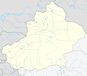
Gongliu County
| Gongliu County 巩留县 توققۇزتارا ناھىيىسى | |
|---|---|
| County | |
 Gongliu Location of the seat in Xinjiang | |
| Coordinates: 43°28′00″N 82°08′56″E / 43.46667°N 82.14889°ECoordinates: 43°28′00″N 82°08′56″E / 43.46667°N 82.14889°E | |
| Country | People's Republic of China |
| Autonomous region | Xinjiang |
| Autonomous prefecture | Ili |
| Time zone | UTC+8 (China Standard) |
| Gongliu | |||||||||||
| Chinese name | |||||||||||
|---|---|---|---|---|---|---|---|---|---|---|---|
| Simplified Chinese | 巩留县 | ||||||||||
| Traditional Chinese | 鞏留縣 | ||||||||||
| |||||||||||
| Alternative Chinese name | |||||||||||
| Simplified Chinese | 特克斯塔留 | ||||||||||
| |||||||||||
| Uyghur name | |||||||||||
| Uyghur |
توققۇزتارا ناھىيىسى | ||||||||||
| |||||||||||
| Kazakh name | |||||||||||
| Kazakh |
توعىزتاراۋ اۋدانى Kazakh Cyrillic: Тоғызтарау ауданы Kazakh Latin alphabet: Tog'yztaray' ay'dany | ||||||||||
Gongliu County (Chinese: 巩留县) as the official romanized name, also transliterated from Uyghur as Tokkuztara County (Uyghur: توققۇزتارا ناھىيىسى ; Chinese: 特克斯塔留县), is a county situated within the Xinjiang Uyghur Autonomous Region and is under the administration of the Ili Kazakh Autonomous Prefecture. It contains an area of 4,119 km2 (1,590 sq mi). According to the 2002 census, it has a population of 160,000.
Name
The place was originally named Tokkuztara, meaning "nine streams" because branches of the Ili River merged in the area. When a county was set up in 1932, Gongliu was chosen as the official name, which is an abbreviation of Gonggu Changliu ("巩固长留"), literally Stability and Long-lasting[1]
Administrative divisions
There is one township and seven villages.
References