Rural Municipality of St. Andrews No. 287
| St. Andrews No. 287 | |
|---|---|
| Rural municipality | |
 St. Andrews No. 287 | |
| Coordinates: 51°29′35″N 107°53′20″W / 51.493°N 107.889°W | |
| Country | Canada |
| Province | Saskatchewan |
| Division | Census Division 12 |
| Seat | Rosetown, Saskatchewan |
| Area | |
| • Total | 805.30 km2 (310.93 sq mi) |
| Population (2006) | |
| • Total | 582 |
| • Density | 0.72/km2 (1.9/sq mi) |
St. Andrews No. 287 is a rural municipality in the Canadian province of Saskatchewan, located in the Census Division 12 which is a part of SARM Division 6. The seat of the municipality is located in the town of Rosetown.
Demographics
In 2006, St. Andrews No. 287 had a population of 582 in 140 dwellings, a -7.0% decrease from 2001. On a surface of 805.30 km² it has a density of 0.7 inhabitants/km².[1]
Communities and localities
The following urban municipalities are surrounded by the Rural Municipality of St. Andrews No. 287:
- none
- none
- none
The following hamlets are located within the Rural Municipality of St. Andrews No. 66:
- none
- Sovereign, (dissolved as a village, December 31, 2005)
- none
- Fortune
- Glamis
- Thrasher
Transportation
See also
References
External links
- Municipal Affairs - St. Andrews No. 287, Saskatchewan
| Towns | 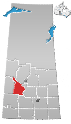 | ||||
|---|---|---|---|---|---|
| Villages | |||||
| Resort villages | |||||
| Rural municipalities | |||||
| Indian reserves |
| ||||
| Unincorporated communities |
| ||||
This article is issued from
Wikipedia.
The text is licensed under Creative Commons - Attribution - Sharealike.
Additional terms may apply for the media files.