Rural Municipality of Battle River No. 438
| Battle River No. 438 | |
|---|---|
| Rural municipality | |
 Battle River No. 438 | |
| Coordinates: 52°42′5″N 108°20′0″W / 52.70139°N 108.33333°WCoordinates: 52°42′5″N 108°20′0″W / 52.70139°N 108.33333°W | |
| Country | Canada |
| Province | Saskatchewan |
| Area | |
| • Total | 1,061.4 km2 (409.8 sq mi) |
| Population (2006) | |
| • Total | 1,053 |
| • Density | 0.99/km2 (2.6/sq mi) |
Battle River No. 438 is a rural municipality in the Canadian province of Saskatchewan.
Statistics
According to the Canada 2006 Census:
- Population: 1,053
- Dwellings: 427
- Area (km².): 1,061.40
- Density (persons per km².): 1.0
Communities and localities
The following urban municipalities are surrounded by the Rural Municipality of Battle River No. 438:
- none
- none
- none
The following hamlets are located within the Rural Municipality of Battle River No. 438:
- none
- none
The following Indian reserves are surrounded by the Rural Municipality of Battle River No. 438
- Sweet Grass 113
- Sweet Grass 113-M16
Saskatchewan railways and railway stations
(historic or current)
Saskatchewan highways and roads
- For more information see also List of Saskatchewan provincial highways
- For more information see also List of Saskatchewan provincial roads
See also
External links
| Towns | 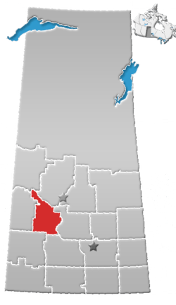 | ||||
|---|---|---|---|---|---|
| Villages | |||||
| Resort villages | |||||
| Rural municipalities | |||||
| Indian reserves |
| ||||
| Unincorporated communities |
| ||||
This article is issued from
Wikipedia.
The text is licensed under Creative Commons - Attribution - Sharealike.
Additional terms may apply for the media files.