Macrorie, Saskatchewan
| Macrorie | |
|---|---|
| Village | |
| Village of Macrorie | |
 Location of Macrorie in Saskatchewan  Macrorie, Saskatchewan (Canada) | |
| Coordinates: 51°19′19″N 107°04′55″W / 51.322°N 107.082°W | |
| Country |
|
| Province |
|
| Region | Central |
| Census division | 12 |
| Rural Municipality | Fertile Valley No. 285 |
| Incorporated (Village) | February 8, 1912 |
| Government | |
| • Type | Municipal |
| • Governing body | Macrorie Village Council |
| • Mayor | Mike Perry |
| • Administrator | Darla Fraser |
| Area | |
| • Total | 0.77 km2 (0.30 sq mi) |
| Population (2016) | |
| • Total | 68 |
| • Density | 88.4/km2 (229/sq mi) |
| Time zone | CST |
| Postal code | S0L 2E0 |
| Area code(s) | 306 |
| Highways |
|
| Railways | Canadian National Railway |
| [1][2][3][4] | |
Macrorie is a village within the Rural municipality of Fertile Valley No. 285, in the province of Saskatchewan, Canada. The population was 68 at the 2016 Canadian Census, (a 4.6% increase from 65 in the 2011 Canada Census. The village contains a Co-op gas and grocery store. Danielson Provincial Park is 20 km southeast on Highway 44.
Demographics
| Canada census – Macrorie, Saskatchewan community profile | |||
|---|---|---|---|
| 2016 | 2011 | 2006 | |
| Population: | 68 (4.6% from 2011) | 65 (-16.7% from 2006) | 78 (-18.8% from 2001) |
| Land area: | 2.00 km2 (0.77 sq mi) | 0.77 km2 (0.30 sq mi) | 0.77 km2 (0.30 sq mi) |
| Population density: | 88.4/km2 (229/sq mi) | 84.5/km2 (219/sq mi) | 101.4/km2 (263/sq mi) |
| Median age: | 54.5 (M: 58.0, F: 45.0) | 52.6 (M: 54.1, F: 52.0) | 46.0 (M: 47.7, F: 40.5) |
| Total private dwellings: | 46 | 46 | 41 |
| Median household income: | |||
| References: 2016[5] 2011[6] 2006[7] earlier[8] | |||
Notable people
- Howard Fredeen (born December 10, 1921 in Macrorie) is a Canadian animal breeding researcher.
See also
References
- ↑ National Archives, Archivia Net, Post Offices and Postmasters, archived from the original on 2006-10-06
- ↑ Government of Saskatchewan, MRD Home, Municipal Directory System, archived from the original on November 21, 2008
- ↑ Canadian Textiles Institute. (2005), CTI Determine your provincial constituency, archived from the original on 2007-09-11
- ↑ Commissioner of Canada Elections, Chief Electoral Officer of Canada (2005), Elections Canada On-line, archived from the original on 2007-04-21
- ↑ "2016 Community Profiles". Canada 2016 Census. Statistics Canada. February 21, 2017. Retrieved 2017-03-15.
- ↑ "2011 Community Profiles". Canada 2011 Census. Statistics Canada. July 5, 2013. Retrieved 2012-10-14.
- ↑ "2006 Community Profiles". Canada 2006 Census. Statistics Canada. March 30, 2011. Retrieved 2010-09-11.
- ↑ "2001 Community Profiles". Canada 2001 Census. Statistics Canada. February 17, 2012.
External links
Places adjacent to Macrorie, Saskatchewan | |
|---|---|
| Subdivisions | |
|---|---|
| Communities | |
| Cities | |
| Topics |
|
| |
| Towns | 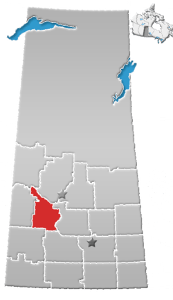 | ||||
|---|---|---|---|---|---|
| Villages | |||||
| Resort villages | |||||
| Rural municipalities | |||||
| Indian reserves |
| ||||
| Unincorporated communities |
| ||||
This article is issued from
Wikipedia.
The text is licensed under Creative Commons - Attribution - Sharealike.
Additional terms may apply for the media files.