South Wairarapa District
| South Wairarapa District | ||
|---|---|---|
| Territorial authority of New Zealand | ||
| ||
 | ||
| Country |
| |
| Region | Wellington | |
| Seat | Martinborough | |
| Wards | ||
| Government | ||
| • Mayor | Viv Napier | |
| Area | ||
| • Total | 2,484.55 km2 (959.29 sq mi) | |
| Population (June 2018)[1] | ||
| • Total | 10,450 | |
| • Density | 4.2/km2 (11/sq mi) | |
| Time zone | UTC+12 (NZST) | |
| • Summer (DST) | UTC+13 (NZDT) | |
| Postcode(s) | 5710, 5711, 5712, 5740, 5741, 5742, 5771, 5772, 5773, 5781, 5782, 5783, 5784, 5794 | |
| Area code(s) | 06 | |
| Website | District Council | |
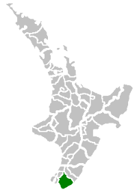
The South Wairarapa District is an area at the south-east tip of the North Island of New Zealand governed by the South Wairarapa District Council. The district comprises the southernmost part of the Wairarapa, and is part of the Wellington Region.
Features
The district comprises the floodplain of the Ruamahanga River and the associated Lake Wairarapa, as well as the long southern stretch of Palliser Bay. To the west of the plains rise the eastern slopes of the Remutaka Range, the crest of which forms the western boundary of the district, while the Aorangi Range lies to the southeast. The southernmost point of the North Island, Cape Palliser is in the South Wairarapa.
While it is predominantly rural, the South Wairarapa includes three towns. The largest town, and seat of the district council, is Martinborough; the town is the centre of a nationally important wine-producing area. The second largest town in the district, Greytown, is where Arbor Day was first celebrated in New Zealand). The Fell Locomotive Museum in the third town, Featherston, has a museum displaying the world's only Fell locomotive.
It is expected that the amount of people living in the district's urban areas will increase over the coming years due to increasing property prices in Wellington proper, and the proximity to transport links.[2][3]
Transport
Because of South Wairarapa's proximity to the capital city of New Zealand, Wellington, there are close links between the two areas. For example, some people live in South Wairarapa and commute to Wellington each day to work; others live and work in Wellington while spending weekends in South Wairarapa. The Wairarapa Line, part of the Metlink public transport network for the Wellington region, passes through the district (which is served by the three stations of Featherston, Woodside, and Matarawa) and provides a faster method of transport into the city than the Remutaka pass road. Metlink buses also provide services to Greytown and Martinborough from the railway stations and Masterton.
Local and regional government
The South Wairarapa District Council is the territorial authority responsible for the area. The council consists of nine councillors; the current mayor is Viv Napier.[4] The three towns also have their own community boards.[5]
References
- ↑ "Subnational Population Estimates: At 30 June 2018 (provisional)". Statistics New Zealand. 23 October 2018. Retrieved 23 October 2018. For urban areas, "Subnational population estimates (UA, AU), by age and sex, at 30 June 1996, 2001, 2006-18 (2018 boundary)". Statistics New Zealand. 23 October 2018. Retrieved 23 October 2018.
- ↑ Macdonald, Nikki (May 2018). "Featherston: from bleak town to boom town". Stuff.co.nz. Retrieved 23 July 2018.
- ↑ Fuller, Piers (15 July 2018). "High cost of Wellington living forces students into long commutes". Stuff.co.nz. Retrieved 23 July 2018.
- ↑ "Contact a Councillor". South Wairarapa District Council. Retrieved 23 July 2018.
- ↑ "Council Committees and Working Parties" (PDF). South Wairarapa District Council. 22 November 2000. Retrieved 23 July 2018.