Songir
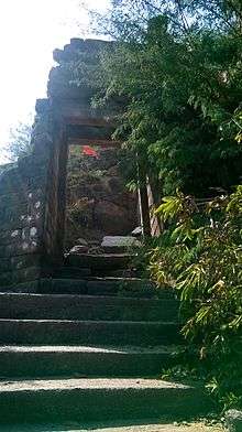
Main gate
| Songir Suvarngiri | |
|---|---|
| town | |
 Songir Location in Maharashtra | |
| Coordinates: 21°05′N 74°47′E / 21.083°N 74.783°ECoordinates: 21°05′N 74°47′E / 21.083°N 74.783°E | |
| Country |
|
| State | Maharashtra |
| District | Dhule |
| Government | |
| • Body | Songir Grampanchayat |
| Population (2011) | |
| • Total | 33,000 |
| Languages =Marathi. | |
| Time zone | UTC+5:30 (IST) |
| PIN | 424309 |
| Telephone code | 02562 |
| Vehicle registration | MH-18 |
| Nearest city | Dhule |
| Literacy | 80% |
| Lok Sabha constituency | Dhule |
| Vidhan Sabha constituency | Dhule(Gramin) |
| Civic agency | Songir Grampanchayat |
| Climate | Hot (Köppen) |
Songir is the largest town in Dhule Taluka, situated on the intersection of National Highway 3 (Mumbai-Agra) and state highway 17 (Ahmedabad).
The Songir fort atop the village is in the form of narrow strip 30m wide. An easy climb of 20 mins takes to the top of the fort. Songir is covered by 3 to 4 small forts, which are helping in winter and summer season from cold and hot wind respectively.
Temples in Songir include Someshwar, Gurugovind Maharaj, Jain Mandir and also Balaji Rath. Balaji Rath is in a "Rath Galli " the rath galli is main galli of Songir. A couple of the notable temples are Someshwar and Samadhi of Guru Govind Maharaj.
References
| Topics | |||||||||||||
|---|---|---|---|---|---|---|---|---|---|---|---|---|---|
| Regions | |||||||||||||
| Divisions and Districts |
| ||||||||||||
| Million-plus cities in Maharashtra | |||||||||||||
| Other cities with municipal corporations | |||||||||||||
Portal: Maharashtra | |||||||||||||
This article is issued from
Wikipedia.
The text is licensed under Creative Commons - Attribution - Sharealike.
Additional terms may apply for the media files.