Sauméjan
| Sauméjan | |
|---|---|
| Commune | |
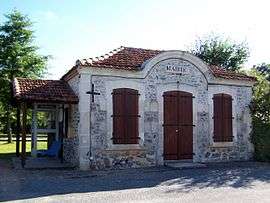 The town hall in Sauméjan | |
 Sauméjan Location within Nouvelle-Aquitaine region  Sauméjan | |
| Coordinates: 44°14′15″N 0°00′09″W / 44.2375°N 0.0025°WCoordinates: 44°14′15″N 0°00′09″W / 44.2375°N 0.0025°W | |
| Country | France |
| Region | Nouvelle-Aquitaine |
| Department | Lot-et-Garonne |
| Arrondissement | Nérac |
| Canton | Les Forêts de Gascogne |
| Intercommunality | Communauté de communes des Coteaux et des Landes de Gascogne |
| Government | |
| • Mayor (2008–2014) | Francis Da Ros |
| Area1 | 19.5 km2 (7.5 sq mi) |
| Population (1999)2 | 68 |
| • Density | 3.5/km2 (9.0/sq mi) |
| Time zone | UTC+1 (CET) |
| • Summer (DST) | UTC+2 (CEST) |
| INSEE/Postal code | 47286 /47420 |
| Elevation |
103–147 m (338–482 ft) (avg. 120 m or 390 ft) |
|
1 French Land Register data, which excludes lakes, ponds, glaciers > 1 km2 (0.386 sq mi or 247 acres) and river estuaries. 2 Population without double counting: residents of multiple communes (e.g., students and military personnel) only counted once. | |
Sauméjan is a commune in the Lot-et-Garonne department in south-western France.
See also
| Wikimedia Commons has media related to Sauméjan. |
This article is issued from
Wikipedia.
The text is licensed under Creative Commons - Attribution - Sharealike.
Additional terms may apply for the media files.