Lougratte
| Lougratte | |
|---|---|
| Commune | |
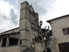 The church in Lougratte | |
 Lougratte Location within Nouvelle-Aquitaine region  Lougratte | |
| Coordinates: 44°35′04″N 0°37′28″E / 44.5844°N 0.6244°ECoordinates: 44°35′04″N 0°37′28″E / 44.5844°N 0.6244°E | |
| Country | France |
| Region | Nouvelle-Aquitaine |
| Department | Lot-et-Garonne |
| Arrondissement | Villeneuve-sur-Lot |
| Canton | Le Val du Dropt |
| Government | |
| • Mayor (2008–2014) | Jean Delard |
| Area1 | 20.45 km2 (7.90 sq mi) |
| Population (2006)2 | 439 |
| • Density | 21/km2 (56/sq mi) |
| Time zone | UTC+1 (CET) |
| • Summer (DST) | UTC+2 (CEST) |
| INSEE/Postal code | 47152 /47290 |
| Elevation |
82–183 m (269–600 ft) (avg. 80 m or 260 ft) |
|
1 French Land Register data, which excludes lakes, ponds, glaciers > 1 km2 (0.386 sq mi or 247 acres) and river estuaries. 2 Population without double counting: residents of multiple communes (e.g., students and military personnel) only counted once. | |
Lougratte is a commune and a village in the Lot-et-Garonne department in south-western France.
See also
| Wikimedia Commons has media related to Lougratte. |
This article is issued from
Wikipedia.
The text is licensed under Creative Commons - Attribution - Sharealike.
Additional terms may apply for the media files.