Laparade
| Laparade | ||
|---|---|---|
| Commune | ||
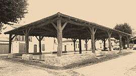 The covered marketplace in Laparade | ||
| ||
 Laparade Location within Nouvelle-Aquitaine region  Laparade | ||
| Coordinates: 44°23′21″N 0°26′55″E / 44.3892°N 0.4486°ECoordinates: 44°23′21″N 0°26′55″E / 44.3892°N 0.4486°E | ||
| Country | France | |
| Region | Nouvelle-Aquitaine | |
| Department | Lot-et-Garonne | |
| Arrondissement | Marmande | |
| Canton | Tonneins | |
| Intercommunality | Communauté de communes Lot et Tolzac | |
| Government | ||
| • Mayor (2008–2014) | Gislain Gozzerino | |
| Area1 | 16.22 km2 (6.26 sq mi) | |
| Population (1999)2 | 408 | |
| • Density | 25/km2 (65/sq mi) | |
| Time zone | UTC+1 (CET) | |
| • Summer (DST) | UTC+2 (CEST) | |
| INSEE/Postal code | 47135 /47260 | |
| Elevation |
32–192 m (105–630 ft) (avg. 190 m or 620 ft) | |
|
1 French Land Register data, which excludes lakes, ponds, glaciers > 1 km2 (0.386 sq mi or 247 acres) and river estuaries. 2 Population without double counting: residents of multiple communes (e.g., students and military personnel) only counted once. | ||
.svg.png)
Laparade is a commune in the Lot-et-Garonne department in south-western France.
See also
| Wikimedia Commons has media related to Laparade. |
This article is issued from
Wikipedia.
The text is licensed under Creative Commons - Attribution - Sharealike.
Additional terms may apply for the media files.