Saint-Eutrope-de-Born
| Saint-Eutrope-de-Born | |
|---|---|
| Commune | |
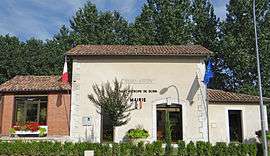 The town hall in Saint-Eutrope-de-Born | |
 Saint-Eutrope-de-Born Location within Nouvelle-Aquitaine region  Saint-Eutrope-de-Born | |
| Coordinates: 44°34′11″N 0°41′58″E / 44.5697°N 0.6994°ECoordinates: 44°34′11″N 0°41′58″E / 44.5697°N 0.6994°E | |
| Country | France |
| Region | Nouvelle-Aquitaine |
| Department | Lot-et-Garonne |
| Arrondissement | Villeneuve-sur-Lot |
| Canton | Le Haut agenais Périgord |
| Intercommunality | Pays Villeréalais |
| Government | |
| • Mayor (2001–2008) | René Ortyl |
| Area1 | 38.28 km2 (14.78 sq mi) |
| Population (1999)2 | 609 |
| • Density | 16/km2 (41/sq mi) |
| Time zone | UTC+1 (CET) |
| • Summer (DST) | UTC+2 (CEST) |
| INSEE/Postal code | 47241 /47210 |
| Elevation |
83–185 m (272–607 ft) (avg. 150 m or 490 ft) |
|
1 French Land Register data, which excludes lakes, ponds, glaciers > 1 km2 (0.386 sq mi or 247 acres) and river estuaries. 2 Population without double counting: residents of multiple communes (e.g., students and military personnel) only counted once. | |
Saint-Eutrope-de-Born is a commune in the Lot-et-Garonne department in south-western France.
See also
References
| Wikimedia Commons has media related to Saint-Eutrope-de-Born. |
This article is issued from
Wikipedia.
The text is licensed under Creative Commons - Attribution - Sharealike.
Additional terms may apply for the media files.