Trentels
| Trentels | |
|---|---|
| Commune | |
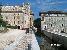 The lock, castle and mill in Lustrac | |
 Trentels Location within Nouvelle-Aquitaine region  Trentels | |
| Coordinates: 44°26′11″N 0°51′49″E / 44.4364°N 0.8636°ECoordinates: 44°26′11″N 0°51′49″E / 44.4364°N 0.8636°E | |
| Country | France |
| Region | Nouvelle-Aquitaine |
| Department | Lot-et-Garonne |
| Arrondissement | Villeneuve-sur-Lot |
| Canton | Le Fumélois |
| Intercommunality | Fumelois-Lémance |
| Government | |
| • Mayor (2001–2008) | André Bonneilh |
| Area1 | 19.47 km2 (7.52 sq mi) |
| Population (2006)2 | 818 |
| • Density | 42/km2 (110/sq mi) |
| Time zone | UTC+1 (CET) |
| • Summer (DST) | UTC+2 (CEST) |
| INSEE/Postal code | 47315 /47140 |
| Elevation |
52–222 m (171–728 ft) (avg. 78 m or 256 ft) |
|
1 French Land Register data, which excludes lakes, ponds, glaciers > 1 km2 (0.386 sq mi or 247 acres) and river estuaries. 2 Population without double counting: residents of multiple communes (e.g., students and military personnel) only counted once. | |
Trentels is a commune in the Lot-et-Garonne department in south-western France.
See also
| Wikimedia Commons has media related to Trentels. |
This article is issued from
Wikipedia.
The text is licensed under Creative Commons - Attribution - Sharealike.
Additional terms may apply for the media files.