Bournel
| Bournel | |
|---|---|
| Commune | |
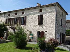 The town hall in Bournel | |
 Bournel Location within Nouvelle-Aquitaine region  Bournel | |
| Coordinates: 44°37′15″N 0°40′18″E / 44.6208°N 0.6717°ECoordinates: 44°37′15″N 0°40′18″E / 44.6208°N 0.6717°E | |
| Country | France |
| Region | Nouvelle-Aquitaine |
| Department | Lot-et-Garonne |
| Arrondissement | Villeneuve-sur-Lot |
| Canton | Le Haut agenais Périgord |
| Government | |
| • Mayor (2008–2014) | Roland Soulage |
| Area1 | 14.7 km2 (5.7 sq mi) |
| Population (2009)2 | 258 |
| • Density | 18/km2 (45/sq mi) |
| Time zone | UTC+1 (CET) |
| • Summer (DST) | UTC+2 (CEST) |
| INSEE/Postal code | 47037 /47210 |
| Elevation |
72–161 m (236–528 ft) (avg. 100 m or 330 ft) |
|
1 French Land Register data, which excludes lakes, ponds, glaciers > 1 km2 (0.386 sq mi or 247 acres) and river estuaries. 2 Population without double counting: residents of multiple communes (e.g., students and military personnel) only counted once. | |
Bournel is a commune in the Lot-et-Garonne department in southwestern France.
Population
| Historical population | ||
|---|---|---|
| Year | Pop. | ±% |
| 1806 | 695 | — |
| 1821 | 657 | −5.5% |
| 1831 | 735 | +11.9% |
| 1836 | 751 | +2.2% |
| 1841 | 726 | −3.3% |
| 1846 | 709 | −2.3% |
| 1851 | 708 | −0.1% |
| 1856 | 662 | −6.5% |
| 1861 | 617 | −6.8% |
| 1866 | 613 | −0.6% |
| 1872 | 577 | −5.9% |
| 1876 | 580 | +0.5% |
| 1881 | 553 | −4.7% |
| 1886 | 536 | −3.1% |
| 1891 | 495 | −7.6% |
| 1896 | 463 | −6.5% |
| 1901 | 448 | −3.2% |
| 1906 | 417 | −6.9% |
| 1911 | 390 | −6.5% |
| 1921 | 327 | −16.2% |
| 1926 | 338 | +3.4% |
| 1931 | 345 | +2.1% |
| 1936 | 336 | −2.6% |
| 1946 | 319 | −5.1% |
| 1954 | 326 | +2.2% |
| 1962 | 279 | −14.4% |
| 1968 | 284 | +1.8% |
| 1975 | 220 | −22.5% |
| 1982 | 237 | +7.7% |
| 1990 | 228 | −3.8% |
| 1999 | 250 | +9.6% |
| 2006 | 229 | −8.4% |
| 2009 | 258 | +12.7% |
See also
References
| Wikimedia Commons has media related to Bournel. |
This article is issued from
Wikipedia.
The text is licensed under Creative Commons - Attribution - Sharealike.
Additional terms may apply for the media files.