Flaxcombe, Saskatchewan
| Flaxcombe | |
|---|---|
| Village | |
| Village of Flaxcombe | |
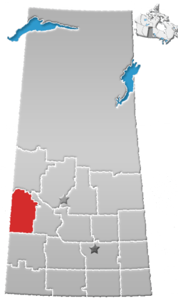
 Location of Flaxcombe in Saskatchewan  Flaxcombe, Saskatchewan (Canada) | |
| Coordinates: 51°27′32″N 109°37′19″W / 51.459°N 109.622°W | |
| Country | Canada |
| Province | Saskatchewan |
| Region | West-central |
| Census division | 13 |
| Rural Municipality | Kindersley |
| Post office Founded | March 1, 1910 |
| Government | |
| • Type | Municipal |
| • Governing body | Flaxccombe Village Council |
| • Mayor | Blaine Sautner |
| • Administrator | Charlotte Helfrich |
| • MP | Bill Boyd |
| • MLA | David Anderson |
| Area | |
| • Total | 1.49 km2 (0.58 sq mi) |
| Population (2016) | |
| • Total | 129 |
| • Density | 74.6/km2 (193/sq mi) |
| Time zone | UTC-6 (CST) |
| Postal code | S0L 1E0 |
| Area code(s) | 306 |
| Highways |
|
| Railways | Canadian National Railway |
| [1][2][3][4] | |
Flaxcombe (2016 Population: 124) is a village within the Rural Municipality of Kindersley No. 290, Saskatchewan, Canada. The village is located approximately 30 km west of the town of Kindersley, on Highway 7, and approximately 27 km east of the Alberta-Saskatchewan border.
Demographics
| Canada census – Flaxcombe, Saskatchewan community profile | |||
|---|---|---|---|
| 2016 | 2011 | 2006 | |
| Population: | 129 (+ 6.0% from 2011) | 117 (5.4% from 2006) | 111 (-13.3% from 2001) |
| Land area: | 1.49 km2 (0.58 sq mi) | 1.49 km2 (0.58 sq mi) | 1.49 km2 (0.58 sq mi) |
| Population density: | 83.4/km2 (216/sq mi) | 78.7/km2 (204/sq mi) | 74.6/km2 (193/sq mi) |
| Median age: | 30.0 (M: 35.0, F: 29.0) | 35.2 (M: 38.5, F: 31.0) | 35.5 (M: 37.5, F: 29.0) |
| Total private dwellings: | 51 | 47 | 48 |
| Median household income: | |||
| References: 2016[5] 2011[6] 2006[7] earlier[8] | |||
See also
References
- ↑ National Archives, Archivia Net, Post Offices and Postmasters, archived from the original on October 6, 2006
- ↑ Government of Saskatchewan, MRD Home, Municipal Directory System, archived from the original on November 21, 2008
- ↑ Canadian Textiles Institute. (2005), CTI Determine your provincial constituency, archived from the original on 2007-09-11
- ↑ Commissioner of Canada Elections, Chief Electoral Officer of Canada (2005), Elections Canada On-line, archived from the original on April 21, 2007
- ↑ "2016 Community Profiles". Canada 2016 Census. Statistics Canada. February 21, 2017. Retrieved 2017-03-15.
- ↑ "2011 Community Profiles". Canada 2011 Census. Statistics Canada. July 5, 2013. Retrieved 2012-08-12.
- ↑ "2006 Community Profiles". Canada 2006 Census. Statistics Canada. March 30, 2011. Retrieved 2009-02-24.
- ↑ "2001 Community Profiles". Canada 2001 Census. Statistics Canada. February 17, 2012.
External links
- Flaxcombe Town website
- Saskatchewan City & Town Maps
- Saskatchewan Gen Web - One Room School Project
- Post Offices and Postmasters - ArchiviaNet - Library and Archives Canada
- Saskatchewan Gen Web Region
- Online Historical Map Digitization Project
- GeoNames Query
- 2006 Community Profiles
Places adjacent to Flaxcombe, Saskatchewan | ||||||||||
|---|---|---|---|---|---|---|---|---|---|---|
| ||||||||||
| Subdivisions | |
|---|---|
| Communities | |
| Cities | |
| Topics |
|
| |
Coordinates: 51°27′32″N 109°37′19″W / 51.459°N 109.622°W
This article is issued from
Wikipedia.
The text is licensed under Creative Commons - Attribution - Sharealike.
Additional terms may apply for the media files.