Brock, Saskatchewan
| Brock | |
|---|---|
| Village | |
| Village of Brock | |
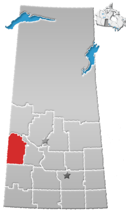
 Location of Brock in Saskatchewan  Brock, Saskatchewan (Canada) | |
| Coordinates: 51°26′30″N 108°43′01″W / 51.441667°N 108.716944°W | |
| Country | Canada |
| Province | Saskatchewan |
| Region | Southwest Saskatchewan |
| Census division | 13 |
| Rural Municipality | Kindersley |
| Post office Founded | March 1, 1910 |
| Government | |
| • Type | Municipal |
| • Governing body | Brock Village Council |
| • Mayor | Vance Brost |
| • Administrator | Charlotte Helfrich |
| • MP | Bill Boyd |
| • MLA | David Anderson |
| Area | |
| • Land | 0.74 km2 (0.29 sq mi) |
| Population (2016) | |
| • Total | 142 |
| • Density | 192.8/km2 (499/sq mi) |
| Postal code | S0L 0H0 |
| Area code(s) | 306 |
| Highways |
|
| Railways | Canadian National Railway |
| [1] | |
Brock is a village within the Rural Municipality of Kindersley No. 290 Saskatchewan, Canada. The village is located 165 km south-west of the city of Saskatoon. Brock was named for Isaac Brock, hero of the War of 1812. It is the hometown of Edmonton Oilers enforcer, Steve MacIntyre.
| Canada census – Brock, Saskatchewan community profile | |||
|---|---|---|---|
| 2016 | 2011 | 2006 | |
| Population: | 142 (+ 11.8% from 2011) | 127 (10.4% from 2006) | 115 (-11.5% from 2001) |
| Land area: | 0.74 km2 (0.29 sq mi) | 0.74 km2 (0.29 sq mi) | 0.74 km2 (0.29 sq mi) |
| Population density: | 192.8/km2 (499/sq mi) | 172.5/km2 (447/sq mi) | 156.2/km2 (405/sq mi) |
| Median age: | 37.2 (M: 39.5, F: 32.5) | 35.8 (M: 39.5, F: 32.2) | 42.5 (M: 39.0, F: 45.5) |
| Total private dwellings: | 63 | 60 | 60 |
| Median household income: | $NA | $NA | |
| References: 2016[2] 2011[3] 2006[4] earlier[5] | |||
See also
References
- ↑ National Archives, Archivia Net, Post Offices and Postmasters, retrieved 2011-08-01
- ↑ "2016 Community Profiles". Canada 2016 Census. Statistics Canada. February 21, 2017.
- ↑ "2011 Community Profiles". Canada 2011 Census. Statistics Canada. July 5, 2013. Retrieved 2012-08-04.
- ↑ "2006 Community Profiles". Canada 2006 Census. Statistics Canada. March 30, 2011. Retrieved 2009-02-24.
- ↑ "2001 Community Profiles". Canada 2001 Census. Statistics Canada. February 17, 2012.
External links
| Subdivisions | |
|---|---|
| Communities | |
| Cities | |
| Topics |
|
| |
Coordinates: 51°26′30″N 108°43′01″W / 51.44167°N 108.71694°W
This article is issued from
Wikipedia.
The text is licensed under Creative Commons - Attribution - Sharealike.
Additional terms may apply for the media files.