Netherhill, Saskatchewan
| Netherhill | |
|---|---|
| Village | |
| Village of Netherhill | |
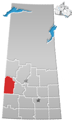
 Location of Netherhill in Saskatchewan  Netherhill, Saskatchewan (Canada) | |
| Coordinates: 51°29′13″N 108°56′56″W / 51.487°N 108.949°W | |
| Country | Canada |
| Province | Saskatchewan |
| Region | West-central |
| Census division | 13 |
| Rural Municipality | Kindersley |
| Government | |
| • Type | Municipal |
| • Governing body | Netherhill Village Council |
| • Mayor | Lorne Gerwing |
| • Administrator | Leona Henderson |
| • MP | Bill Boyd |
| • MLA | David Anderson |
| Area | |
| • Total | 0.73 km2 (0.28 sq mi) |
| Population (2016) | |
| • Total | 25 |
| • Urban density | 34.2/km2 (89/sq mi) |
| Time zone | CST |
| Postal code | S0L 2M0 |
| Area code(s) | 306 |
| Highways |
Hwy 658 |
| Railways | Canadian National Railway |
| [1][2][3][4] | |
Netherhill (2016 Population: 25) is a village within the Rural Municipality of Kindersley No. 290, Saskatchewan, Canada. The village is located approximately 20km east of the town of Kindersley at the junction of Highway 7 and 658.
Demographics
| Canada census – Netherhill, Saskatchewan community profile | |||
|---|---|---|---|
| 2016 | 2011 | 2006 | |
| Population: | 25 (0.0% from 2011) | 25 (-16.7% from 2006) | 30 (-14.3% from 2001) |
| Land area: | 0.73 km2 (0.28 sq mi) | 0.73 km2 (0.28 sq mi) | 0.73 km2 (0.28 sq mi) |
| Population density: | 34.2/km2 (89/sq mi) | 34.2/km2 (89/sq mi) | 41.0/km2 (106/sq mi) |
| Median age: | NA (M: NA, F: NA) | NA (M: NA, F: NA) | |
| Total private dwellings: | 14 | 15 | 14 |
| Median household income: | $NA | $NA | |
| References: 2016[5] 2011[6] 2006[7] earlier[8] | |||
Notable people
- Bob Bourne, a retired professional ice hockey left wing who played in the NHL between 1974 and 1988.
See also
References
- ↑ National Archives, Archivia Net, Post Offices and Postmasters
- ↑ Government of Saskatchewan, MRD Home, Municipal Directory System, archived from the original (– Scholar search) on November 21, 2008
- ↑ Canadian Textiles Institute. (2005), CTI Determine your provincial constituency, archived from the original on 2007-09-11
- ↑ Commissioner of Canada Elections, Chief Electoral Officer of Canada (2005), Elections Canada On-line
- ↑ "2016 Community Profiles". Canada 2016 Census. Statistics Canada. February 21, 2017. Retrieved 2017-03-15.
- ↑ "2011 Community Profiles". Canada 2011 Census. Statistics Canada. July 5, 2013.
- ↑ "2006 Community Profiles". Canada 2006 Census. Statistics Canada. March 30, 2011.
- ↑ "2001 Community Profiles". Canada 2001 Census. Statistics Canada. February 17, 2012.
External links
- Netherhill Village Council
- Saskatchewan City & Town Maps
- Saskatchewan Gen Web - One Room School Project
- Post Offices and Postmasters - ArchiviaNet - Library and Archives Canada
- Saskatchewan Gen Web Region
- Online Historical Map Digitization Project
- GeoNames Query
- 2001 Community Profiles
Places adjacent to Netherhill, Saskatchewan | ||||||||||
|---|---|---|---|---|---|---|---|---|---|---|
| ||||||||||
| Subdivisions | |
|---|---|
| Communities | |
| Cities | |
| Topics |
|
| |
This article is issued from
Wikipedia.
The text is licensed under Creative Commons - Attribution - Sharealike.
Additional terms may apply for the media files.