Roussillon, Isère
| Roussillon | |
|---|---|
| Commune | |
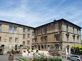 The old chateau where Charles IX signed the edict in 1564 | |
 Roussillon Location within Auvergne-Rhône-Alpes region  Roussillon | |
| Coordinates: 45°22′19″N 4°49′38″E / 45.3719°N 4.8272°ECoordinates: 45°22′19″N 4°49′38″E / 45.3719°N 4.8272°E | |
| Country | France |
| Region | Auvergne-Rhône-Alpes |
| Department | Isère |
| Arrondissement | Vienne |
| Canton | Roussillon |
| Intercommunality | Pays Roussillonnais |
| Government | |
| • Mayor (2014–2020) | Robert Duranton |
| Area1 | 11.62 km2 (4.49 sq mi) |
| Population (2011)2 | 7,983 |
| • Density | 690/km2 (1,800/sq mi) |
| Time zone | UTC+1 (CET) |
| • Summer (DST) | UTC+2 (CEST) |
| INSEE/Postal code | 38344 /38150 |
| Elevation | 146–265 m (479–869 ft) |
|
1 French Land Register data, which excludes lakes, ponds, glaciers > 1 km2 (0.386 sq mi or 247 acres) and river estuaries. 2 Population without double counting: residents of multiple communes (e.g., students and military personnel) only counted once. | |
Roussillon is a commune in the Isère department in southeastern France.
Population
| Historical population | ||
|---|---|---|
| Year | Pop. | ±% |
| 1793 | 1,549 | — |
| 1806 | 937 | −39.5% |
| 1821 | 1,260 | +34.5% |
| 1831 | 1,337 | +6.1% |
| 1841 | 1,594 | +19.2% |
| 1851 | 1,532 | −3.9% |
| 1861 | 1,528 | −0.3% |
| 1872 | 1,578 | +3.3% |
| 1881 | 1,478 | −6.3% |
| 1891 | 1,277 | −13.6% |
| 1901 | 1,263 | −1.1% |
| 1911 | 1,172 | −7.2% |
| 1921 | 1,195 | +2.0% |
| 1931 | 3,088 | +158.4% |
| 1946 | 3,576 | +15.8% |
| 1954 | 4,623 | +29.3% |
| 1962 | 6,588 | +42.5% |
| 1968 | 7,339 | +11.4% |
| 1975 | 7,551 | +2.9% |
| 1982 | 7,173 | −5.0% |
| 1990 | 7,365 | +2.7% |
| 1999 | 7,437 | +1.0% |
| 2006 | 7,806 | +5.0% |
| 2011 | 7,983 | +2.3% |
See also
References
| Wikimedia Commons has media related to Roussillon (Isère). |
This article is issued from
Wikipedia.
The text is licensed under Creative Commons - Attribution - Sharealike.
Additional terms may apply for the media files.