La Buisse
| La Buisse | |
|---|---|
| Commune | |
.jpg) Town hall | |
 La Buisse Location within Auvergne-Rhône-Alpes region  La Buisse | |
| Coordinates: 45°20′09″N 5°37′16″E / 45.3358°N 5.6211°ECoordinates: 45°20′09″N 5°37′16″E / 45.3358°N 5.6211°E | |
| Country | France |
| Region | Auvergne-Rhône-Alpes |
| Department | Isère |
| Arrondissement | Grenoble |
| Canton | Voiron |
| Intercommunality | CA Pays Voironnais |
| Government | |
| • Mayor (2008–2014) | Patrick Cholat |
| Area1 | 11.52 km2 (4.45 sq mi) |
| Population (2009)2 | 2,743 |
| • Density | 240/km2 (620/sq mi) |
| Time zone | UTC+1 (CET) |
| • Summer (DST) | UTC+2 (CEST) |
| INSEE/Postal code | 38061 /38500 |
| Elevation | 187–942 m (614–3,091 ft) |
|
1 French Land Register data, which excludes lakes, ponds, glaciers > 1 km2 (0.386 sq mi or 247 acres) and river estuaries. 2 Population without double counting: residents of multiple communes (e.g., students and military personnel) only counted once. | |
La Buisse is a commune in the Isère department in southeastern France.
Population
| Historical population | ||
|---|---|---|
| Year | Pop. | ±% |
| 1793 | 1,138 | — |
| 1800 | 1,215 | +6.8% |
| 1821 | 1,274 | +4.9% |
| 1831 | 1,347 | +5.7% |
| 1841 | 1,407 | +4.5% |
| 1851 | 1,295 | −8.0% |
| 1861 | 1,175 | −9.3% |
| 1872 | 1,078 | −8.3% |
| 1881 | 1,044 | −3.2% |
| 1891 | 996 | −4.6% |
| 1901 | 973 | −2.3% |
| 1911 | 850 | −12.6% |
| 1921 | 797 | −6.2% |
| 1931 | 995 | +24.8% |
| 1946 | 884 | −11.2% |
| 1954 | 1,055 | +19.3% |
| 1962 | 1,087 | +3.0% |
| 1968 | 1,006 | −7.5% |
| 1975 | 1,050 | +4.4% |
| 1982 | 1,206 | +14.9% |
| 1990 | 2,238 | +85.6% |
| 2006 | 2,627 | +17.4% |
| 2009 | 2,743 | +4.4% |
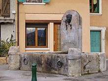
Medieval water fountain in La Buisse
See also
References
| Wikimedia Commons has media related to La Buisse. |
This article is issued from
Wikipedia.
The text is licensed under Creative Commons - Attribution - Sharealike.
Additional terms may apply for the media files.