Arrondissement of Vienne
| Vienne | |
|---|---|
| Arrondissement | |
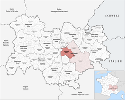 Location of Vienne in Auvergne-Rhône-Alpes | |
| Country | France |
| Region | Auvergne-Rhône-Alpes |
| Department | Isère |
| Communes | 117 |
| Subprefecture | Vienne |
| Area¹ | |
| • Total | 1,490 km2 (580 sq mi) |
| Population (2013) | |
| • Total | 212,106 |
| • Density | 140/km2 (370/sq mi) |
| ¹ French Land Register data, which exclude lakes, ponds, and glaciers larger than 1 km² as well as the estuaries of rivers. | |
The arrondissement of Vienne is an arrondissement of France in the Isère department in the Auvergne-Rhône-Alpes region. Since the January 2017 reorganization of the arrondissements of Isère, it has 117 communes.[1]
Composition
Cantons
The cantons of the arrondissement of Vienne are:
- Bièvre (partly)
- L'Isle-d'Abeau (partly)
- Roussillon
- La Verpillière (partly)
- Vienne-1
- Vienne-2
Communes
The communes of the arrondissement of Vienne, and their INSEE codes, are:
- Agnin (38003)
- Anjou (38009)
- Artas (38015)
- Arzay (38016)
- Assieu (38017)
- Auberives-sur-Varèze (38019)
- Balbins (38025)
- Beaufort (38032)
- Beaurepaire (38034)
- Beauvoir-de-Marc (38035)
- Bellegarde-Poussieu (38037)
- Bossieu (38049)
- Bougé-Chambalud (38051)
- Bressieux (38056)
- Brézins (38058)
- Brion (38060)
- Champier (38069)
- Chanas (38072)
- La Chapelle-de-Surieu (38077)
- Charantonnay (38081)
- Chasse-sur-Rhône (38087)
- Châtenay (38093)
- Cheyssieu (38101)
- Chonas-l'Amballan (38107)
- Chuzelles (38110)
- Chalon (38066)
- Châtonnay (38094)
- Clonas-sur-Varèze (38114)
- Commelle (38121)
- La Côte-Saint-André (38130)
- Les Côtes-d'Arey (38131)
- Cour-et-Buis (38134)
- Culin (38141)
- Diémoz (38144)
- Estrablin (38157)
- Eyzin-Pinet (38160)
- Faramans (38161)
- La Forteresse (38171)
- La Frette (38174)
- Gillonnay (38180)
- Grenay (38184)
- Heyrieux (38189)
- Jarcieu (38198)
- Jardin (38199)
- Lentiol (38209)
- Lieudieu (38211)
- Longechenal (38213)
- Luzinay (38215)
- Marcilloles (38218)
- Marcollin (38219)
- Marnans (38221)
- Meyrieu-les-Étangs (38231)
- Meyssiez (38232)
- Moidieu-Détourbe (38238)
- Moissieu-sur-Dolon (38240)
- Monsteroux-Milieu (38244)
- Montfalcon (38255)
- Montseveroux (38259)
- Mottier (38267)
- Nantoin (38274)
- Ornacieux (38284)
- Oytier-Saint-Oblas (38288)
- Pact (38290)
- Pajay (38291)
- Le Péage-de-Roussillon (38298)
- Penol (38300)
- Pisieu (38307)
- Plan (38308)
- Pommier-de-Beaurepaire (38311)
- Pont-Évêque (38318)
- Primarette (38324)
- Revel-Tourdan (38335)
- Reventin-Vaugris (38336)
- Les Roches-de-Condrieu (38340)
- Roussillon (38344)
- Royas (38346)
- Roybon (38347)
- Sablons (38349)
- Saint-Agnin-sur-Bion (38351)
- Saint-Alban-du-Rhône (38353)
- Saint-Barthélemy (38363)
- Saint-Clair-du-Rhône (38378)
- Saint-Clair-sur-Galaure (38379)
- Sainte-Anne-sur-Gervonde (38358)
- Saint-Étienne-de-Saint-Geoirs (38384)
- Saint-Geoirs (38387)
- Saint-Georges-d'Espéranche (38389)
- Saint-Hilaire-de-la-Côte (38393)
- Saint-Jean-de-Bournay (38399)
- Saint-Julien-de-l'Herms (38406)
- Saint-Just-Chaleyssin (38408)
- Saint-Maurice-l'Exil (38425)
- Saint-Michel-de-Saint-Geoirs (38427)
- Saint-Paul-d'Izeaux (38437)
- Saint-Pierre-de-Bressieux (38440)
- Saint-Prim (38448)
- Saint-Romain-de-Surieu (38452)
- Saint-Siméon-de-Bressieux (38457)
- Saint-Sorlin-de-Vienne (38459)
- Salaise-sur-Sanne (38468)
- Sardieu (38473)
- Savas-Mépin (38476)
- Semons (38479)
- Septème (38480)
- Serpaize (38484)
- Seyssuel (38487)
- Sillans (38490)
- Sonnay (38496)
- Thodure (38505)
- Tramolé (38512)
- Valencin (38519)
- Vernioz (38536)
- Vienne (38544)
- Villeneuve-de-Marc (38555)
- Ville-sous-Anjou (38556)
- Villette-de-Vienne (38558)
- Viriville (38561)
Sub-prefects
- Richard Samuel: on 24 March 1993
References
- ↑ "Arrêté n° 16-535, p 740" (PDF). Retrieved 2017-07-27.
External links
This article is issued from
Wikipedia.
The text is licensed under Creative Commons - Attribution - Sharealike.
Additional terms may apply for the media files.