Paradise Cay, California
| Paradise Cay County Service Area No. 29 | |
|---|---|
| Unincorporated community | |
 | |
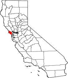
 Paradise Cay Location in California | |
| Coordinates: 37°54′46″N 122°28′32″W / 37.91278°N 122.47556°WCoordinates: 37°54′46″N 122°28′32″W / 37.91278°N 122.47556°W | |
| Country | United States |
| State | California |
| County | Marin County |
| Elevation[1] | 23 ft (7 m) |
Paradise Cay, also known as County Service Area No. 29,[2] is an unincorporated enclave, surrounded by the town of Tiburon in Marin County, California,[1] located 2 miles (3 km) south of Point San Quentin[3] at an elevation of 23 feet (7 m).[1] The waterfront community lies at the foot of the Tiburon Peninsula south of Corte Madera Creek along San Francisco Bay.[4] The community is in ZIP code 94920 and area code 415.
History
In the 1960s, the community was built as one of the last landfills allowed in San Francisco Bay. To many people who reside in Paradise Cay, it is known as "Moseleyville." The community was developed by patriarch Tim Moseley. Currently, his son Tom Moseley, his grandson Jeff Moseley, and Jonny Moseley (who won a gold medal in the 1998 Winter Olympics), and other family members all reside in their own respective homes in Paradise Cay, which includes just over 200 homes (Belvedere-Tiburon zip code 94920). Many of Paradise Cay's homes have docks that can accommodate a 60-foot (18 m) yacht.[5] Located along the community's north end is Tiburon Yacht Club, formerly called Paradise Yacht Club.[6]
Paradise Cay is situated close to Triangle Marsh, a location of considerable biological productivity. To the south is the Tiburon Peninsula, which is dominated by Ring Mountain; Ring Mountain itself exhibits extensive floral biodiversity and also manifests extant Native American petroglyphs.[7]
Politics
In the state legislature, Paradise Cay is in the 3rd Senate District, and in the 6th Assembly District. Federally, Paradise Cay is in California's 2nd congressional district, represented by Democrat Jared Huffman.[8]
Notable people
- Robin Williams (1951–2014), American stand-up comedian and actor.
References
- C. Michael Hogan. 2008. Ring Mountain, The Megalithic Portal, ed. A. Burnham
- Willis and Associates. 1973. Paradise Cay, Marin County, California: Environmental Impact Report, State of California Environmental Clearinghouse, Sacramento, CA.
- 1 2 3 "Paradise Cay". Geographic Names Information System. United States Geological Survey.
- ↑ Measure B: Increase and Extension of Funding for Maintenance of Paradise Cay - Marin County, CA
- ↑ Durham, David L. (1998). California's Geographic Names: A Gazetteer of Historic and Modern Names of the State. Clovis, Calif.: Word Dancer Press. p. 677. ISBN 1-884995-14-4.
- ↑ Paradise Cay, Marin County, California, USA - Maps, Photos, Weather, Local Links Archived 2009-11-10 at the Wayback Machine.
- ↑ Wood, Jim (May 2008). "Paradise Cay: Lots of yachts and so much more". Marin Magazine. Retrieved August 12, 2014.
- ↑ Fanning, Branwell (2010). Tiburon and Belvedere. Arcadia Publishing. p. 78. ISBN 978-0-7385-8188-0.
- ↑ C. Michael Hogan. 2008
- ↑ "California's 2nd Congressional District - Representatives & District Map". Civic Impulse, LLC. Retrieved March 8, 2013.
External links
| Wikimedia Commons has media related to Paradise Cay, California. |
| Bodies of water |
|  |
|---|---|---|
| Counties | ||
| Major cities | ||
| Cities and towns 100k–250k | ||
| Cities and towns 50k–99k | ||
| Cities and towns 25k-50k | ||
| Cities and towns 10k–25k |
| |
| Sub-regions | ||