Lairds Landing, California
| Lairds Landing | |
|---|---|
| Unincorporated community | |
 Lairds Landing Location in California  Lairds Landing Lairds Landing (the US) | |
| Coordinates: 38°09′34″N 122°54′45″W / 38.15944°N 122.91250°WCoordinates: 38°09′34″N 122°54′45″W / 38.15944°N 122.91250°W | |
| Country | United States |
| State | California |
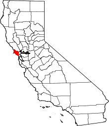
| County | Marin County |
| Elevation[1] | 36 ft (11 m) |
Lairds Landing is an unincorporated community in Marin County, California.[1] It is located on the southwest shore of Tomales Bay 6 miles (9.7 km) south of Tomales,[2] at an elevation of 36 feet (11 m).[1]
History
The name honors Charles & George Laird, who leased the site in 1858.[2]
The location was settled by the Felix family around 1861, a family of Filipino and Miwok heritage.[3] After the 1955 departure of the descendants of the Felix family, the land was zoned for development, was then made part of the Point Reyes National Seashore, before becoming home to artist Clayton Lewis.[4] In 2015, structures built by the Felix family were placed on the National Register of Historic Places.[5]
References
- 1 2 3 U.S. Geological Survey Geographic Names Information System: Lairds Landing, California
- 1 2 Durham, David L. (1998). California's Geographic Names: A Gazetteer of Historic and Modern Names of the State. Clovis, Calif.: Word Dancer Press. p. 650. ISBN 1-884995-14-4.
- ↑ Christy Avery (2009). Tomales Bay Environmental History and Historical Resource Study (Report). United States Department of the Interior. Retrieved 26 September 2018.
- ↑ Curwen, Thomas (18 April 2016). "Reminders of a bohemian artist's past will soon fade at Laird's Landing". Los Angeles Times. Retrieved 26 September 2018.
- ↑ Guth, Anna (20 September 2018). "Restoration underway at Lairds Landing". Point Reyes Light. Retrieved 26 September 2018.
This article is issued from
Wikipedia.
The text is licensed under Creative Commons - Attribution - Sharealike.
Additional terms may apply for the media files.