Taylorville, California
| Taylorville | |
|---|---|
| Former settlement | |
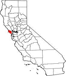
 Taylorville Location in California | |
| Coordinates: 38°01′45″N 122°44′27″W / 38.02917°N 122.74083°WCoordinates: 38°01′45″N 122°44′27″W / 38.02917°N 122.74083°W | |
| Country | United States |
| State | California |
| County | Marin County |
| Elevation[1] | 141 ft (43 m) |
Taylorville is a former settlement in Marin County, California.[1] It was located on the Northwestern Pacific Railroad 11 miles (18 km) west-southwest of downtown Novato,[2] at an elevation of 141 feet (43 m).[1] Taylorville still appeared on maps as of 1914.[1]
The name honors Samuel P. Taylor, founder of the first paper mill on the West Coast.[2]
References
Taylorville had a post office, a tannery, a gun powder factory, a water powered paper mill, then later a steam driven mill. An orchard, cattle ranch and was serviced by train from 1875 until 1933. Cap Taylor, on the same property had a hotel, a dance hall,two bowling alleys, boating on the creek, hunting and fishing. As many as 3000 people would visit on popular weekends.
This article is issued from
Wikipedia.
The text is licensed under Creative Commons - Attribution - Sharealike.
Additional terms may apply for the media files.