Territories of the United States
Territories of the United States | |
|---|---|
  | |
 The 50 states and the Federal District Commonwealth (see footnote) Incorporated unorganized territory Unincorporated organized territory Unincorporated unorganized territory | |
| Largest settlement | San Juan, Puerto Rico, United States |
| Languages | English, Spanish, Hawaiian, Chamorro, Carolinian, Samoan |
| Demonym | American |
| Territories | |
| Leaders | |
| Donald Trump | |
| List of current territorial governors | |
| Area | |
• Total | 22,294.19 km2 (8,607.83 sq mi) |
| Population | |
• Estimate | 4,065,516 |
| Currency | United States Dollar |
| Date format | mm/dd/yyyy (AD) |
| |
| Administrative divisions of the United States |
|---|
| First level |
|
|
| Second level |
|
| Third level |
|
|
| Fourth level |
| Other areas |
|
|
Territories of the United States are sub-national administrative divisions directly overseen by the United States Federal Government. Unlike U.S. states and Native American tribes which exercise limited sovereignty alongside the federal government, territories are without sovereignty.[2] The territories are classified by whether they are incorporated and whether they have an "organized" government through an Organic Act passed by the U.S. Congress.[3]
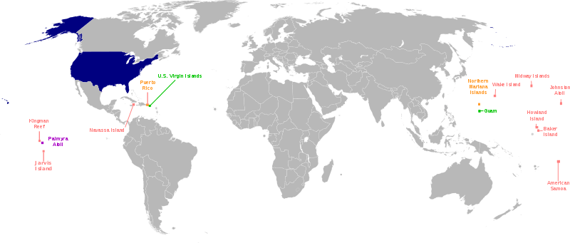
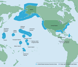
The U.S. has sixteen territories in the Caribbean Sea, the south Pacific Ocean, and the western portion of the north Pacific Ocean.[n 1][n 2] Five of the territories are permanently inhabited and are classified as unincorporated territories — they are American Samoa, Guam, the Northern Mariana Islands, Puerto Rico and the U.S. Virgin Islands. The other eleven territories are small islands, atolls, and reefs with no native or permanent population. Of those eleven, only one is classified as an incorporated territory. Two territories (Bajo Nuevo Bank and Serranilla Bank) are administered by Colombia.
Historically, territories were created to govern newly acquired land. Most territories eventually attained statehood.[5][6] Other territories at some point administered by the U.S., such as the Philippines, Micronesia, the Marshall Islands and Palau, eventually became independent countries.
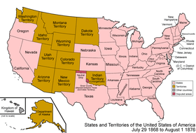
Many organized incorporated territories of the United States existed from 1789 to 1959. The first were the Northwest and the Southwest territories, and the last were the Alaska Territory and the Hawaii Territory. Of these, 31 territories applied for and were admitted as states. In the process of organizing and promoting territories to statehood, some areas of a territory lacking sufficient development and population densities were temporarily orphaned from parts of a larger territory after residents voted on whether to petition Congress for statehood. For example, when a portion of the Missouri Territory became the state of Missouri, the remaining portion of the territory, consisting of all the states of Iowa, Nebraska, South Dakota, and North Dakota, most of Kansas, Wyoming, and Montana, and parts of Colorado and Minnesota, effectively became an unorganized territory.[7]
U.S. territories tend to have infrastructure and telecommunications inferior to the United States mainland; for example, American Samoa's Internet speed was found to be slower than several Eastern European countries.[8] Poverty rates are also higher in the territories than in the states.[9][10]
Existing territories and their legal status
See also: Insular area
Territories have always been a part of the U.S.[11] According to federal law, the term "United States", when used in a geographical sense, means "the continental United States, Alaska, Hawaii, Puerto Rico, Guam, and the United States Virgin Islands".[12] Since political union with the Northern Mariana Islands in 1986, they too are treated as a part of the U.S.[12] An executive order adopted in 2007 includes American Samoa in the U.S. "geographical extent" as reflected in U.S. Department of State documents.[13]
Permanently inhabited territories
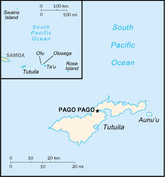
The U.S. has five territories that are permanently inhabited: Puerto Rico and the U.S. Virgin Islands in the Caribbean Sea; Guam and the Northern Mariana Islands in the Marianas archipelago in the western North Pacific Ocean; and American Samoa in the South Pacific Ocean.
Approximately 4 million people in these territories are U.S. citizens. U.S. citizenship at birth is granted in four of the five major territories.[14] American Samoa has about 32,000 non-citizen U.S. nationals.[15] Under U.S. law, among the territories, "only persons born in American Samoa and Swains Island are non-citizen U.S. nationals."[16] American Samoans are under the protection of the U.S., with the ability to travel to the U.S. without a visa.[16] However, to become U.S. citizens, American Samoans must naturalize as if they were foreigners.[17] American Samoans don't have natural-born U.S. citizenship because the US Congress has not passed any legislation giving citizenship to residents of American Samoa (unlike the other 4 inhabited territories).[14]
Each of these territories is an organized,[n 3] self-governing territory with three branches of government, a locally elected governor, and a territorial legislature.
Each territory also elects a non-voting member (or a non-voting resident commissioner in the case of Puerto Rico) to the U.S. House of Representatives.[18][19] They "possess the same powers as other members of the House, except that they may not vote when the House is meeting as the House of Representatives."[20] They participate in debate, are assigned offices and money for staff, and nominate constituents from their territories to the Army, Navy and Marine Corps, Air Force, and Merchant Marine service academies.[20] They can vote in committee on all legislation presented to the House of Representatives. They are included in their party count for each committee, and they are equal to senators on conference committees. Depending on the congress, they may also vote on the floor in the House Committee of the Whole.[21] As of January 2017, the members of Congress from these territories were: Gregorio Sablan for the Northern Mariana Islands, Madeleine Bordallo for Guam, Amata Coleman Radewagen for American Samoa, Jenniffer González for Puerto Rico, and Stacey Plaskett for the U.S. Virgin Islands.[22] The District of Columbia also has a non-voting delegate.
Like the District of Columbia, territories of the United States do not have voting representation in the US Congress, and they do not have U.S. Senators.[23][24]
Every four years, U.S. political parties nominate their presidential candidates at conventions, which include delegates from these territories.[25] However, the U.S. citizens living in territories such as Puerto Rico cannot vote in the general election for president of the U.S.[23] Non-citizen nationals in American Samoa also can't vote for the president.[14]
The capitals of these territories are Pago Pago in American Samoa; Hagåtña in Guam; Saipan in the Northern Mariana Islands; San Juan in Puerto Rico; and, Charlotte Amalie in the U.S. Virgin Islands.[26][27]
The current governors of these territories are the following: Lolo Matalasi Moliga (American Samoa), Eddie Baza Calvo (Guam), Ralph Torres (Northern Mariana Islands), Ricardo Rosselló (Puerto Rico), and Kenneth Mapp (U.S. Virgin Islands).
| Name | Abbr. | Location | Area | Population (2017) |
Capital | Largest town | Status | Date acquired |
|---|---|---|---|---|---|---|---|---|
| AS | Polynesia & South Pacific | 197.1 km2 (76 sq mi) | 51,504 | Pago Pago | Tafuna | Unincorporated & unorganized | April 17, 1900 | |
| GU | Micronesia & North Pacific | 543 km2 (210 sq mi) | 162,742 | Hagåtña | Dededo | Unincorporated & organized | April 11, 1899 | |
| MP | Micronesia & North Pacific | 463.63 km2 (179 sq mi) | 52,263 | Capitol Hill, Saipan[n 4] | Garapan | Unincorporated & organized | November 3, 1986 | |
| PR | Caribbean & North Atlantic | 9,104 km2 (3,515 sq mi) | 3,337,177 | San Juan | San Juan | Unincorporated & organized | April 11, 1899 | |
| VI | Caribbean & North Atlantic | 346.36 km2 (134 sq mi) | 104,901 | Charlotte Amalie | Charlotte Amalie | Unincorporated & organized | March 31, 1917 | |
Notes
- American Samoa — Territory since 1900, when the Treaty of Cession of Tutuila took effect.[28] The Manuʻa islands became part of American Samoa in 1904, and Swains Island became part of American Samoa in 1925.[28] The US Congress ratified American Samoa's treaties in 1929.[28] American Samoa is locally self-governing under a constitution last revised in 1967.[30] People born in American Samoa are non-citizen nationals.[14] American Samoa is technically unorganized. The main island is Tutuila.
- Guam — Territory since 1899, Guam is the home of Naval Base Guam and Andersen Air Force Base. Guam was organized under the Guam Organic Act of 1950.
- Northern Mariana Islands — Commonwealth since 1986; formerly a United Nations Trust Territory under the administration of the United States. A new government and constitution was approved in a 1977 referendum. Sometimes the abbreviation "CNMI" is used (for "Commonwealth of the Northern Mariana Islands"). The main island is Saipan.
- Puerto Rico — Unincorporated territory since 1899, a commonwealth since 1952. Puerto Rico was organized under the Puerto Rico Federal Relations Act of 1950 (Public Law 600). In November 2008, a U.S. District Court judge ruled that a sequence of Congressional actions have had the cumulative effect of changing Puerto Rico's status from "unincorporated" to "incorporated."[31] However, the issue has not finished making its way through the court system;[32] and the U.S. government still refers to Puerto Rico as unincorporated.[33] A Puerto Rico attorney has called Puerto Rico "semi-sovereign".[34] There is a statehood movement in Puerto Rico — its goal is to make Puerto Rico the 51st state.[24][35] See also Political status of Puerto Rico.
- United States Virgin Islands — Purchased by the U.S. from Denmark in 1917, and organized under the Revised Organic Act of the Virgin Islands in 1954. U.S. Citizenship was granted in 1927.[36] The main islands are Saint Thomas, Saint John and Saint Croix.
Statistics
Except for Guam, the inhabited territories have had negative population growth between 2010 and 2017. The inhabited territories also have high poverty rates, but also high Human Development Index (HDI) rankings. All poverty rates are higher than the mainland United States. Four of the five territories have an official language other than English.[37][38]
| Territory | Official Language(s)[37][38] | Population Growth (2010 to 2017)[39] |
Poverty rate (2009)[40][41] | Life expectancy (years) | HDI ranking[42][43] | GDP (dollars)[44] | Driving Side | Time Zone | Calling Code |
|---|---|---|---|---|---|---|---|---|---|
| English and Samoan | −2.39% | 65%[n 5] | 73.4 | 0.827 (Very High HDI) | $658,000,000 | right | Samoan Time (UTC-11) | +1-684 | |
| English and Chamorro | +2.12% | 22.9% | 76 | 0.901 (Very High HDI) | $5,793,000,000 | right | Chamorro Time (UTC+10) | +1-671 | |
| English, Chamorro, and Carolinian |
−0.68% | 52.3% | 75.4 | 0.875 (Very High HDI) | $1,242,000,000 | right | Chamorro Time (UTC+10) | +1-670 | |
| English and Spanish | −10.43% | 43.5%[n 6] | 80.9 | 0.845 (Very High HDI) | $103,135,000,000 | right | Atlantic Time (UTC−4) | +1-787, +1-939 | |
| English | −3.25% | 22.4% | 79.4 | 0.894 (Very High HDI) | $3,765,000,000 | left | Atlantic Time (UTC−4) | +1-340 | |
The inhabited territories do not have counties.[n 7] The U.S. Census Bureau counts the following as county-equivalents: the 78 municipalities of Puerto Rico, the 3 main islands of the U.S. Virgin Islands, all of Guam, the 4 municipalities of the Northern Mariana Islands, and the 3 districts and 2 atolls of American Samoa.[46][47] The U.S. Census Bureau also counts each of the islands in the U.S. Minor Outlying Islands as county-equivalents.[46][47]
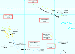
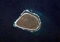
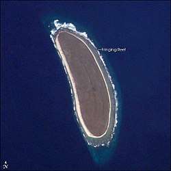
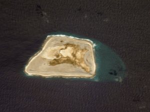
Uninhabited territories
The U.S. has eleven territories with no native or permanent population, called the U.S. Minor Outlying Islands. They are small islands, atolls, and reefs spread across the Caribbean Sea and the Pacific Ocean: Palmyra Atoll, Baker Island, Howland Island, Jarvis Island, Johnston Atoll, Kingman Reef, the Midway Islands, Bajo Nuevo Bank, Navassa Island, Serranilla Bank, and Wake Island. Palmyra Atoll (formally, the United States Territory of Palmyra Island[48]) is the only incorporated U.S. territory, a status it has maintained since the Territory of Hawaii became a state in 1959.
The status of several territories is disputed: Navassa Island is disputed by Haiti, Wake Island is disputed by the Marshall Islands, Swains Island (part of American Samoa) is disputed by Tokelau, and Serranilla Bank and Bajo Nuevo Bank (both administered by Colombia) are disputed by Colombia, Jamaica, Honduras, and Nicaragua.[49][50]
| Name | Location | Area | Population | Status | Note |
|---|---|---|---|---|---|
| Bajo Nuevo Bank | North Atlantic Ocean & Caribbean Sea | 110 km2 (42 sq mi) | 0 | Unincorporated & unorganized | Administered by Colombia. Claimed by the U.S. (under the Guano Islands Act) and Jamaica. A claim by Nicaragua was resolved in 2012 in favor of Colombia by the International Court of Justice, although the U.S. was not a party to that case and does not recognize the jurisdiction of the ICJ.[51] |
| Baker Island[lower-alpha 1] | North Pacific Ocean | 2.1 km2 (0.81 sq mi) | 0 | Unincorporated & unorganized | Claimed under the Guano Islands Act on October 28, 1856.[52][53] Formally annexed on May 13, 1936, and placed under the jurisdiction of the United States Department of the Interior.[54] |
| Howland Island[lower-alpha 1] | North Pacific Ocean | 4.5 km2 (1.7 sq mi) | 0 | Unincorporated & unorganized | Claimed under the Guano Islands Act on December 3, 1858.[52][53] Formally annexed on May 13, 1936, and placed under the jurisdiction of the U.S. Department of the Interior.[54] |
| Jarvis Island[lower-alpha 1] | South Pacific Ocean & Polynesia | 4.75 km2 (1.83 sq mi) | 0 | Unincorporated & unorganized | Claimed under the Guano Islands Act on October 28, 1856.[52][53] Formally annexed on May 13, 1936, and placed under the jurisdiction of the U.S. Department of the Interior.[54] |
| North Pacific Ocean | 2.67 km2 (1.03 sq mi) | 0 | Unincorporated & unorganized | Last used by the U.S. Department of Defense in 2004 | |
| Kingman Reef[lower-alpha 1] | North Pacific Ocean & Polynesia | 18 km2 (6.9 sq mi) | 0 | Unincorporated & unorganized | Claimed under the Guano Islands Act on February 8, 1860.[52][53] Formally annexed on May 10, 1922, and placed under the jurisdiction of the U.S. Department of the Navy on December 29, 1934.[55] |
| North Pacific Ocean | 6.2 km2 (2.4 sq mi) | 40 | Unincorporated & unorganized | Territory since 1859; primarily a wildlife refuge inhabited only by civilian contractors; previously under the jurisdiction of the U.S. Department of the Navy. | |
| North Atlantic Ocean & Caribbean Sea | 5.4 km2 (2.1 sq mi) | 0 | Unincorporated & unorganized | Territory since 1857. Claimed by Haiti. | |
| North Pacific Ocean & Polynesia | 12 km2 (5 sq mi) | 20 | Incorporated & unorganized | As of 2007, partly privately owned by The Nature Conservancy with much of the rest owned by the federal government and managed by the U.S. Fish and Wildlife Service.[56][57] It is an archipelago of about 50 small islands with about 1.56 sq mi (4.0 km2) of land area, lying about 1,000 miles (1,600 km) south of Oahu, Hawaii. The atoll was acquired by the U.S. through the annexation of the Republic of Hawaii in 1898. When the Territory of Hawaii was incorporated on April 30, 1900, Palmyra Atoll was incorporated as part of that territory. When the State of Hawaii was admitted to the Union in 1959, however, the Act of Congress explicitly separated Palmyra Atoll from the newly federated state. Palmyra remained an incorporated territory, but received no new organized government.[58] | |
| Serranilla Bank | North Atlantic Ocean & Caribbean Sea | 350 km2 (140 sq mi) | 0 | Unincorporated & unorganized | Administered by Colombia; site of a naval garrison. Claimed by the U.S (since 1879 under the Guano Islands Act), Honduras, and Jamaica. A claim by Nicaragua was resolved in 2012 in favor of Colombia by the International Court of Justice, although the U.S. was not a party to that case and does not recognize the jurisdiction of the ICJ.[51] |
| North Pacific Ocean & Micronesia | 7.4 km2 (2.9 sq mi) | 150 | Unincorporated & unorganized | Territory since 1898; host to the Wake Island Airfield administered by the U.S. Air Force; claimed by the Marshall Islands.[59] |
- 1 2 3 4 5 6 These six territories, together with Palmyra Atoll, comprise the Pacific Remote Islands Marine National Monument.
.jpg)

Incorporated and unincorporated territories
The U.S. Congress decides whether a territory is incorporated or unincorporated. The entire U.S. constitution applies to each incorporated territory, including its local government and all of its inhabitants, in the same manner as it applies to the local governments and residents of a state. Incorporated territories are considered an integral part of the U.S., not mere possessions.[60]
From 1901 to 1905, the U.S. Supreme Court in a series of cases known as the Insular Cases held that the constitution extended by its own force to U.S. territories. The Court in these cases, however, also established the doctrine of territorial incorporation, under which the constitution applies fully to incorporated territories, such as the territories of Alaska and Hawaii, and applies partially in the unincorporated territories of Puerto Rico, Guam, and the Philippines.[61][62]
The U.S. had no unincorporated territories (also called "overseas possessions" or "insular areas") until 1856. In that year, the U.S. Congress enacted the Guano Islands Act, which authorised the president to take possession of unclaimed islands to mine guano. Under this law, the U.S. has taken control of and claimed rights in many islands, atolls, etc., especially in the Caribbean Sea and the Pacific Ocean, most of which have since been abandoned. The U.S. also has acquired territories since 1856 under other circumstances, such as under the Treaty of Paris (1898) that ended the Spanish–American War. The U.S. Supreme Court considered the constitutional position of these unincorporated territories in Balzac v. People of Porto Rico, where the Court said the following about a U.S. court in Puerto Rico:[63]:312
The United States District Court is not a true United States court established under article 3 of the Constitution to administer the judicial power of the United States.... It is created ... by the sovereign congressional faculty, granted under article 4, 3, of that instrument, of making all needful rules and regulations respecting the territory belonging to the United States. The resemblance of its jurisdiction to that of true United States courts, in offering an opportunity to nonresidents of resorting to a tribunal not subject to local influence, does not change its character as a mere territorial court.
In Glidden Company v. Zdanok, the U.S. Supreme Court cited the Balzac case and said with regard to courts in unincorporated territories, "Upon like considerations, Article III has been viewed as inapplicable to courts created in unincorporated territories outside the mainland ... and to the consular courts established by concessions from foreign countries...."[64]:547
The courts determined that incorporation involves express declaration, or an implication so strong as to exclude any other view (raising questions about Puerto Rico's status).[65]
In 1966, Congress transformed the United States District Court for the District of Puerto Rico into an Article III district court—the only instance in history for a territory that has not yet attained statehood, which sets Puerto Rico apart judicially from the other unincorporated territories. This has caused at least one U.S. district judge to express the opinion that Puerto Rico is no longer unincorporated:[66]
The court … today holds that in the particular case of Puerto Rico, a monumental constitutional evolution based on continued and repeated congressional annexation has taken place. Given the same, the territory has evolved from an unincorporated to an incorporated one. Congress today, thus, must afford Puerto Rico and the 4,000,000 United States citizens residing therein all constitutional guarantees. To hold otherwise, would amount to the court blindfolding itself to continue permitting Congress per secula seculorum to switch on and off the Constitution.
Express or implied?
In the Balzac case, the Court defined the meaning of "implied":[63]:306
Had Congress intended to take the important step of changing the treaty status of Puerto Rico by incorporating it into the Union, it is reasonable to suppose that it would have done so by the plain declaration, and would not have left it to mere inference. Before the question became acute at the close of the Spanish War, the distinction between acquisition and incorporation was not regarded as important, or at least it was not fully understood and had not aroused great controversy. Before that, the purpose of Congress might well be a matter of mere inference from various legislative acts; but in these latter days, incorporation is not to be assumed without express declaration, or an implication so strong as to exclude any other view.
U.S. Supreme Court decisions about particular territories
The U.S. Supreme Court in Rassmussen v. U.S. first quoted from Article III of the 1867 treaty for the purchase of Alaska and then said, "'The inhabitants of the ceded territory ... shall be admitted to the enjoyment of all the rights, advantages, and immunities of citizens of the United States....' This declaration, although somewhat changed in phraseology, is the equivalent ... of the formula, employed from the beginning to express the purpose to incorporate acquired territory into the United States, especially in the absence of other provisions showing an intention to the contrary."[67]:522
Part of the act of incorporation is on the people of the territory, not on the territory per se, by extending the privileges and immunities clause of the constitution to them, such as when it was extended to Puerto Rico in 1947 (despite this, Puerto Rico remains officially unincorporated).[65]
The 2016 Supreme Court case Puerto Rico v. Sanchez Valle ruled that territories don't have their own sovereignty.[2]
In 2016, the Supreme Court declined to rule on a lower court ruling that American Samoans do not get citizenship at birth (Tuana v. United States).[68][69]
Alaska Territory
The Rassmussen case arose out of a criminal conviction by a six-person jury in Alaska under a federal law allowing this procedure there. The Court held that Alaska had been incorporated into the U.S. because of the treaty of cession with Russia.[70] In addition, the Congressional implication was so strong as to exclude any other view:[67]:523
That Congress, shortly following the adoption of the treaty with Russia, clearly contemplated the incorporation of Alaska into the United States as a part thereof, we think plainly results from the act of July 20, 1868, concerning internal revenue taxation ... and the act of July 27, 1868 ... extending the laws of the United States relating to customs, commerce, and navigation over Alaska, and establishing a collection district therein. ... And this is fortified by subsequent action of Congress, which it is unnecessary to refer to.
In his concurring opinion, Justice Henry Brown expressed the same thought:[67]:533–4
Apparently, acceptance of the territory is insufficient in the opinion of the court in this case, since the result that Alaska is incorporated into the United States is reached, not through the treaty with Russia, or through the establishment of a civil government there, but from the act ... extending the laws of the United States relating to the customs, commerce, and navigation over Alaska, and establishing a collection district there. Certain other acts are cited, notably the judiciary act ... making it the duty of this court to assign ... the several territories of the United States to particular Circuits.
Florida Territory
In Dorr v. U.S., the U.S. Supreme Court quoted Chief Justice John Marshall from an earlier case as follows:[71]:141–2
The 6th article of the treaty of cession contains the following provision: 'The inhabitants of the territories which His Catholic Majesty cedes the United States by this treaty shall be incorporated in the Union of the United States as soon as may be consistent with the principles of the Federal Constitution, and admitted to the enjoyment of the privileges, rights, and immunities of the citizens of the United States.' ... This treaty is the law of the land, and admits the inhabitants of Florida to the enjoyment of the privileges, rights, and immunities of the citizens of the United States. It is unnecessary to inquire whether this is not their condition, independent of stipulation. They do not, however, participate in political power; they do not share in the government till Florida shall become a state. In the meantime Florida continues to be a territory of the United States, governed by virtue of that clause in the Constitution which empowers Congress "to make all needful rules and regulations respecting the territory or other property belonging to the United States.'"
In Downes v. Bidwell, the Court said, "The same construction was adhered to in the treaty with Spain for the purchase of Florida ... the 6th article of which provided that the inhabitants should 'be incorporated into the Union of the United States, as soon as may be consistent with the principles of the Federal Constitution.'"[72]:256
Southwest Territory
In the Downes case, the first mention of incorporation is made in the following paragraph by Justice Brown:[72]:321–2
In view of this it cannot, it seems to me, be doubted that the United States continued to be composed of states and territories, all forming an integral part thereof and incorporated therein, as was the case prior to the adoption of the Constitution. Subsequently, the territory now embraced in the state of Tennessee was ceded to the United States by the state of North Carolina. In order to insure the rights of the native inhabitants, it was expressly stipulated that the inhabitants of the ceded territory should enjoy all the rights, privileges, benefits, and advantages set forth in the ordinance 'of the late Congress for the government of the western territory of the United States.
Louisiana Territory
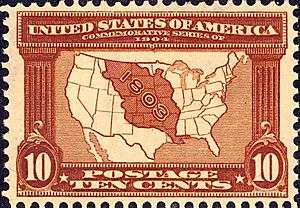
In the Downes case, the Court said:[72]:252
Owing to a new war between England and France being upon the point of breaking out, there was need for haste in the negotiations, and Mr. Livingston took the responsibility of disobeying his (Mr. Jefferson's) instructions, and, probably owing to the insistence of Bonaparte, consented to the 3d article of the treaty (with France to acquire the territory of Louisiana), which provided that 'the inhabitants of the ceded territory shall be incorporated in the Union of the United States, and admitted as soon as possible, according to the principles of the Federal Constitution, to the enjoyment of all the rights, advantages, and immunities of citizens of the United States; and in the meantime they shall be maintained and protected in the free enjoyment of their liberty, property, and the religion which they profess.' [8 Stat. at L. 202.] This evidently committed the government to the ultimate, but not to the immediate, admission of Louisiana as a state....
The U.S. Supreme Court is unanimous in its interpretation that the extension of the privileges and immunities clause of the U.S. Constitution to the inhabitants of a territory in effect produces the incorporation of that territory. The net effect of incorporation is that the territory becomes an integral part of the geographical boundaries of the U.S. and cannot, from then on, be separated. The whole body of the U.S. Constitution is extended to the inhabitants of that territory, except for those provisions that relate to its federal character.
Moreso, the needful rules and regulations of the territorial clause must yield to the Constitution and the inherent constraints imposed on it in dealing with the privileges and immunities of the inhabitants of the incorporated territory.
Notice must be taken that incorporation of a territory takes place through the incorporation of its inhabitants, not of the territory per se. As such, those inhabitants receive the full impact of the U.S. Constitution, except for those provisions that deal specifically with the federal character of the Union.
Current U.S. territories by group
All U.S. territories are in the Northern Hemisphere with the exception of American Samoa and Jarvis Island.
Incorporated organized territories
With the exception of Washington DC, a special type of territory called a federal district, no incorporated organized territory has existed since 1959, when both Alaska and Hawaii were granted Admission to the Union.
Incorporated unorganized territories
Many incorporated unorganized territories became incorporated organized territories or states. For example, when the eastern part of the incorporated organized territory called Minnesota became the state of Minnesota in 1858, the western part became part of an unorganized territory. Later, that became a part of the Dakota Territory, out of which two states and some parts of other states were created. California was part of an unorganized territory when it became a state. Currently, only Palmyra Atoll is incorporated and unorganized.
There are also territories that have the status of being incorporated but that are not organized:
- U.S. coastal waters out to 12 nautical miles (14 mi; 22 km) offshore (except state waters extend a minimum of 3 nautical miles (3.5 mi; 5.6 km) offshore).
Unincorporated organized territories
There are four unincorporated and organized territories: Guam, Northern Mariana Islands, Puerto Rico, and U.S. Virgin Islands.
Unincorporated unorganized territories
American Samoa and all of the U.S. Minor Outlying Islands are unincorporated and unorganized (except Palmyra Atoll, which is incorporated and unorganized).
|
|
Inhabited territories
American Samoa, Guam, the Northern Mariana Islands, Puerto Rico and the U.S. Virgin Islands are inhabited.
Uninhabited territories
The U.S. Minor Outlying Islands have no permanent human population. All are unincorporated and unorganized, except for Palmyra Atoll, which is incorporated and unorganized. There are non-permanent human populations at Palmyra Atoll, Wake Island and Midway Atoll.
|
|
Extraterritorial jurisdiction
The U.S. exercises some degree of extraterritorial jurisdiction in several overseas areas, such as:
- Guantanamo Bay Naval Base (since 1903): A 45 square miles (120 km2) land area along Guantánamo Bay, Cuba, to which the U.S. claims to hold a perpetual lease.[73] The Cuban government does not recognize this claim and has refused to accept any payment since 1959. The lease amount is US$2,000 in gold per year.[74]
- American research stations in Antarctica: Amundsen–Scott South Pole Station, McMurdo Station, and Palmer Station are under U.S. jurisdiction but are held without sovereignty per the Antarctic Treaty.
- Certain other parcels in foreign countries held by lease, such as military bases, depending on the terms of a lease, treaty, or status of forces agreement with the host country.
Associated states
Micronesia, the Marshall Islands, and Palau gained independence under the Compact of Free Association (COFA), which gives the U.S. full authority over aid and defense in exchange for continuing access to U.S. health care, government services such as the Federal Communications Commission and the U.S. Postal Service, and the right for COFA citizens to work freely in the U.S. and vice versa.[75]
The United States exercises a high degree of control in defense, funding, and government services in:
Organized territory
Organized territories are lands under the sovereignty of the federal government (but not part of any state) that were given a measure of self-rule by the Congress through an Organic Act subject to the Congress's plenary powers under the territorial clause of Article IV, sec. 3, of the U.S. Constitution.[76]
Classification of former U.S. territories and administered areas
Former incorporated organized territories of the United States
Former unincorporated territories of the United States (incomplete)
- The Corn Islands (1914–1971): leased for 99 years under the Bryan-Chamorro Treaty. However, returned to Nicaragua upon the abrogation of the treaty in 1970.
- The Line Islands (?–1979): disputed claim with the United Kingdom. U.S. claim to most of the islands was ceded to Kiribati upon its independence in 1979. The U.S. retained Kingman Reef, Palmyra Atoll, and Jarvis Island.
- The Philippine Islands (1898–1935), the Commonwealth of the Philippines (1935–46): granted full independence on July 4, 1946.
- Phoenix Islands (?–1979): disputed claim with the United Kingdom. U.S. claim ceded to Kiribati upon its independence in 1979. Baker Island and Howland Island, which could be considered part of this group, are retained by the U.S.
- Quita Sueño Bank (1869–1981): claimed under Guano Islands Act. Claim abandoned on September 7, 1981, by treaty.
- Roncador Bank (1856–1981): claimed under Guano Islands Act. Ceded to Colombia on September 7, 1981, by treaty.
- Serrana Bank (1874?–1981): claimed under Guano Islands Act. Ceded to Colombia on September 7, 1981, by treaty.
- Swan Islands (1863–1972): claimed under Guano Islands Act. Ceded to Honduras in 1972, by treaty.
Former unincorporated territories of the United States under military government

Areas formerly administered by the United States


Other zones
- United States occupation of Greenland (1941–1945)[79]
- United States occupation of Iceland during World War II (1941–1946),[79] retained a military base until 2006.
- American Occupation Zones in Allied-occupied Austria and Vienna (1945–1955)
- American Occupation Zone in West Berlin (1945–1990)
- American Occupation Zones of the Allied Occupation Zones in Germany (1945–1949)
- Allied Military Government for Occupied Territories in full force in Allied-controlled sections of Italy from Invasion of Sicily in July 1943 until the armistice with Italy in September 1943. AMGOT continued in newly liberated areas of Italy until the end of World War II. Also existed in combat zones of Allied nations such as France.
- Free Territory of Trieste (1947–1954) The U.S. co-administered a portion of the Free Territory between the Kingdom of Italy and the former Kingdom of Yugoslavia after World War II along with the United Kingdom.
- Occupation of Japan (1945–1952) after World War II.
- U.S. participation in the Occupation of the Rhineland (Germany) (1918–1921)
- South Korea (U.S. occupation of the south of the 38th parallel north in Korea in 1945–1948). The region is slightly different from the practical boundary of the Republic of Korea (South Korea) since the ceasefire of the Korean War. See also Division of Korea.
- Coalition Provisional Authority Iraq (2003–2004)
- Green zone Iraq (March 20, 2003 – December 31, 2008)[80]
- Clipperton Island (1944–1945), occupied territory; returned to France on October 23, 1945.
- Grenada invasion and occupation (1983)
Cultural image
In his book The Not-Quite States of America (a book about the U.S. territories), author Doug Mack said the following about the U.S. territories: "It seemed that, right around the turn of the twentieth century, the territories were part of the national mythology and the everyday conversation. [...] A century or so ago, Americans didn't just know about the territories but cared about them, argued about them. But what changed? How and why did they disappear from the national conversation?"[81] He also said, "The territories have made us who we are. They represent the USA's place in the world. They've been a reflection of our national mood in nearly every period of American history."[81]
In 2018, regarding a bill to make Puerto Rico the 51st state, representative Stephanie Murphy of Florida said the following: "The hard truth is that Puerto Rico’s lack of political power allows Washington to treat Puerto Rico like an afterthought, as the federal government’s inadequate preparation for and response to Hurricane Maria made crystal clear.”[82] Similarly, the Governor of Puerto Rico (Ricardo Rosselló) said the following about Puerto Rico: "Because we don’t have political power, because we don’t have representatives, [no] senators, no vote for president, we are treated as an afterthought."[83] Rosselló also said that Puerto Rico is the "oldest, most populous colony in the world".[84]
Galleries
Current territorial non-voting members of the House of Representatives
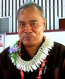
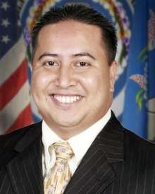
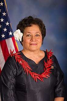 Congresswoman Amata Coleman Radewagen (American Samoa)
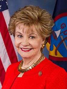 Congresswoman Madeleine Bordallo (Guam)
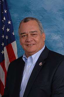 Congressman Gregorio Sablan (Northern Mariana Islands)
 Congresswoman Jenniffer González (Puerto Rico)
.jpg) Congresswoman Stacey Plaskett (U.S. Virgin Islands)
Congresswoman Stacey Plaskett (U.S. Virgin Islands)
Current territorial governors


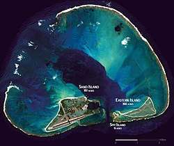
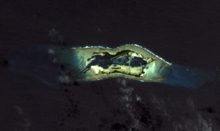
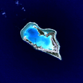
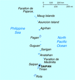
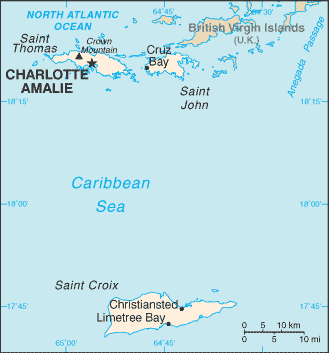
Satellite images
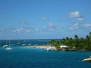
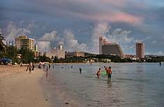
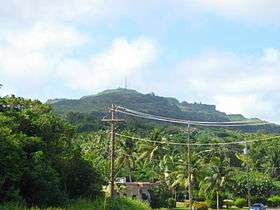
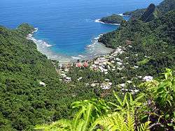
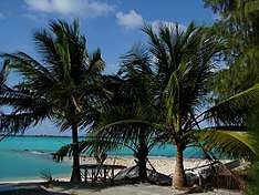
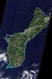
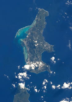
Inhabited territories
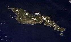
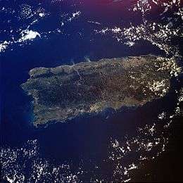
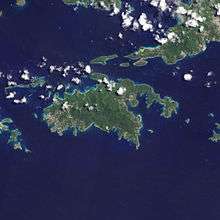
Uninhabited territories (U.S. Minor Outlying Islands)


Maps
_-_GUM_-_UNOCHA.svg.png)
.png)
See also
- Enabling act (United States)
- Extreme points of the United States
- Hawaiian Organic Act
- Historic regions of the United States
- Legal status of Hawaii
- Organic Acts of 1845–46
- Political divisions of the United States
- Political status of Puerto Rico
- Territories of the United States on stamps
- United States Minor Outlying Islands
- United States territory
- Unorganized territories
Notes
- ↑ Excluding Bajo Nuevo Bank and Serranilla Bank (which are administered by Colombia), the U.S. has fourteen territories.
- ↑ Some residents of Sikaiana (also known as the Stewart Islands) believe they are U.S. Citizens and that Sikaiana is part of the United States: "They base their claim on the assertion that the Stewart Islands were ceded to King Kamehameha IV and accepted by him as part of the Kingdom of Hawaii in 1856 and, thus, were part of the Republic of Hawaii (which was declared in 1893) when it was annexed to the United States by law in 1898." However, Sikaiana was not included within "Hawaii and its dependencies".[4]
- ↑ American Samoa is technically unorganized, but it is de facto organized.
- ↑ Because Saipan is governed as a single municipality, most publications refer to the capital as "Saipan"
- ↑ American Samoa's poverty rate (65%) is from 2017.[9] In 2009, the poverty rate in American Samoa was 57.8%[45]
- ↑ Puerto Rico's poverty rate is from 2017.
- ↑ American Samoa has 14 counties, but they are not counted by the U.S. Census Bureau (they are treated as minor civil divisions).[46][47]
References
- ↑ "Definition of Terms - 1120 Acquisition of U.S. Nationality in U.S. Territories and Possessions" (PDF). U.S. Department of State Foreign Affairs Manual Volume 7- Consular Affairs. U.S. Department of State.
- 1 2 https://www.usatoday.com/story/news/politics/2016/06/09/supreme-court-puerto-rico-independent-sovereign/85155382/ Puerto Rico Not Sovereign, Supreme Court Says. Richard Wolf, USA Today. June 9, 2016. Retrieved 19 January 2018.
- ↑ "Definitions of Insular Area Political Organizations". U.S. Department of the Interior. 2015-06-12.
- ↑ https://www.gpo.gov/fdsys/pkg/GAOREPORTS-OGC-98-5/pdf/GAOREPORTS-OGC-98-5.pdf
GAO. United States General Accounting Office. U.S. Insular Areas. Application of the U.S. Constitution. November 1997. Page 39 (Page 41 of PDF). Retrieved September 19, 2018. - ↑ United States Summary, 2010: Population and housing unit counts. U.S. Department of Commerce, Economics and Statistics Administration, U.S. Census Bureau. 2012.
- ↑ Smith, Gary Alden (February 28, 2011). State and National Boundaries of the United States. McFarland. p. 170. ISBN 9781476604343.
- ↑ Gold, Susan Dudley (September 2010). Missouri Compromise. Marshall Cavendish. p. 33. ISBN 9781608700417.
- ↑ https://www.engadget.com/2012/07/04/most-expensive-internet-in-america-samoa-broadband-interview/ "The most expensive internet in America: fighting to bring affordable broadband to American Samoa". Darren Murph. Engadget.com. Retrieved November 24, 2017.
- 1 2 http://www.pireport.org/articles/2017/03/02/american-samoa-governor-says-small-economies-cannot-afford-any-reduction Pireport.org. "American Samoa Governor Says Small Economies 'Cannot Afford Any Reduction In Medicaid". Fili Sagapolutele. 03/02/2017. Retrieved 9 January 2018.
- ↑ https://www.gao.gov/new.items/d10240r.pdf Gao.gov. Poverty Determination in U.S. Insular Areas. Retrieved 9 January 2018.
- ↑ Bartholomew H. Sparrow (2005). Sanford Levinson; Bartholomew H. Sparrow, eds. The Louisiana Purchase and American Expansion, 1803–1898. Rowman & Littlefield. p. 232. ISBN 978-0-7425-4984-5. Retrieved December 2, 2012.
- 1 2 8 FAM 301.1-2. State Department Foreign Affairs Manual (FAM) Vol 8. Viewed July 18, 2018.
- ↑ Executive Order 13423 Sec. 9. (l). "The "United States" when used in a geographical sense, means the fifty states, the District of Columbia, the Commonwealth of Puerto Rico, Guam, American Samoa, the U.S. Virgin Islands, and the Northern Mariana Islands, and associated territorial waters and airspace."
- 1 2 3 4 https://harvardlawreview.org/2017/04/american-samoa-and-the-citizenship-clause/ American Samoa and the Citizenship Clause: A Study in Insular Cases Revisionism. Chapter 3. Harvard Law Review. Retrieved 5 January 2018.
- ↑ Nativity by Place of Birth and Citizenship Status, United States Census, 2010.
- 1 2 8 FAM 301.1-1(b). State Department Foreign Affairs Manual (FAM) Vol 8. However, as reported in Samoa lawsuit, Newsweek, July 13, 2012. viewed December 16, 2012.
- ↑ Joshua Keating. (June 15, 2015). "How Come American Samoans Still Don't Have U.S. Citizenship at Birth?". Slate. Retrieved January 1, 2018.
- ↑ U.S. General Accounting Office, U.S. Insular Areas: Application of the U.S. Constitution, November 1997, pp. 8, 14, 27, viewed September 3, 2015.
- ↑ U.S. Department of State, Common Core Document of the United States of America, report to the United Nations Committee on Human Rights, December 30, 2011, sec. 82, 83, 84, 85, 86, 87, viewed September 3, 2015. American Samoa, Guam, and the U.S. Virgin Islands appear on the United Nations' list of non-self-governing territories, viewed September 3, 2015.
- 1 2 House Learn webpage. Viewed January 26, 2013.
- ↑ Application of the U.S. Constitution, GAO Report, U.S. Insular Areas, November 1997, (p. 26–28).
- ↑ viewed August 10, 2015.
- 1 2 http://time.com/3736845/john-oliver-last-week-tonight-voting-rights/ Watch John Oliver Cast His Ballot for Voting Rights for U.S. Territories. Time.com. Melissa Locker. March 9, 2015. Retrieved 1 January 2018
- 1 2 https://thehill.com/latino/407494-puerto-rico-governor-asks-trump-to-consider-statehood Puerto Rico governor asks Trump to consider statehood. Thehill.com. Rafael Bernal. September 19, 2018. Retrieved September 22, 2018.
- ↑ The Green Papers, 2016 Presidential primaries, caucuses and conventions, viewed September 3, 2015.
- ↑ U.S. State Department, Dependencies and Areas of Special Sovereignty. The chart, under "Sovereignty", lists five places under U.S. sovereignty that are administered by a local "Administrative Center" with "Short form names": American Samoa, Guam, the Northern Mariana Islands, Puerto Rico, and the Virgin Islands, U.S.
- ↑ The Not-Quite States of America (book). Doug Mack. 2017.
- 1 2 3 http://www.soest.hawaii.edu/pibhmc/cms/data-by-location/american-samoa/
Pacific Islands Benthic Habitat Mapping Center. American Samoa. Retrieved September 22, 2018. - ↑ IBP USA (2009), SAMOA American Country Study Guide: Strategic Information and Developments, Int'l Business Publications, pp. 49–64, ISBN 978-1-4387-4187-1, retrieved 2011-10-20
- ↑ The revised constitution was approved on June 2, 1967 by Stewart L. Udall, then U.S. Secretary of the Interior, under authority granted on June 29, 1951. It became effective on July 1, 1967.[29]
- ↑ Consejo de Salud Playa Ponce v. Johnny Rullan, p.28: "The Congressional incorporation of Puerto Rico throughout the past century has extended the entire Constitution to the island ...."
- ↑ Hon. Gustavo A. Gelpi, "The Insular Cases: A Comparative Historical Study of Puerto Rico, Hawai'i, and the Philippines", The Federal Lawyer, March/April 2011. "Archived copy" (PDF). Archived from the original (PDF) on 2011-04-27. Retrieved 2011-08-24. p. 25: "In light of the [Supreme Court] ruling in Boumediene, in the future the Supreme Court will be called upon to reexamine the Insular Cases doctrine as applied to Puerto Rico and other U.S. territories."
- ↑ accessed 26 January 2013 Archived 10 June 2013 at the Wayback Machine.: "Puerto Rico is a self-governing, unincorporated territory of the United States located in the Caribbean".
- ↑ http://www.slate.com/articles/news_and_politics/supreme_court_dispatches/2016/01/the_supreme_court_considers_puerto_rico_s_sovereignty_in_sanchez_valle.html Second-Class Sovereignty. Mark Joseph Stern. Slate.com. January 14, 2016. Retrieved 19 January 2018.
- ↑ https://www.huffingtonpost.com/entry/puerto-rico-statehood-bipartisan-bill_us_5b347d5fe4b0b745f17ac7a9
Bipartisan Bill Seeks To Make Puerto Rico the 51st State By 2021. Dominique Mosbergen. Huffington Post. June 28, 2018. Retrieved September 22, 2018. - ↑ https://www.law.cornell.edu/uscode/text/8/1406 Law.cornell.edu. Cornell Law School. Legal Information Institute. 8 U.S. Code section 1406 - Persons living in and born in the Virgin Islands. Retrieved September 21, 2018.
- 1 2 http://aboutworldlanguages.com/us-languages U.S. Languages. Aboutworldlanguages.com. Retrieved 17 January 2018.
- 1 2 http://www.vinow.com/general_usvi/culture/virgin-islands-language/ Virgin Islands Language. vinow.com. Retrieved 17 January 2018.
- ↑ https://www.census.gov/data/tables/2016/demo/popest/state-total.html Census.gov (2016). Retrieved 9 January 2018.
- ↑ http://factfinder.census.gov/faces/tableservices/jsf/pages/productview.xhtml?pid=DEC_10_VISF_PBG76&prodType=table
https://factfinder.census.gov/faces/tableservices/jsf/pages/productview.xhtml?pid=DEC_10_GUSF_PBG82&prodType=table
https://factfinder.census.gov/faces/tableservices/jsf/pages/productview.xhtml?pid=DEC_10_MPSF_PBG82&prodType=table
https://factfinder.census.gov/faces/tableservices/jsf/pages/productview.xhtml?pid=DEC_10_ASSF_PBG82&prodType=table
Census.gov American Factfinder. Poverty status in 2009 by age. Retrieved 9 January 2018. - ↑ https://www.census.gov/quickfacts/PR Census.gov. Quick Facts. Puerto Rico. Retrieved 9 January 2018.
- ↑ http://www.unescap.org/sites/default/files/wp-09-02.pdf Filling Gaps In The Human Development Index: Findings For Asia And The Pacific. David A. Hastings. Retrieved 9 January 2018.
- ↑ https://ceterisparibusuprm.org/human-development-index-trends-and-inequality-in-puerto-rico-2010-2015-by-ricardo-r-fuentes-ramirez/ Fuentes-Ramírez, Ricardo R. (2017). Ceteris Paribus: Journal of Socio-Economic Research. 7. Retrieved 9 January 2018.
- ↑ https://data.worldbank.org/country/American-Samoa
https://data.worldbank.org/country/Virgin-Islands-US
https://data.worldbank.org/country/Northern-Mariana-Islands
https://data.worldbank.org/country/Guam
https://data.worldbank.org/country/Puerto-Rico Worldbank.org. Retrieved 9 January 2018. - ↑ https://www.gao.gov/assets/670/662127.pdf
GAO - American Samoa and the Commonwealth of the Northern Mariana Islands - Economic Indicators Since Minimum Wage Increases Began. March 2014. Page 39 (page 45 of the PDF). Retrieved October 7, 2018. - 1 2 3 https://www.census.gov/geo/reference/codes/cou.html
2010 FIPS Codes for Counties and County Equivalent Entities. Census.gov. Retrieved September 22, 2018. - 1 2 3 https://www2.census.gov/geo/pdfs/reference/GARM/Ch4GARM.pdf
States, Counties, and Statistically Equivalent Entities (Chapter 4). Census.gov. Retrieved September 22, 2018. - ↑ Act of Admission, § 2, Pub. L. No. 86-3, 73 Stat. 4 (March 18, 1959).
- ↑ U.S. General Accounting Office Report, U.S. Insular Areas: application of the U.S. Constitution, November 1997, p. 1, 6, 39n. viewed April 6, 2016.
- ↑ U.S. State Department, Dependencies and Areas of Special Sovereignty Chart, under "Sovereignty", lists nine places under U.S. sovereignty thar are administered by the U.S. Department of the Interior: Baker Island, Howland Island, Jarvis Island, Johnston Atoll, Kingman Reef, the Midway Islands, Navassa Island, Palmyra Atoll, and Wake Island.
- 1 2 International Court of Justice (2012). "Territorial and maritime dispute (Nicaragua vs Colombia)" (PDF). Retrieved 29 June 2013.
- 1 2 3 4 Moore, John Bassett (1906). "A Digest of International Law as Embodied in Diplomatic Discussions, Treaties and Other International Agreements, International Awards, the Decisions of Municipal Courts, and the Writings of Jurists and Especially in Documents, Published and Unpublished, Issued by Presidents and Secretaries of State of the United States, the Opinions of the Attorneys-General, and the Decisions of Courts, Federal and State". Washington, D. C.: U.S. Government Printing Office. pp. 566–580.
- 1 2 3 4 "Acquisition Process of Insular Areas". United States Department of the Interior Office of Insular Affairs. 2015-06-12. Retrieved July 15, 2016.
- 1 2 3 Exec. Order No. 7368 (May 13, 1936; in English) President of the United States
- ↑ "Kingman Reef". Office of Insular Affairs. 2015-06-12. Retrieved July 15, 2016.
- ↑ "AUSTRALIA-OCEANIA :: UNITED STATES PACIFIC ISLAND WILDLIFE REFUGES (TERRITORIES OF THE US)". The World Factbook. Central Intelligence Agency.
- ↑ "DOI Office of Insular Affairs (OIA) - Palmyra Atoll". 31 October 2007. Archived from the original on 31 October 2007.
- ↑ "Palmyra Atoll". U.S. Department of the Interior Office of Insular Affairs. Retrieved 23 June 2010.
- ↑ "Wake Island". The World Factbook. Central Intelligence Agency.
- ↑ "Definitions of insular area political organizations". Office of Insular Affairs, U.S. Department of the Interior. 2015-06-12. Retrieved September 30, 2017.
- ↑ "Consejo de Salud Playa de Ponce v. Johnny Rullan, Secretary of Health of the Commonwealth of Puerto Rico, pages 6–7" (PDF). United States District Court for the District of Puerto Rico. Retrieved February 4, 2010.
- ↑ "The Insular Cases: The Establishment of a Regime of Political Apartheid (2007) Juan R. Torruella" (PDF). Retrieved February 5, 2010.
- 1 2 "Balzac v. People of Porto Rico". U.S. Supreme Court. April 10, 1922. Retrieved October 4, 2017 – via FindLaw.
- ↑ "Glidden Company v. Zdanok". U.S. Supreme Court. June 25, 1962. Retrieved October 4, 2017 – via FindLaw.
- 1 2 http://www.caribbeanbusiness.com/is-puerto-rico-on-a-path-to-incorporation Is Puerto Rico On A Path To Incorporation? Eva Lloréns Vélez. February 13, 2017. Retrieved 17 January 2018.
- ↑ "CONSEJO DE SALUD PLAYA DE PONCE, et.al Plaintiffs v. JOHNNY RULLAN, SECRETARY OF HEALTH OF THE COMMONWEALTH OF PUERTO RICO, portion III.iii" (PDF). U.S. Supreme Court. December 2, 2008. Retrieved August 8, 2018.
- 1 2 3 "Rassmussen v. U.S". U.S. Supreme Court. April 10, 1905. Retrieved October 4, 2017 – via FindLaw.
- ↑ http://www.latimes.com/nation/la-na-court-samoans-20160613-snap-story.html Supreme Court rejects citizenship for American Samoans. David G. Savage. June 13, 2016. Latimes.com. Retrieved 30 January 2018.
- ↑ http://www.equalrightsnow.org/case_overview About Tuana v. United States. Equalrightsnow.org. Retrieved 30 January 2018.
- ↑ Juan R. Torruella (2007). "The Insular Cases: The Establishment of a Regime of Political Apartheid" (PDF). pp. 318–319. Retrieved February 7, 2010.
- ↑ "Dorr v. U.S". U.S. Supreme Court. May 31, 1904. Retrieved October 4, 2017 – via FindLaw.
- 1 2 3 "Downes v. Bidwell". U.S. Supreme Court. May 27, 1901. Retrieved October 4, 2017 – via FindLaw.
- ↑ "Agreement Between the United States and Cuba for the Lease of Lands for Coaling and Naval stations". The Avalon Project at Yale Law School. February 23, 1903. Retrieved 2 April 2008.
- ↑ Michael Ratner; Ellen Ray (2004). Guantanamo: What the World Should Know. Chelsea Green Publishing. p. xiv. ISBN 978-1-931498-64-7.
- ↑ "USCompact.org | U.S. Compact of Free Association with the FSM and the RMI". Retrieved 14 January 2018.
- ↑ U.S. Const. art. IV, § 3, cl. 2 ("The Congress shall have Power to dispose of and make all needful Rules and Regulations respecting the Territory or other Property belonging to the United States...").
- ↑ Zaide, Sonia M. (1994). The Philippines: A Unique Nation. All-Nations Publishing Co., Inc. p. 279. ISBN 978-9716420715. Retrieved October 20, 2011.
- ↑ Okinawa Reversion Agreement – 1971, The Contemporary Okinawa Website. Accessed 5 June 2007.
- 1 2 Committee, America First (1 January 1990). In Danger Undaunted: The Anti-interventionist Movement of 1940-1941 as Revealed in the Papers of the America First Committee. Hoover Institution Press. p. 331. ISBN 9780817988418 – via Google Books.
- ↑ Campbell Robertson; Stephen Farrell (December 31, 2008), "Green Zone, Heart of U.S. Occupation, Reverts to Iraqi Control", The New York Times
- 1 2 The Not-Quite States Of America. Doug Mack. page xxii-xxiii and page 274. 2017.
- ↑ https://www.huffingtonpost.com/entry/puerto-rico-statehood-bipartisan-bill_us_5b347d5fe4b0b745f17ac7a9
Huffingtonpost.com. Bipartisan Bill Seeks To Make Puerto Rico The 51st U.S. State By 2021. Dominique Mosbergen. June 28, 2018. Retrieved September 19, 2018. - ↑ https://www.nytimes.com/2018/01/09/us/politics/advocates-of-puerto-rico-statehood-plan-to-demand-representation.html
Advocates of Puerto Rico Statehood Plan to Demand Representation. New York Times. Carl Hulse. January 9, 2018. Retrieved September 19, 2018. - ↑ https://www.washingtonpost.com/politics/puerto-ricos-governor-ramps-up-push-for-statehood-on-anniversary-of-maria/2018/09/20/1d99974c-bcd2-11e8-8792-78719177250f_story.html
Puerto Rico's Governor Ramps Up Push For Statehood On Anniversary Of Maria. Washington Post. John Wagner. September 20, 2018. Retrieved September 22, 2018.
External links
- FindLaw: Downes v. Bidwell, 182 U.S. 244 (1901) regarding the distinction between incorporated and unincorporated territories
- FindLaw: People of Puerto Rico v. Shell Co., 302 U.S. 253 (1937) regarding application of U.S. law to organized but unincorporated territories
- FindLaw: United States v. Standard Oil Company, 404 U.S. 558 (1972) regarding application of U.S. law to unorganized unincorporated territories
- Office of Insular Affairs
- Application of the U.S. Constitution in U.S. Insular Areas
- Department of the Interior Definitions of Insular Area Political Organizations
- United States District Court decision addressing the distinction between Incorporated vs Unincorporated territories