List of extreme points of the United States
This is a list of points in the United States that are farther north, south, east, or west than any other location in the country. Also included are extreme points in elevation, extreme distances, and other points of peculiar geographic interest.

Northernmost points
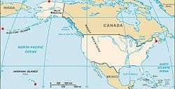
- Point Barrow, Alaska 71°23′20″N 156°28′45″W / 71.38889°N 156.47917°W – northernmost point in all U.S. territory
- Utqiaġvik, Alaska 71°17′44″N 156°45′59″W / 71.29556°N 156.76639°W – northernmost incorporated place in all U.S. territory, population about 4,000
- Fairbanks, Alaska 64°50′22.94″N 147°43′14.63″W / 64.8397056°N 147.7207306°W – northernmost city of more than 20,000 residents, and northernmost incorporated city with public road access
- Anchorage, Alaska 61°13′4.17″N 149°53′33.17″W / 61.2178250°N 149.8925472°W – northernmost city of more than 100,000 residents
- Northwest Angle Inlet in Lake of the Woods, Minnesota 49°23′04.1″N 95°9′12.2″W / 49.384472°N 95.153389°W – northernmost point in the 48 contiguous states (because of incomplete information at the time of the Treaty of Paris (1783) settling the American Revolutionary War)
- Sumas, Washington 49°00′08.6″N 122°15′40″W / 49.002389°N 122.26111°W – northernmost incorporated place in the 48 contiguous states (because of 19th century survey inaccuracy placing the international border slightly north of the 49th parallel here.[1])
- Lynden, Washington 48°56′43″N 122°27′10″W / 48.94528°N 122.45278°W – northernmost city of more than 10,000 residents in the 48 contiguous states
- Bellingham, Washington 48°45′19.12″N 122°28′43.54″W / 48.7553111°N 122.4787611°W – northernmost city of more than 50,000 residents in the 48 contiguous states
- Everett, Washington 47°58′41″N 122°12′27″W / 47.97806°N 122.20750°W – northernmost city of more than 100,000 residents in the 48 contiguous states
- Spokane, Washington 47°39′37″N 117°25′25″W / 47.66028°N 117.42361°W – northernmost city of more than 200,000 residents in the 48 contiguous states
- Seattle, Washington 47°36′13.81″N 122°19′48.56″W / 47.6038361°N 122.3301556°W – northernmost city of more than 500,000 residents in the United States
- Alaska has the northernmost geographic center of all the states. North Dakota has the northernmost geographic center of the 48 contiguous states.
Southernmost points
- Amundsen–Scott South Pole Station, Antarctica (90°0′0″S 0°0′0″E / 90.00000°S 0.00000°E) – southernmost point under United States jurisdiction
- Rose Atoll, American Samoa (14°34′11″S 168°9′10″W / 14.56972°S 168.15278°W) – southernmost point in all U.S.-controlled territory
- Palmyra Atoll (5°53′2″N 162°4′42″W / 5.88389°N 162.07833°W) – southernmost point in all U.S. incorporated territory
- Ka Lae, Hawaii (18°54′39″N 155°40′52″W / 18.91083°N 155.68111°W) – southernmost point in the 50 states
- Nā'ālehu, Hawaii (19°3′57″N 155°35′15″W / 19.06583°N 155.58750°W) – southernmost town in the 50 states
- Hilo, Hawaii (19°41′58″N 155°4′51″W / 19.69944°N 155.08083°W) – southernmost place with a population over 25,000 in the 50 states
- City and County of Honolulu, Hawaii (21°18′19″N 157°51′25″W / 21.30528°N 157.85694°W) – southernmost incorporated place in the 50 states (Hawaii's only incorporated place)
- Western Dry Rocks, Florida (24°26.8′N 81°55.6′W / 24.4467°N 81.9267°W) In the Florida Keys – southernmost point in the 48 contiguous states occasionally above water at low tide
- Ballast Key, Florida (24°31′15″N 81°57′49″W / 24.52083°N 81.96361°W) – southernmost point in the 48 contiguous states continuously above water
- Key West, Florida (24°32′38.724″N 81°48′17.658″W / 24.54409000°N 81.80490500°W) – southernmost incorporated place in the contiguous 48 states
- Cape Sable, Florida (25°7′6″N 81°5′11″W / 25.11833°N 81.08639°W) – southernmost point on the U.S. mainland
- Florida City, Florida (25°26′54″N 80°28′57″W / 25.44833°N 80.48250°W) – Southernmost municipality in the contiguous U.S.
- Miami, Florida (25°43′40″N 80°14′2″W / 25.72778°N 80.23389°W) – the southernmost major metropolitan city in the 48 contiguous states
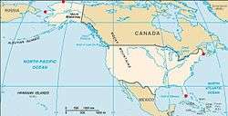
- Cameron County, Texas (25°50′14.5″N 97°23′39.9″W / 25.837361°N 97.394417°W) – Southernmost point on the Mexico–United States border.
- Hawaii has the southernmost geographic center of all the states. Florida has the southernmost geographic center of the 48 contiguous states.
Easternmost points
- Point Udall, St. Croix, U.S. Virgin Islands 17°45′19″N 64°33′54″W / 17.75528°N 64.56500°W – easternmost point in all U.S. territory, by direction of travel
- Christiansted, United States Virgin Islands 17°44′54″N 64°43′00″W / 17.7482°N 64.7168°W – easternmost town in all U.S. territory, by direction of travel
- Sail Rock, Maine 44°48′45.2″N 66°56′49.3″W / 44.812556°N 66.947028°W, just offshore of West Quoddy Head, Maine – easternmost point in the 50 states, by direction of travel
- West Quoddy Head, Maine 44°48′55.4″N 66°56′59.2″W / 44.815389°N 66.949778°W – easternmost point on the U.S. mainland
- Lubec, Maine (44°49′03″N 66°57′00″W / 44.817419°N 66.949895°W) – easternmost incorporated place in the 50 states
- Eastport, Maine (44°54′20″N 66°59′24″W / 44.90556°N 66.99000°W) – easternmost incorporated city in the 50 states[2]
- Calais, Maine (45°11′18″N 67°16′37″W / 45.18833°N 67.27694°W) – easternmost city of more than 2,500 residents in the 50 states
- Houlton, Maine (46°7′37″N 67°50′22″W / 46.12694°N 67.83944°W – easternmost city of more than 5,000 residents in the 50 states
- Bangor, Maine – easternmost city of more than 20,000 residents in the 50 states
- Portland, Maine – easternmost city of more than 50,000 residents in the 50 states
- Boston, Massachusetts – easternmost major U.S. city (more than 500,000 residents)
- Pochnoi Point, Semisopochnoi Island, Alaska 51°57′42″N 179°46′23″E / 51.96167°N 179.77306°E – easternmost point in all U.S. territory by longitude, ironically, in the Alaskan Aleutian Islands "west" of the westernmost point in the U.S. by longitude (Amatignak Island) due to interposition of 180° longitude, which conventionally divides "west" from "east" in geographic terms.
- Peacock Point, Wake Island 19°16′13.2″N 166°39′26.3″E / 19.270333°N 166.657306°E – first sunrise (at equinox) in all U.S. territory
- Northern Islands Municipality, Northern Mariana Islands 16°01′38″N 146°03′52″E / 16.0271°N 146.0645°E – easternmost municipality in all U.S. territory, by longitude
- Maine has the easternmost geographic center of the 50 states.
Westernmost points
- Point Udall, Guam (13°26′51″N 144°37′5.5″E / 13.44750°N 144.618194°E) – westernmost point in all U.S. territory, by direction of travel
- Peaked Island, offshore from Cape Wrangell, Attu Island, Alaska 52°55′14″N 172°26′16″E / 52.92056°N 172.43778°E – westernmost point in the 50 states by direction of travel, and last sunset (at equinox) in all U.S. territory. West of it passes the International Date Line, after which come Russian territorial islands.
- Amatignak Island, Alaska 51°16′7″N 179°8′55″W / 51.26861°N 179.14861°W – technically, westernmost point in all of U.S. territory by longitude, but not the westernmost of the U.S. Aleutian Islands. It possesses the highest longitude west figure (179°8'55"W) before 180° longitude, which passes west of it. After 180°, longitude is termed "east" and declines numerically.
- Adak, Alaska 51°49′21″N 176°42′53″W / 51.8224°N 176.7147°W – westernmost incorporated city in the 50 states
- Unalaska, Alaska 53°53′20″N 166°31′38″W / 53.888984°N 166.527239°W - westernmost city of more than 2,500 residents in the 50 states
- Cape Prince of Wales, Alaska 65°38′32″N 168°7′8″W / 65.64222°N 168.11889°W – westernmost point on the North American continent
- Anchor Point, Alaska (59°46′20.8914″N 151°52′2.373″W / 59.772469833°N 151.86732583°W) – Westernmost point on the continuous road system of North America[3]
- Umatilla Reef, offshore from Cape Alava, Washington (48°11.1′N 124°47.1′W / 48.1850°N 124.7850°W) – westernmost point in the 48 contiguous states occasionally above water at low tide
- Bodelteh Islands, offshore from Cape Alava, Washington 48°10′42.7″N 124°46′18.1″W / 48.178528°N 124.771694°W – westernmost point in the 48 contiguous states continuously above water
- Cape Alava, Washington (48°9′51″N 124°43′59″W / 48.16417°N 124.73306°W) – westernmost point on the U.S. mainland (contiguous)
- Ozette, Washington (48°09′17″N 124°40′02″W / 48.154722°N 124.667222°W) – westernmost town in the 48 contiguous states
- Port Orford, Oregon 42°45′15″N 124°30′45″W / 42.754065°N 124.512605°W – westernmost incorporated place in the 48 contiguous states
- Brookings, Oregon 42°03′19″N 124°17′15″W / 42.0553°N 124.2875°W – westernmost city of more than 5,000 residents in the 48 contiguous states
- Coos Bay, Oregon 43°22′05″N 124°13′03″W / 43.3681°N 124.2174°W – westernmost city of more than 10,000 residents in the 48 contiguous states
- Eureka, California – westernmost city of more than 25,000 residents in the 48 contiguous states
- Corvallis, Oregon – westernmost city of more than 50,000 residents in the 48 contiguous states
- Eugene, Oregon – westernmost city of more than 100,000 residents in the 48 contiguous states
- Portland, Oregon – westernmost city of more than 500,000 residents in the United States
- Hawaii has the westernmost geographic center of all the states. Oregon has the westernmost geographic center of the 48 contiguous states.
Interpretation of easternmost and westernmost
There are three methods for reckoning the eastern and western extremes of the United States.
One method is to use the Prime Meridian as the dividing line between east and west. This meridian running through Greenwich, London, is defined as zero degrees longitude and could be called the least eastern and least western place in the world. The 180th meridian, on the opposite side of the globe, is therefore the easternmost and westernmost place in the world.
Another method is to use the International Date Line as the easternmost–westernmost extreme. On the equinox, the easternmost place would be where the day first begins, and the westernmost is where the day last ends.
Still another method is to first determine the geographic center of the country and from there measure the shortest distance to every other point. All U.S. territory is spread across less than 180° of longitude, so from any spot in the U.S. it is more direct to reach the easternmost point, Point Udall, U.S. Virgin Islands, by traveling east than by traveling west. Likewise, there is not a single point in U.S. territory from which heading east is a shorter route to the westernmost point, Point Udall, Guam, than heading west would be, even accounting for circumpolar routes. The two different Point Udalls are named for two brothers from the Udall family of Arizona; Mo Udall (Guam) and Stewart Udall (Virgin Islands), sons of Chief Justice Levi Stewart Udall of the Arizona Supreme Court, both served as U.S. Congressman.[4]
Highest points
- Denali, Alaska 63°4′9″N 151°0′23″W / 63.06917°N 151.00639°W – highest summit in the United States, all US territories, and North America at 20,310 feet (6,190.5 m)[5]
- Mount Whitney,[note 1][6][7][8] California 36°34′43″N 118°17′31″W / 36.57861°N 118.29194°W – highest point in the 48 contiguous states at 14,505 feet (4,421 m)
- Mount Elbert,[note 2][9][10] Colorado – highest point on the Continental Divide of North America at 14,440 feet (4,400 m)
- Mauna Kea,[note 3][11] Hawaiʻi 19°49′14″N 155°28′5″W / 19.82056°N 155.46806°W – highest island summit in all U.S. territory and the entire Pacific Ocean at 13,796 feet (4,205 m)
- Taos Ski Valley, New Mexico 36°35′52″N 105°26′42″W / 36.59778°N 105.44500°W – highest village limits in all U.S. territory at 12,581 feet (3,835 m) (No residents of Taos Ski Valley live above 10,350 feet (3,150 m))[12]
- Winter Park, Colorado 39°53′34″N 105°45′43″W / 39.89278°N 105.76194°W – highest city limits in all U.S. territory at 12,060 feet (3,680 m) (No residents of Winter Park live above 9,550 feet (2,910 m))
- San Juan County, Colorado 37°49′N 107°40′W / 37.817°N 107.667°W – highest U.S. county based on a mean elevation (11,240 feet (3,430 m))
- Alma, Colorado 39°17′2″N 106°3′46″W / 39.28389°N 106.06278°W – highest town in all U.S. territory at 10,355 feet (3,156 m); contiguous residential areas extend to 11,680 feet (3,560 m).
- Leadville, Colorado 39°14′50″N 106°17′30″W / 39.24722°N 106.29167°W – highest city in all U.S. territory at 10,152 feet (3,094 m). (No residents of Leadville live above 10,360 feet (3,160 m))
- Lake County Airport, Colorado 39°13′13″N 106°19′00″W / 39.22028°N 106.31667°W – highest airfield in all U.S. territory and North America at 9,927 feet (3,026 m)
- New Mexico State Capitol, Santa Fe 35°40′56″N 105°56′23″W / 35.68222°N 105.93972°W – highest state capitol in the United States at 7,005 feet (2,135 m)
- State of Colorado 39°00′N 105°30′W / 39.000°N 105.500°W – highest U.S. state based on an average elevation of 6,800 feet (2,100 m)
- Mount Mitchell, North Carolina 35°45′53″N 82°15′54″W / 35.76472°N 82.26500°W – highest point in eastern United States at 6,684 feet (2,037 m)
- Mount Washington, New Hampshire 44°16′13″N 71°18′12″W / 44.27028°N 71.30333°W – highest point in northeastern United States at 6,288 feet (1,917 m)
- Arikaree River, Yuma County, Colorado at Kansas state line 39°58′42″N 102°3′6″W / 39.97833°N 102.05167°W – highest U.S. state low point at 3,317 feet (1,011 m)
- Beech Mountain, North Carolina 36°12′23″N 81°52′59″W / 36.20639°N 81.88306°W – highest incorporated community east of the Mississippi River at an elevation of 5,506 feet (1,678 m).
- Boone, North Carolina 36°12′41″N 81°40′7″W / 36.21139°N 81.66861°W – highest elevation (3,333 feet, 1015.9 m) east of the Mississippi River of any town of its size (over 10,000 population).
- Eisenhower Tunnel, west of Denver, Colorado – highest point on the Interstate Highway System, at 11,158 feet (3,401 m).
Lowest points
- Badwater Basin, Death Valley, California, 36°14′23″N 116°50′5″W / 36.23972°N 116.83472°W – lowest surface point in all U.S. territory and North America, at −279 feet (−85 m)[13]
- Salton Sea, California, 33°19′59″N 115°50′3″W / 33.33306°N 115.83417°W – lowest lake in all U.S. territory and North America, at −226 feet (−69 m)
- Furnace Creek Airport, California 36°27′50″N 116°52′53″W / 36.46389°N 116.88139°W – lowest airfield in all U.S. territory and Western Hemisphere, at −210 feet (−64 m)
- Furnace Creek, California,[14] 36°27′29″N 116°52′15″W / 36.45806°N 116.87083°W – lowest settlement in all U.S. territory and Western Hemisphere, at −190 feet (−58 m)
- Calipatria, California, 33°07′32″N 115°30′51″W / 33.12556°N 115.51417°W – lowest city in all U.S. territory and Western Hemisphere, at −184 feet (−56 m)
- Ninth Ward of New Orleans, Louisiana, 30°02′40″N 89°56′47″W / 30.04444°N 89.94639°W – lowest surface point in eastern United States, at −7 feet (−2.1 m)
- New Orleans, Louisiana, 29°58′N 90°03′W / 29.967°N 90.050°W – lowest city over 250,000 population in all U.S. territory and Western Hemisphere, with an average elevation of −1.5 feet (−0.46 m)
- State of Delaware 39°0′17″N 75°32′46″W / 39.00472°N 75.54611°W – lowest state, with an average elevation of 60 feet (18 m)
- Britton Hill, Florida, 30°59′18″N 86°16′55″W / 30.98833°N 86.28194°W – lowest state high point, at 345 feet (105 m)
- Lake Superior bottom, Michigan, 46°54′31″N 86°35′52″W / 46.90861°N 86.59778°W – lowest freshwater point in all U.S. territory, at −732 feet (−223 m)[15]
- Puget Sound bottom, Washington, 47°44.9′N 122°25.7′W / 47.7483°N 122.4283°W – lowest seawater point in the interior of the United States, at −956 feet (−291 m)[16]
Other points
- Most remote point in the 50 states: Ipnavik River, National Petroleum Reserve–Alaska, 68°45′N 156°41′W / 68.750°N 156.683°W; 120 miles (190 km) from nearest habitation
- Geographic center of the 50 states: approximately 20 miles (32 km) north of Belle Fourche, South Dakota, 44°58′N 103°46′W / 44.967°N 103.767°W
- Geographic center of the 48 contiguous states: approximately 4 miles (6.4 km) west of Lebanon, Kansas, 39°50′N 98°35′W / 39.833°N 98.583°W
- Closest to the equator: Baker Island is at 0°11′41″N 176°28′46″W / 0.19472°N 176.47944°W.[17][18]
- The geographic center of North America is at 48°10′N 100°10′W / 48.167°N 100.167°W, about 6 miles (10 km) west of Balta, in Pierce County, North Dakota.[19]
- The North American pole of inaccessibility (distant from ocean access) is at 43°22′N 101°58′W / 43.367°N 101.967°W, about eleven miles (18 km) southeast of the town of Kyle, on the Pine Ridge Indian Reservation, in Bennett County, South Dakota, 1,025 miles (1,650 km) from the nearest coastline.
- The southwesternmost point of the contiguous United States is Border Field State Park, California.[20]
- The northwesternmost point of the contiguous United States is Cape Flattery, Washington.[21]
Islands
- Island of Hawaiʻi, Hawaiʻi 19°49′15″N 155°28′5″W / 19.82083°N 155.46806°W – most extensive island in all U.S. territory at 4,028 square miles (10,430 km2) and tallest island in all U.S. territory and the entire Pacific Ocean at 13,796 feet (4,205 m)
- Kodiak Island, Alaska 57°28′N 153°26′W / 57.467°N 153.433°W – most extensive Gulf of Alaska island at 3,595.09 square miles (9,311.2 km2)
- Island of Puerto Rico, Puerto Rico 18°15′N 66°30′W / 18.250°N 66.500°W – most extensive island of U.S. Caribbean territory at 3,515.1 square miles (9,104 km2)
- Prince of Wales Island, Alaska 55°37′55″N 132°54′27″W / 55.63194°N 132.90750°W – most extensive island of the Alexander Archipelago at 2,577 square miles (6,670 km2)
- Saint Lawrence Island, Alaska 63°24′54″N 170°23′58″W / 63.41500°N 170.39944°W – most extensive Bering Sea island at 1,791.56 square miles (4,640.1 km2)
- Unimak Island, Alaska 54°46′6″N 164°11′12″W / 54.76833°N 164.18667°W – most extensive Aleutian island at 1,571.41 square miles (4,069.9 km2)
- Long Island, New York 40°52′10″N 73°00′00″W / 40.86944°N 73.00000°W – most extensive island of the U.S. Atlantic coast at 1,401 square miles (3,630 km2)
- Padre Island, Texas 26°50′40″N 97°22′04″W / 26.84444°N 97.36778°W – most extensive Gulf of Mexico island at 209 square miles (540 km2) and longest barrier island on Earth at 113 miles (182 km)
- Isle Royale in Lake Superior, Michigan 48°0′N 88°55′W / 48.000°N 88.917°W – most extensive island in a lake in all U.S. territory at 206.73 square miles (535.4 km2)
- Whidbey Island, Washington 48°8′11″N 122°34′57″W / 48.13639°N 122.58250°W – most extensive island of Puget Sound at 168.67 square miles (436.9 km2)
- Santa Cruz Island, California 34°0′13″N 119°43′35″W / 34.00361°N 119.72639°W – most extensive of the Channel Islands of California at 97 square miles (250 km2)
Lakes
- Lake Michigan-Huron 45°48′N 84°45′W / 45.800°N 84.750°W – largest freshwater lake in the world by surface area, at 45,300 square miles (117,000 km2), of which 31,507 square miles (81,600 km2) is within the United States.
- Lake Superior 47°42′N 87°30′W / 47.700°N 87.500°W – Lying along the Canada–United States border, it is the second largest freshwater lake in the world by surface area, at 31,700 sq mi (82,100 km2), of which 20,600 square miles (53,350 km2) is within the United States.[22] It is also North America's largest lake by volume, at 2,900 cu mi (12,000 km3); it is commonly called the largest lake by surface area when Lake Michigan and Lake Huron are not considered one lake.
- Great Salt Lake, Utah, 41°10′N 112°35′W / 41.167°N 112.583°W – most extensive endorheic lake, at 1,700 square miles (4,400 km2)
- Crater Lake, Oregon, 42°57′N 122°5′W / 42.950°N 122.083°W – deepest lake, at 1,943 feet (592 m)[23]
Rivers
- Mississippi River 29°9′4″N 89°15′12″W / 29.15111°N 89.25333°W – most extensive river basin at 1,151,000 square miles (2,980,000 km2)
- Mississippi-Missouri-Jefferson Rivers 29°9′4″N 89°15′12″W / 29.15111°N 89.25333°W – longest river system at 3,902 miles (6,280 km)
- Missouri River 38°48′49″N 90°7′11″W / 38.81361°N 90.11972°W – longest main stem river at 2,341 miles (3,767 km)
- Mississippi River 29°9′4″N 89°15′12″W / 29.15111°N 89.25333°W – longest Gulf of Mexico main stem river at 2,202 miles (3,544 km)
- Yukon River 62°35′55″N 164°47′40″W / 62.59861°N 164.79444°W – longest Bering Sea main stem river at 1,979 miles (3,185 km)
- Colorado River 31°48′57″N 114°48′22″W / 31.81583°N 114.80611°W – longest Gulf of California main stem river at 1,450 miles (2,330 km)
- Columbia River 46°14′39″N 124°3′29″W / 46.24417°N 124.05806°W – longest Pacific Ocean main stem river at 1,243 miles (2,000 km)
- Saint Lawrence River 49°40′N 64°30′W / 49.667°N 64.500°W – longest Atlantic Ocean main stem river at 600 miles (970 km)
- Bear River 41°27′30″N 112°17′25″W / 41.45833°N 112.29028°W – longest endorheic basin main stem river at 491 miles (790 km)
Extreme distances
- Greatest east–west distance in the 48 contiguous states: 2,800 miles (4,500 km)
- Greatest north–south distance in the 48 contiguous states: 1,650 miles (2,660 km).[24]
- Greatest distance between any two points in U.S. territory: 9,514 miles (15,311 km), from Point Udall, Guam, to Point Udall, St. Croix, U.S. Virgin Islands (formerly known as Orote Point and East Point, respectively).[25]
- Greatest distance between any two points in the 50 states: 5,859 miles (9,429 km), from Kure Atoll, Hawaii, to Log Point, Elliott Key, Florida.[25]
- Greatest distance between any two points in the contiguous 48 states: 2,901 miles (4,669 km), from North Farallon Island, California, to Sail Rock, east of West Quoddy Head, Maine.[25]
- Greatest distance between any two mainland points in the contiguous 48 states: 2,892 miles (4,654 km), from Point Arena, California, to West Quoddy Head, Maine.[25]
- Greatest east–west distance in U.S. territory [?]: 5,823 miles (9,371 km), from Kure Atoll, Hawaii, to Riviera Beach, Florida.[25]
- Some map projections make diagonal lines appear longer than they actually are. The diagonal line from Kure Atoll, Hawaii, to West Quoddy Head, Maine, is 5,797 miles (9,329 km); and the diagonal from Cape Wrangell, Attu Island, Alaska, to Log Point, on Elliott Key, Florida, is 5,505 miles (8,859 km).
See also
- Geography of the United States
- Territories of the United States on stamps
- Extreme points of the Earth
Notes
- ↑ The summit of Mount Whitney is the highest point of the Sierra Nevada, the State of California, and the contiguous United States.
- ↑ The summit of Mount Elbert is the highest point of the Front Range and the Continental Divide of North America.
- ↑ The summit of Mauna Kea is the highest point of the Island of Hawaiʻi, the State of Hawaiʻi, and the entire Pacific Ocean. Mauna Kea is also the tallest mountain on Earth as measured from base to summit. The shield volcano sits on the ocean floor at a depth of 19,678 feet (5,998 m) for a total height of 33,474 feet (10,203 m).
References
- ↑ "49th Parallel". Internationalboundarycommission.org. Archived from the original on 2016-06-13.
- ↑ "Quoddy Loop--Eastport, Quoddy Village, Moose Island, and Carlow Island, Maine". Quoddyloop.com. Retrieved 2 October 2018.
- ↑ The Milepost 61st edition pg. 626 ISBN 978-1892-15426-2
- ↑ Donald Winslow Carson; James W. Johnson (2001). Life and times of Morris K. Udall. University of Arizona Press. p. 220. ISBN 0-8165-2049-6.
- ↑ Mark Newell; Blaine Horner (September 2, 2015). "New Elevation for Nation's Highest Peak" (Press release). USGS. Retrieved September 26, 2015.
- ↑ "Mount Whitney". NGS Station Datasheet. United States National Geodetic Survey. Retrieved September 9, 2012.
- ↑ "Mount Whitney". Peakbagger.com. Retrieved September 9, 2012.
- ↑ The summit elevation of Mount Whitney includes an adjustment of +1.869 m (+6.1 ft) from NGVD 29 to NAVD 88.
- ↑ "Mount Elbert". NGS Station Datasheet. United States National Geodetic Survey. Retrieved June 21, 2016.
- ↑ "Mount Elbert". Peakbagger.com. Retrieved June 21, 2016.
- ↑ "Mauna Kea". Peakbagger.com. Retrieved April 1, 2012.
- ↑ "About Taos Ski Valley". Taos Ski Valley Chamber of Commerce. Retrieved February 29, 2012.
- ↑ "USGS National Elevation Dataset (NED) 1 meter Downloadable Data Collection from The National Map 3D Elevation Program (3DEP) - National Geospatial Data Asset (NGDA) National Elevation Data Set (NED)". United States Geological Survey. September 21, 2015. Retrieved September 22, 2015.
- ↑ Furnace Creek, in Death Valley, California, set the world record for the highest reliably reported ambient air temperature of 134 °F (57 °C), on July 10, 1913. This record has been eclipsed only once, by a questionable reading of 136 °F (58 °C), recorded in 'Aziziya, Libya, on September 13, 1922.
- ↑ Sounding at 46° 54' 31"N, 86° 35' 52"W, on NOAA chart 14963, Grand Marais to Big Bay Point, scale 1:120,000, 2006. Chart datum (as shown on the chart) is 601.1 feet above mean sea level, at Rimouski, Quebec.
- ↑ Two identical soundings at 47° 45.2'N, 122° 26.0'W, and 47° 44.6'N, 122° 25.4'W, on NOAA chart 18446, Puget Sound: Apple Cove Point to Keyport, scale 1:25,000, 2005. Chart datum (as shown on the chart) is lower low water.
- ↑ "Baker Island". Geographic Names Information System. United States Geological Survey. Retrieved February 24, 2009.
- ↑ "CIA World Factbook: Jarvis Island". CIA World Factbook. Retrieved July 3, 2009.
- ↑ "The Intel". Condé Nast Traveler. Retrieved 2 October 2018.
- ↑ The Canyoneers (1 June 2016). "No bay at Border Field State Park for about 7000 years". San Diego Reader. Retrieved 6 April 2017.
Binkowski, Brooke (8 October 2012). "Friendship Park — A Link Between Two Countries — Opens Again". KPBS. San Diego. Retrieved 6 April 2017.San Diego's Friendship Park, or Border Field State Park, is tucked into the extreme southwest corner of the United States and the extreme northwest of Mexico, with fields on the U.S. side, the city of Tijuana on the other, and the blue Pacific Ocean to the west.
"Tijuana River National Estuarine Research Reserve Comprehensive Management Plan" (PDF). Office of Coastal Management. National Oceanic and Atmospheric Administration. August 2010. Retrieved 6 April 2017. - ↑ National Geographic Society (U. S.); National Geographic (2013). Guide to Scenic Highways & Byways. National Geographic. p. 4. ISBN 978-1-4262-1014-3.
Victoriah Arsenian (22 December 2015). Moon Pacific Coast Highway Road Trip: California, Oregon & Washington. Avalon Publishing. p. 69. ISBN 978-1-63121-029-7. - ↑
- ↑ "Park Map Viewer". Nps.gov. Retrieved 2 October 2018.
- ↑ "Adventure". Georgraphy.howstuffworks.com. 16 June 2008. Retrieved 2 October 2018.
- 1 2 3 4 5 Services, Eastern Region Geography, Information. "Elevations and Distances". Pubs.usgs.gov. Retrieved 2 October 2018.
External links
- Text of congressional resolution designating Udall Point, Guam
- Maps of Orote Point, Guam:
- Map of Ballast Key, FL
- Detailed US coastline maps