Awang–Upi–Lebak–Kalamansig–Palimbang–Sarangani Road
| ||||
|---|---|---|---|---|
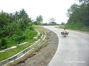 Section of the Road at General Santos | ||||
| Route information | ||||
| Maintained by Department of Public Works and Highways | ||||
| Length | 323 km (201 mi) | |||
| Component highways |
| |||
| Major junctions | ||||
| North end |
| |||
| ||||
| South end |
| |||
| Location | ||||
| Major cities | General Santos | |||
| Towns | Datu Odin Sinsuat, Upi, South Upi, Lebak, Kalamansig, Palimbang, Sarangani, Kiamba, Maasim | |||
| Highway system | ||||
|
Roads in the Philippines
| ||||
.svg.png)
The Awang–Upi–Lebak–Kalamansig–Palimbang–Sarangani Road is a 323-kilometre (201 mi), two-to-four lane national secondary road, connecting the provinces of Maguindanao, Sultan Kudarat,[1] Sarangani,[2] and South Cotabato.[3] It starts from Datu Odin Sinsuat in Maguindanao and ends at General Santos in South Cotabato.
The entire road is designated as the National Route 935 (N935) of the Philippine highway network.
Intersections
Intersections are numbered by kilometre post, with the Marawi city proper designated as kilometre 0.
| Province | City/Municipality | km | mi | Destinations | Notes |
|---|---|---|---|---|---|
| Sultan Kudarat | Palimbang | ||||
| South Cotabato | General Santos | ||||
| 1.000 mi = 1.609 km; 1.000 km = 0.621 mi | |||||
References
- ↑ "Sultan Kudarat 2nd". www.dpwh.gov.ph. Retrieved 2018-09-03.
- ↑ "Sarangani". www.dpwh.gov.ph. Retrieved 2018-09-03.
- ↑ "South Cotabato 2nd". www.dpwh.gov.ph. Retrieved 2018-09-03.
| National primary roads |
| |||||||
|---|---|---|---|---|---|---|---|---|
| National secondary roads |
| |||||||
See also: Philippine expressway network | ||||||||
This article is issued from
Wikipedia.
The text is licensed under Creative Commons - Attribution - Sharealike.
Additional terms may apply for the media files.