Davao–Cotabato Road
| ||||
|---|---|---|---|---|
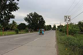 Reassurance Marker at Pigcawayan, North Cotabato | ||||
| Route information | ||||
| Maintained by Department of Public Works and Highways | ||||
| Length | 165 km (103 mi) | |||
| Component highways | ||||
| Major junctions | ||||
| From |
| |||
| ||||
| To |
| |||
| Location | ||||
| Major cities | Digos, Kidapawan | |||
| Towns | Bansalan, Makilala, Matalam, Kabacan, Datu Montawal, Pagalungan, Pikit, Aleosan, Midsayap, Libungan, Pigcawayan | |||
| Highway system | ||||
|
Roads in the Philippines
| ||||
.svg.png)
The Davao–Cotabato Road is a 165-kilometre (103 mi), two-to-four lane national primary road, connecting the provinces of Maguindanao, North Cotabato,[1][2] and Davao del Sur.[3] It starts from Digos, Davao del Sur to Sultan Kudarat, Maguindanao.
This entire road is designated as the National Route 75 (N75) of the Philippine highway network.
Intersections
Intersections are numbered by kilometre post, with the Rizal Park in Manila designated as kilometre 0.
| Province | City/Municipality | km | mi | Destinations | Notes |
|---|---|---|---|---|---|
| Davao del Sur | Digos | Eastern terminus. | |||
| Cotabato | Makilala | ||||
| Kidapawan | Roundabout. | ||||
| Kabacan | |||||
| Midsayap | |||||
| Libungan | |||||
| Maguindanao | Sultan Kudarat | Western terminus. | |||
| 1.000 mi = 1.609 km; 1.000 km = 0.621 mi | |||||
References
- ↑ "Cotabato 1st". www.dpwh.gov.ph. Retrieved 2018-08-04.
- ↑ "Cotabato 2nd". www.dpwh.gov.ph. Retrieved 2018-08-04.
- ↑ "Davao del Sur". www.dpwh.gov.ph. Retrieved 2018-08-04.
| National primary roads |
| |||||||
|---|---|---|---|---|---|---|---|---|
| National secondary roads |
| |||||||
See also: Philippine expressway network | ||||||||
This article is issued from
Wikipedia.
The text is licensed under Creative Commons - Attribution - Sharealike.
Additional terms may apply for the media files.