N402 highway (Philippines)
| ||||
|---|---|---|---|---|
|
Antero Soriano Highway Naic–Indang Road Indang–Mendez Road Mendez–Tagaytay Road | ||||
| Route information | ||||
| Maintained by Department of Public Works and Highways (DPWH) - Cavite 1st District Engineering Office and Cavite 2nd District Engineering Office | ||||
| Major junctions | ||||
| From |
| |||
| To |
| |||
| Location | ||||
| Major cities | Tagaytay | |||
| Towns | Tanza, Naic, Indang, Mendez | |||
| Highway system | ||||
|
Roads in the Philippines
| ||||
The National Route 402 (N402) (or Noveleta–Naic–Tagaytay Road) forms part of the Philippine highway network.[1] It runs through the rural municipalities of Cavite.
Route description
Tanza to Naic
The route starts at Tanza as a continuation of Antero Soriano Highway, a two-to-six lane, 21.6-kilometre (13.4 mi) secondary highway traversing through the western coast of Cavite.
Naic to Indang
| |
|---|---|
|
General Ambrocio Mojica Street Juan Dimabiling Street | |
 Route alignment of Naic–Indang Road | |
|
The intersection of the road in Barangay Calumpang Cerca, Indang, Cavite | |
| Route information | |
| Maintained by Department of Public Works and Highways (DPWH) - Cavite 2nd District Engineering Office | |
| Component highways | |
| Major junctions | |
| North end |
|
|
| |
| South end |
|
| Location | |
| Provinces | Cavite |
| Towns | Naic, Indang |
| Highway system | |
|
Roads in the Philippines | |
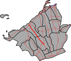
The road continues as a two-lane road named Naic–Indang Road that connects the municipality of Naic and the municipality of Indang.[2] It connects the municipality of Naic and the municipality of Indang.[3]
Indang to Mendez
| |
|---|---|
|
San Gregorio Street San Gregorio Extension | |
 Route alignment of Indang–Mendez Road | |
|
The northern terminus of the road in Indang | |
| Route information | |
| Maintained by Department of Public Works and Highways (DPWH) - Cavite 2nd District Engineering Office | |
| Component highways | |
| Major junctions | |
| North end |
|
| South end |
|
| Location | |
| Provinces | Cavite |
| Towns | Indang, Mendez |
| Highway system | |
|
Roads in the Philippines | |
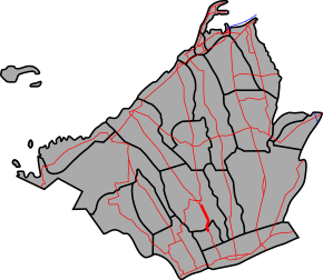
After traversing the poblacion area of Indang, the route continues as Indang–Mendez Road all the way up to Mendez. This segment is under road-widening.
Mendez to Tagaytay
| |
|---|---|
| J. P. Rizal Street | |
 Route alignment of Mendez–Tagaytay Road | |
|
A segment of Mendez–Tagaytay Road in Mendez | |
| Route information | |
| Maintained by Department of Public Works and Highways (DPWH) - Cavite 2nd District Engineering Office | |
| Length | 7.32 km (4.55 mi) |
| Component highways | |
| Major junctions | |
| North end |
|
| South end |
|
| Location | |
| Provinces | Cavite |
| Major cities | Tagaytay |
| Towns | Mendez |
| Highway system | |
|
Roads in the Philippines | |
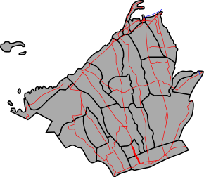
Finally the road continues as Mendez–Tagaytay Road a 7.32-kilometre (4.55 mi), two-to-four lane, secondary road that connects the municipality of Mendez and the city of Tagaytay.[4]
Intersections
The entire route is located in Cavite.
| City/Municipality | km[5] | mi | Destinations | Notes | |
|---|---|---|---|---|---|
| Naic | |||||
| 49.000 | 30.447 | Route 402 reassurance sign. | |||
| 57.000 | 35.418 | Route 402 reassurance sign. | |||
| Indang | |||||
| 65.000 | 40.389 | Route 402 reassurance sign. | |||
| 66.000 | 41.010 | Indang Kilometre Zero. | |||
| Indang–Alfonso Road – Alfonso | |||||
| Mendez | 73.000 | 45.360 | Route 402 reassurance sign. | ||
| Osorio Street / Llamado Street | One way intersection. | ||||
| 75.000 | 46.603 | Mendez kilometre zero | |||
| Tagaytay | 76.321– 64.119 | 47.424– 39.842 | Kilometre number reverses. | ||
| 61.690 | 38.332 | Southern Terminus. | |||
| 1.000 mi = 1.609 km; 1.000 km = 0.621 mi | |||||
Spurs and Bypasses
| |
|---|---|
| Location | Tanza, Cavite |
| |
|---|---|
| Location | Indang, Cavite |
References
- ↑ "2016 DPWH Road Data". Department of Public Works and Highways. Retrieved 8 March 2018.
- ↑ "Cavite 2nd". www.dpwh.gov.ph. Retrieved 2018-01-09.
- ↑ "Cavite 2nd". www.dpwh.gov.ph. Retrieved 2018-03-23.
- ↑ "Cavite". www.dpwh.gov.ph. Retrieved 2018-01-09.
- ↑ "Road and Bridge Inventory". www.dpwh.gov.ph. Retrieved 2018-01-20.
.svg.png)
