Maasim, Sarangani
| Maasim | |
|---|---|
| Municipality | |
| Municipality of Maasim | |
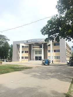 Municipal Hall of Maasim | |
 Map of Sarangani with Maasim highlighted | |
.svg.png) Maasim Location within the Philippines | |
| Coordinates: 5°52′N 125°00′E / 5.87°N 125°ECoordinates: 5°52′N 125°00′E / 5.87°N 125°E | |
| Country |
|
| Region | Soccsksargen (Region XII) |
| Province | Sarangani |
| District | Lone District |
| Barangays | 16 (see Barangays) |
| Government [1] | |
| • Type | Sangguniang Bayan |
| • Mayor | Aniceto P. Lopez Jr. |
| • Electorate | 31,578 voters (2016) |
| Area [2] | |
| • Total | 500.43 km2 (193.22 sq mi) |
| Population (2015 census)[3] | |
| • Total | 59,468 |
| • Density | 120/km2 (310/sq mi) |
| Time zone | UTC+8 (PST) |
| ZIP code | 9502 |
| PSGC | 128004000 |
| IDD : area code | +63 (0)83 |
| Climate type | Tropical rainforest climate |
| Income class | 1st municipal income class |
| Revenue (₱) | 176,467,700.60 (2016) |
| Native languages |
Cebuano Tboli Maguindanao language Blaan language Tagalog |
| Website |
www |
Maasim, officially the Municipality of Maasim, is a 1st class municipality in the province of Sarangani, Philippines. According to the 2015 census, it has a population of 59,468 people.[3]
It is bordered on the west by the municipality of Kiamba, on the easy by Sarangani Bay, on the north by South Cotabato, and on the south by the Celebes Sea.
The town is home to the Tampat Shrine, a tomb system of Muslim missionaries and subordinates of the Sultanate of Maguindanao prior to Spanish colonization. Among the wilds in its rainforest and mountainous areas lives the Philippine tarsier.
Barangays
Maasim is politically subdivided into 16 barangays.
- Amsipit
- Bales
- Colon
- Daliao
- Kabatiol
- Kablacan
- Kamanga
- Kanalo
- Lumasal
- Lumatil
- Malbang
- Nomoh
- Pananag
- Poblacion (Maasim)
- Seven Hills
- Tinoto
Demographics
| Population census of Maasim | ||
|---|---|---|
| Year | Pop. | ±% p.a. |
| 1990 | 26,734 | — |
| 1995 | 31,641 | +3.21% |
| 2000 | 39,424 | +4.83% |
| 2007 | 49,274 | +3.12% |
| 2010 | 52,933 | +2.64% |
| 2015 | 59,468 | +2.24% |
| Source: Philippine Statistics Authority[3][4][5][6] | ||
The majority of the population are Moro and Lumad origin. One of the indigenous peoples living in mountainous areas of Maasim is known as Bla'an.
Economy
The economy of Maasim is largely based on agriculture with a high level production of copra (dried coconut meat). Animal husbandry is the second biggest income earner, notably cattle farming. Other agricultural products are coconuts, maize, sugarcane, bananas, pineapples, mangoes, eggs, beef; fish.
The economy has accelerated in the past decade driven by advances in global communication technology and the finishing of a modern highway that tremendously improved trade and transport.
Kamanga Power Plant
KPP announced on June 3, 2008, that Alcantara-controlled Conal Holdings Co. will build in mid-2009 the $450 million 200-megawatt clean coal Kamanga Power Plant, in Maasim, Saranggani. The plant will supply part of Mindanao's baseload power requirements when it is operational in 2012.[7]
References
- ↑ "Municipality". Quezon City, Philippines: Department of the Interior and Local Government. Retrieved 31 May 2013.
- ↑ "Province: Sarangani". PSGC Interactive. Quezon City, Philippines: Philippine Statistics Authority. Retrieved 12 November 2016.
- 1 2 3 Census of Population (2015). "Region XII (Soccsksargen)". Total Population by Province, City, Municipality and Barangay. PSA. Retrieved 20 June 2016.
- ↑ Census of Population and Housing (2010). "Region XII (Soccsksargen)". Total Population by Province, City, Municipality and Barangay. NSO. Retrieved 29 June 2016.
- ↑ Censuses of Population (1903–2007). "Region XII (Soccsksargen)". Table 1. Population Enumerated in Various Censuses by Province/Highly Urbanized City: 1903 to 2007. NSO.
- ↑ "Province of Sarangani". Municipality Population Data. Local Water Utilities Administration Research Division. Retrieved 17 December 2016.
- ↑ gmanews.tv/story, 200-MW coal power plant to rise in Saranggani
External links
- Maasim Municipal Profile at the Province of Sarangani Official Website
- Philippine Standard Geographic Code
- Philippine Census Information
- Local Governance Performance Management System
Places adjacent to Maasim, Sarangani | |
|---|---|