Palimbang, Sultan Kudarat
| Palimbang | |
|---|---|
| Municipality | |
| Municipality of Palimbang | |
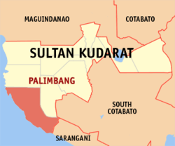 Map of Sultan Kudarat with Palimbang highlighted | |
.svg.png) Palimbang Location within the Philippines | |
| Coordinates: 6°13′N 124°12′E / 6.22°N 124.2°ECoordinates: 6°13′N 124°12′E / 6.22°N 124.2°E | |
| Country |
|
| Region | Soccsksargen (Region XII) |
| Province | Sultan Kudarat |
| District | 2nd District |
| Founded | August 14, 1959 |
| Barangays | 40 (see Barangays) |
| Government [1] | |
| • Type | Sangguniang Bayan |
| • Mayor | Abubacar Pendatun Maulana |
| • Electorate | 32,517 voters (2016) |
| Area [2] | |
| • Total | 484.85 km2 (187.20 sq mi) |
| Population (2015 census)[3] | |
| • Total | 90,424 |
| • Density | 190/km2 (480/sq mi) |
| Time zone | UTC+8 (PST) |
| ZIP code | 9809 |
| PSGC | 126509000 |
| IDD : area code | +63 (0)64 |
| Climate type | Tropical climate |
| Income class | 2nd municipal income class |
| Revenue (₱) | 194,262,638.89 (2016) |
| Native languages |
Hiligaynon Maguindanao language Cotabato Manobo Tagalog |
Palimbang, officially the Municipality of Palimbang, is a 2nd class municipality in the province of Sultan Kudarat, Philippines. According to the 2015 census, it has a population of 90,424 people.[3]
It was incorporated on August 14, 1959 through Executive Order No. 350 by President Carlos P. Garcia.
It celebrates their annual feast named Kalilang sa Biwang every 11 November.
History
The municipality of Palimbang was transferred from Cotabato Province to Province of Sultan Kudarat on November 22, l973 by presidential decree 341 of President Ferdinand E. Marcos.[4]
Barangays
Palimbang is politically subdivided into 40 barangays.
- Akol
- Badiangon
- Baliango
- Baluan (Bulan)
- Bambanen
- Baranayan
- Barongis
- Batang-baglas
- Butril
- Colobe (Tagadtal)
- Datu Maguiales (Likuban)
- Domolol
- Kabuling
- Kalibuhan
- Kanipaan (converged with Sinangkangan)
- Kidayan
- Kiponget
- Kisek
- Kraan
- Kulong-kulong
- Langali
- Libua
- Ligao
- Lopoken (Lepolon)
- Lumitan
- Maganao
- Maguid
- Malatunol
- Malisbong
- Medol
- Milbuk
- Mina
- Molon
- Namat (Namat Masla & Namat Padido converged)
- Napnapon
- Poblacion
- San Roque (Former Tibulos)
- Tibuhol (East Badiangon)
- Wal
- Wasag
Demographics
| Population census of Palimbang | ||
|---|---|---|
| Year | Pop. | ±% p.a. |
| 1948 | 4,717 | — |
| 1960 | 19,128 | +12.37% |
| 1970 | 31,696 | +5.17% |
| 1975 | 21,113 | −7.83% |
| 1980 | 24,252 | +2.81% |
| 1990 | 33,821 | +3.38% |
| 1995 | 40,646 | +3.50% |
| 2000 | 43,742 | +1.59% |
| 2007 | 78,523 | +8.40% |
| 2010 | 83,265 | +2.16% |
| 2015 | 90,424 | +1.58% |
| Source: Philippine Statistics Authority[3][5][6] | ||
References
- ↑ "Municipality". Quezon City, Philippines: Department of the Interior and Local Government. Retrieved 31 May 2013.
- ↑ "Province: Sultan Kudarat". PSGC Interactive. Quezon City, Philippines: Philippine Statistics Authority. Retrieved 12 November 2016.
- 1 2 3 Census of Population (2015). "Region XII (Soccsksargen)". Total Population by Province, City, Municipality and Barangay. PSA. Retrieved 20 June 2016.
- ↑ "Presidential Decree No. 341, s. 1973 | GOVPH". Official Gazette of the Republic of the Philippines. Retrieved 9 September 2017.
- ↑ Census of Population and Housing (2010). "Region XII (Soccsksargen)". Total Population by Province, City, Municipality and Barangay. NSO. Retrieved 29 June 2016.
- ↑ Censuses of Population (1903–2007). "Region XII (Soccsksargen)". Table 1. Population Enumerated in Various Censuses by Province/Highly Urbanized City: 1903 to 2007. NSO.
External links
- Philippine Standard Geographic Code
- Philippine Census Information
- Local Governance Performance Management System
Places adjacent to Palimbang, Sultan Kudarat | |
|---|---|
Isulan (capital) | |
| Municipalities | |
| Component city | |
This article is issued from
Wikipedia.
The text is licensed under Creative Commons - Attribution - Sharealike.
Additional terms may apply for the media files.