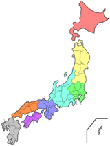
Miyagi Prefecture
| Miyagi Prefecture 宮城県 | |||
|---|---|---|---|
| Prefecture | |||
| Japanese transcription(s) | |||
| • Japanese | 宮城県 | ||
| • Rōmaji | Miyagi-ken | ||
| |||
 | |||
| Country | Japan | ||
| Region | Tōhoku | ||
| Island | Honshu | ||
| Capital | Sendai | ||
| Government | |||
| • Governor | Yoshihiro Murai | ||
| Area | |||
| • Total | 7,285.16 km2 (2,812.82 sq mi) | ||
| Area rank | 17th | ||
| Population (June 30, 2016) | |||
| • Total | 2,321,358 | ||
| • Rank | 15th | ||
| • Density | 318.64/km2 (825.3/sq mi) | ||
| ISO 3166 code | JP-04 | ||
| Districts | 10 | ||
| Municipalities | 35 | ||
| Flower | Miyagi bush clover (Lespedeza thunbergii) | ||
| Tree |
Japanese zelkova (Zelkova serrata) | ||
| Bird | Wild goose | ||
| Website |
www | ||


Miyagi Prefecture (宮城県 Miyagi-ken) is a prefecture in the Tōhoku region of Japan.[1] The capital is Sendai.[2]
History
Miyagi Prefecture was formerly part of the province of Mutsu.[3] Mutsu Province, on northern Honshu, was one of the last provinces to be formed as land was taken from the indigenous Emishi, and became the largest as it expanded northward. The ancient capital was at Taga-jō in modern Miyagi Prefecture.
In the third month of the second year of the Wadō era (709), there was an uprising against governmental authority in Mutsu Province and in nearby Echigo Province. Troops were promptly dispatched to subdue the revolt.[4]
In Wadō 5 (712), the land of Mutsu Province was administratively separated from Dewa Province. Empress Genmei's Daijō-kan continued to organize other cadastral changes in the provincial map of the Nara period, as in the following year when Mimasaka Province was divided from Bizen Province; Hyūga Province was sundered from Ōsumi Province; and Tanba Province was severed from Tango Province.[4]
During the Sengoku period various clans ruled different parts of the province. The Uesugi clan had a castle town at Wakamatsu in the south, the Nanbu clan at Morioka in the north, and Date Masamune, a close ally of the Tokugawa, established Sendai, which is now the largest town of the Tōhoku region.
In the Meiji period, four new provinces were created from parts of Mutsu: Rikuchū, Rikuzen, Iwaki, and Iwashiro.
The area that is now Aomori Prefecture continued to be part of Mutsu until the abolition of the han system and the nationwide conversion to the prefectural structure of modern Japan.
Date Masamune built a castle at Sendai as his seat to rule Mutsu. In 1871, Sendai Prefecture was formed. It was renamed Miyagi prefecture the following year.
2011 Tōhoku earthquake and tsunami
| Wikinews has related news: | |
On March 11, 2011, a 9.0 magnitude earthquake and a subsequent major tsunami hit Miyagi Prefecture, causing major damage to the area.[5] The tsunami was estimated to be approximately 10 meters high in Miyagi Prefecture.[6]
On April 7, 2011: 7.4-magnitude earthquake strikes off the coast of Miyagi, Japan, Japan's meteorological agency says. Workers were then evacuated from the nearby troubled Fukushima-Daiichi nuclear facility once again, as a tsunami warning was issued for the coastline. Residents were told to flee for inner land at this time.
Officials from the U.S. Geological Survey later downgraded the magnitude to 7.1 from 7.4.[7]
In 2013, Crown Prince Naruhito and Crown Princess Masako visited the prefecture to see the progress made since the tsunami.[8]
Geography

Government Ordinance Designated City City Town Village
Miyagi Prefecture is in the central part of Tōhoku, facing the Pacific Ocean, and contains Tōhoku's largest city, Sendai. There are high mountains on the west and along the northeast coast, but the central plain around Sendai is fairly large.
Matsushima is known as one of the three most scenic views of Japan, with a bay full of 260 small islands covered in pine groves.
Oshika Peninsula projects from the northern coastline of the prefecture.
As of 1 April 2012, 23% of the total land area of the prefecture was designated as Natural Parks, namely the Rikuchū Kaigan National Park; Kurikoma, Minami Sanriku Kinkasan, and Zaō Quasi-National Parks; and Abukuma Keikoku, Asahiyama, Funagata Renpō, Futakuchi Kyōkoku, Kenjōsan Mangokuura, Kesennuma, Matsushima, and Zaō Kōgen Prefectural Natural Parks.[9]
Cities
Fourteen cities are located in Miyagi Prefecture:
- Sendai - the largest and the capital city of the prefecture.
Towns and villages
These are the towns and villages in each district:
Mergers
Economy
Although Miyagi has a good deal of fishing and agriculture, producing a great deal of rice and livestock, it is dominated by the manufacturing industries around Sendai, particularly electronics, appliances, and food processing.
As of March 2011, the prefecture produced 4.7% of Japan's rice, 23% of oysters, and 15.9% of sauries.[10]
In July 2011, the Japanese government decided to ban all shipments of beef cattle from northeast Miyagi Prefecture over fears of radioactive contamination.[11] This has since been rescinded.
Education
University
- Miyagi University
- Miyagi University of Education
- Miyagi Gakuin Women's University
- Sendai University
- Sendai Shirayuri Women's College
- Tohoku University
- Tohoku Gakuin University
- Tohoku Bunka Gakuen University
- Tohoku Institute of Technology
- Tohoku Fukushi University
- Tohoku Seikatsu Bunka College
- Tohoku Pharmaceutical University
- Shokei Gakuin University
- Ishinomaki Senshu University
Transportation
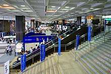
Rail
Roads
Expressways and toll roads
.jpg)
- Yamagata Expressway
- Sanriku Expressway
- Sendai East Road
- Sendai North Road
- Sendai South Road
National highways


Ports
- Sendai Port – Ferry route to Tomakomai, Hokkaido and Nagoya, container hub port
- Ishinomaki Port – Ferry route to Mount Kinka, Tashiro Island and Tashiro Island.
- Matsushima Bay
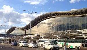
Airports
Sports
The sports teams listed below are based in Miyagi Prefecture.
- Baseball
- Tohoku Rakuten Golden Eagles (Miyagi Baseball Stadium, Sendai)
- Tohoku Reia
- Football (soccer)
- Vegalta Sendai (Yurtec Stadium Sendai, Sendai)
- Sony Sendai F.C. (Yurtec Stadium Sendai, Sendai)
- Vegalta Sendai Ladies (Yurtec Stadium Sendai, Sendai)
- Basketball
- Volleyball
- Sendai Bellefille
- Futsal
- Professional wrestling
Also, the Sendai Hi-Land Raceway hosts motorsport road races.
Visitor attractions
Sendai was the castle town of the daimyō Date Masamune. The remains of Sendai Castle stand on a hill above the city.
Miyagi Prefecture boasts one of Japan's three greatest sights. Matsushima, the pine-clad islands, dot the waters off the coast of the prefecture.
The following are also noted as attractions:
|
|
Famous festivals and events

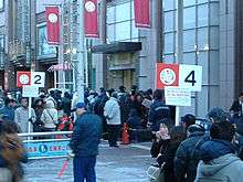
- Sendai New Year's traditional Sale on January 2
- Shiroishi Kokeshi Exhibition, May 3–5
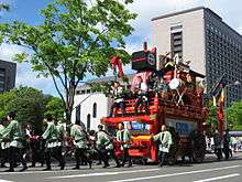
- Aoba Festival, Suzume Odori traditional Japanese dance event in May
- Shiogama Port Festival in July
- Sendai Tanabata Festival, August 6–8
- Narugo Kokeshi Festival in September
- Sendai Pageant of Starlight in December
Notes
- ↑ Nussbaum, Louis-Frédéric. (2005). "Miyagi prefecture" in Japan Encyclopedia, p. 648, p. 648, at Google Books; "Tōhoku" in p. 970, p. 970, at Google Books.
- ↑ Nussbaum, "Sendai" in p. 841, p. 841, at Google Books.
- ↑ Nussbaum, "Provinces and prefectures" in p. 780, p. 780, at Google Books
- 1 2 Titsingh, Isaac. (1834). Annales des empereurs du japon, p. 64.
- ↑ "Japan earthquake: Tsunami hits north-east". BBC News. March 11, 2011. Archived from the original on March 12, 2011.
- ↑ Williams, Martyn. "Report from Japan: Impact of Tsunami Devastates Nation's Northeast". voanews.com. Archived from the original on 9 January 2012. Retrieved 28 April 2018.
- ↑ "CBS News World". April 7, 2011. Archived from the original on 8 April 2011. Retrieved 7 April 2011.
- ↑ "Crown Prince Naruhito, Princess Masako visit tsunami victims in Miyagi". Japan Daily Press. Archived from the original on 2013-08-24.
- ↑ "General overview of area figures for Natural Parks by prefecture" (PDF). Ministry of the Environment. Archived (PDF) from the original on 21 April 2012. Retrieved 19 August 2012.
- ↑ Schreiber, Mark, "Japan's food crisis goes beyond recent panic buying Archived 2011-04-20 at the Wayback Machine.", Japan Times, 17 April 2011, p. 9.
- ↑ http://www.philstar.com/Article.aspx?articleId=710867&publicationSubCategoryId=200%5Bpermanent+dead+link%5D
References
- Nussbaum, Louis-Frédéric and Käthe Roth. (2005). Japan encyclopedia. Cambridge: Harvard University Press. ISBN 978-0-674-01753-5; OCLC 58053128
- Titsingh, Isaac. (1834). Nihon Odai Ichiran; ou, Annales des empereurs du Japon. Paris: Royal Asiatic Society, Oriental Translation Fund of Great Britain and Ireland. OCLC 5850691
External links
| Wikimedia Commons has media related to Miyagi prefecture. |
- Miyagi Prefecture Official Website (in Japanese)
| Wards of Sendai | |
|---|---|
| Cities | |
| Districts | |
| Geology | |||||||||||||||
|---|---|---|---|---|---|---|---|---|---|---|---|---|---|---|---|
| Affected areas |
| ||||||||||||||
| Affected infrastructure |
| ||||||||||||||
| Nuclear Accidents and Incidents |
| ||||||||||||||
| Foreshocks, Aftershocks |
| ||||||||||||||
| People | |||||||||||||||
| Relief and Recovery |
| ||||||||||||||
| Media |
| ||||||||||||||
| Other | |||||||||||||||
Coordinates: 38°21′N 140°58′E / 38.350°N 140.967°E
| Authority control |
|---|