Yamada, Iwate
| Yamada 山田町 | |||
|---|---|---|---|
| Town | |||
 Yamada Town Hall | |||
| |||
 Location of Yamada in Iwate Prefecture | |||
 Yamada | |||
| Coordinates: 39°28′3.2″N 141°56′56.1″E / 39.467556°N 141.948917°ECoordinates: 39°28′3.2″N 141°56′56.1″E / 39.467556°N 141.948917°E | |||
| Country | Japan | ||
| Region | Tōhoku | ||
| Prefecture | Iwate | ||
| District | Shimohei | ||
| Area | |||
| • Total | 262.81 km2 (101.47 sq mi) | ||
| Population (March 1 2017) | |||
| • Total | 16,136 | ||
| • Density | 61.4/km2 (159/sq mi) | ||
| Time zone | UTC+9 (Japan Standard Time) | ||
| City symbols | |||
| - Tree | Sugi | ||
| - Flower | Hamanasu | ||
| - Bird | Black-tailed gull | ||
| Phone number | 0193-82-3111 | ||
| Address | 3-20 Hachiman-cho, Yamada-machi, Shimohei-gun, Iwate-ken 028-1392 | ||
| Website |
www | ||


Yamada (山田町 Yamada-machi) is a town in Iwate Prefecture, Japan. As of 1 March 2017, the town had an estimated population of 16,136. and a population density of 61.4 persons per km2, in 6,668 households.[1]The total area of the town is 262.81 square kilometres (101.47 sq mi).
Geography
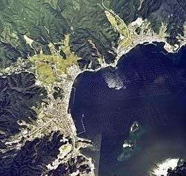
Yamada is located on the ria coastline of central Iwate Prefecture, facing the Pacific Ocean. Parts of the town are within the borders of the Sanriku Fukkō National Park.
Neighbouring municipalities
Iwate Prefecture
Climate
Yamada has a oceanic climate (Köppen Cfb) characterized by mild summers and cold winters. The average annual temperature in Yamada is 9.2 °C. The average annual rainfall is 1415 mm with September as the wettest month and February as the driest month. The temperatures are highest on average in August, at around 21.6 °C, and lowest in January, at around -1.8 °C.[2]
Demographics
Per Japanese census data,[3] the population of Yamada has declined over the past 40 years.
| Census Year | Population |
|---|---|
| 1970 | 24,193 |
| 1980 | 25,321 |
| 1990 | 22,925 |
| 2000 | 21,214 |
| 2010 | 18,625 |
History
The area of present-day Yamada was part of ancient Mutsu Province, dominated by the Nambu clan from the Sengoku period. It was part of Morioka Domain under the Tokugawa shogunate during the Edo period. Yamada was the location of the 1643 Breskens Incident, where the Dutch ship Breskens, part of the De Vries expedition, made two unauthorised visits to Yamada and was captured by Japanese authorities.
With the Meiji period establishment of the modern municipalities system, the town of Yamada was created within Higashihei District on April 1, 1889. Higashihei District was merged into Minamihei District on March 29, 1896. On March 1, 1955, Yamada annexed the neighboring villages of Funakoshi, Orikada, Osawa and Toyomane to reach is present borders.
After the March 2011 Tōhoku earthquake, it was reported that the town had been almost completely submerged by the ensuing tsunami.[4][5]
Economy
The local economy is strongly based on commercial fishing.
Education
Yamada has nine public elementary schools and two public junior high schools operated by the town government, and one public high school operated by the Iwate Prefectural Board of Education.
Transportation
Railway
- East Japan Railway Company (JR East) – Yamada Line (operations currently suspended indefinitely)
Highway
International relations

Notable people from Yamada
- Zenkō Suzuki – former Prime Minister
References
- ↑ Yamada town official home page
- ↑ Yamada climate data
- ↑ Yamada population statistics
- ↑ Quake death toll feared to top 1800, thousands more unaccounted for Archived 2011-03-13 at WebCite, Japan Today article, 13 March 2011
- ↑ Fukada, Takahiro, "Iwate survivors wonder, worry about future", Japan Times, 15 September 2011, p. 3.
- ↑ "International Exchange". List of Affiliation Partners within Prefectures. Council of Local Authorities for International Relations (CLAIR). Archived from the original on 22 December 2015. Retrieved 21 March 2017.
External links
| Wikimedia Commons has media related to Yamada, Iwate. |
- Official Website (in Japanese)