Marumori, Miyagi
| Marumori 丸森町 | |||
|---|---|---|---|
| Town | |||
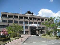 Marumori Town Office | |||
| |||
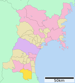 Location of Marumori in Miyagi Prefecture | |||
 Marumori | |||
| Coordinates: 37°54′41.2″N 140°45′55.4″E / 37.911444°N 140.765389°ECoordinates: 37°54′41.2″N 140°45′55.4″E / 37.911444°N 140.765389°E | |||
| Country | Japan | ||
| Region | Tōhoku | ||
| Prefecture | Miyagi | ||
| District | Igu | ||
| Area | |||
| • Total | 273.30 km2 (105.52 sq mi) | ||
| Population (October 2017) | |||
| • Total | 13,979 | ||
| • Density | 51.14/km2 (132.5/sq mi) | ||
| Time zone | UTC+9 (Japan Standard Time) | ||
| - Tree | Cryptomeria | ||
| - Flower | Lilium auratum | ||
| - Bird | Japanese bush warbler | ||
| Phone number | 0224-72-2111 | ||
| Address | 120 Torii, Marumori-machi, Igu-gun, Miyagi-ken 981-2192 | ||
| Website | http://www.town.marumori.miyagi.jp/ | ||


Marumori (丸森町 Marumori-machi) is a town located in Miyagi Prefecture, Japan. As of 1 October 2017, the town had an estimated population of 13,979, and a population density of 51.14 persons per km² in 5,089 households.[1] The total area of the town is 273.30 square kilometres (105.52 sq mi).
Geography
Marumori is located in the extreme southern portion of Miyagi Prefecture in the Tōhoku region of northern Japan, bordered by Fukushima Prefecture to the south, east and west. The name “Marumori” means "circle forest" in Japanese and the town is located in a circular basin surrounded by heavily forested mountains. The Abukuma River passes through the town. Marumori has a humid climate (Köppen climate classification Cfa) characterized by mild summers and cold winters. The average annual temperature in Marumori is 12.6 °C. The average annual rainfall is 1258 mm with September as the wettest month. The temperatures are highest on average in August, at around 25.0 °C, and lowest in January, at around 1.6 °C.[2]
Neighboring municipalities
Demographics
Per Japanese census data,[3] the population of Marumori has declined over the past 40 years.
| Census Year | Population |
|---|---|
| 1970 | 22,027 |
| 1980 | 20,849 |
| 1990 | 19,755 |
| 2000 | 17,868 |
| 2010 | 15,501 |
History
The area of present-day Marumori was part of ancient Mutsu Province, and was part of the holdings of Sendai Domain under the Edo period Tokugawa shogunate. The village of Marumori was established on April 1, 1889 with the establishment of the post-Meiji restoration modern municipalities system. It was raised to town status on December 1, 1954 after merging with the neighboring villages of Kaneyama, Ōuchi, Ōhari, Kőya, Kōsai, Tateyama and Hippo.
Economy
The economy of Marumori is largely based on agriculture and forestry.
Education
Marumori has eight public elementary schools and one public junior high school operated by the town government, and one public high school operated by the Miyagi Prefectural Board of Education. There is also one private elementary school.
Transportation
Railway
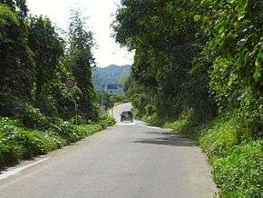
Highway
Sister city relations


References
- ↑ [http://www.town.marumori.miyagi.jp/ Marumori town official home page (in Japanese)
- ↑ Marumori climate data
- ↑ Marumori population statistics
- ↑ "US-Japan Sister Cities by State". Asia Matters for America. Honolulu, HI: East-West Center. Retrieved 20 November 2015.
External links
![]()
- Official Website (in Japanese)