Viropa, West Virginia
| Viropa, West Virginia | |
|---|---|
| Unincorporated community | |
 Viropa  Viropa | |
| Coordinates: 39°24′41″N 80°16′55″W / 39.41139°N 80.28194°WCoordinates: 39°24′41″N 80°16′55″W / 39.41139°N 80.28194°W | |
| Country | United States |
| State | West Virginia |
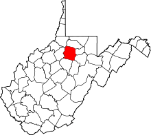
| County | Harrison |
| Elevation | 965 ft (294 m) |
| Time zone | UTC-5 (Eastern (EST)) |
| • Summer (DST) | UTC-4 (EDT) |
| GNIS ID | 1555897[1] |
Viropa is an unincorporated community and coal town in Harrison County, West Virginia. Their post office [2] closed in 1930.[3]
The community's name is an amalgamation of Virginia, Ohio, and Pennsylvania.[4]
References
- ↑ U.S. Geological Survey Geographic Names Information System: Viropa, West Virginia
- ↑ U.S. Geological Survey Geographic Names Information System: Viropa, West Virginia
- ↑ http://webpmt.usps.gov/pmt007.cfm%5Bpermanent+dead+link%5D
- ↑ Kenny, Hamill (1945). West Virginia Place Names: Their Origin and Meaning, Including the Nomenclature of the Streams and Mountains. Piedmont, WV: The Place Name Press. p. 650.
This article is issued from
Wikipedia.
The text is licensed under Creative Commons - Attribution - Sharealike.
Additional terms may apply for the media files.