Light rail in North America
_(14918534190).jpg)
.jpg)
Light rail is a commonly used mode of public transit in North America. The term light rail was coined in 1972 by the Urban Mass Transportation Administration (UMTA; the precursor to the U.S. Federal Transit Administration) to describe new streetcar transformations which were taking place in Europe and the United States. The Germans used the term Stadtbahn, which is the predecessor to North American light rail, to describe the concept, and many in UMTA wanted to adopt the direct translation, which is city rail. However, in its reports, UMTA finally adopted the term light rail instead.[1]
History of streetcars and light rail
From the mid-19th century onwards, horse-drawn trams or horsecars were used in cities around the world. In the late 1880s electrically powered street railways became technically feasible following the invention of a trolley pole system of collecting current by American inventor Frank J. Sprague who installed the first successful system at Richmond, Virginia. They became popular because roads were then poorly surfaced, and before the invention of the internal combustion engine and the advent of motor-buses, they were the only practical means of public transport around cities.[2]
The streetcar systems constructed in the 19th and early 20th centuries typically only ran in single-car setups. Some rail lines experimented with multiple unit configurations, where streetcars were joined together to make short trains. When lines were built over longer distances (typically with a single track) before good roads were common, they were generally called interurban streetcars or radial railways in North America.
After World War II, seven major North American cities (Boston, Newark, New Orleans, Philadelphia, Pittsburgh, San Francisco, and Toronto) continued to operate large streetcar systems.[3][4][5] Some of these cities called their modernized systems light rail in an attempt to differentiate it from their existing streetcars particularly cities that continued to operate both the old and new systems. Cleveland, Ohio, maintained an interurban system (e.g. the Blue and Green Lines) that is equivalent to what is now "light rail", which opened before World War I, and which is still in operation to this day.[3][4][5]
In North America, many of these original streetcar systems were decommissioned in the 1950s and onward as the popularity of the automobile increased. Although some traditional trolley or tram systems still exist to this day, the term "light rail" has come to mean a different type of rail system. Modern light rail technology has primarily German origins, since an attempt by Boeing Vertol to introduce a new American light rail vehicle was a technical failure.
The renaissance of light rail in North American began in 1978 when the Canadian city of Edmonton, Alberta adopted the German Siemens-Duewag U2 system, followed three years later by Calgary, Alberta[6] and San Diego, California.[7]
Historically, the rail gauge has had considerable variations, with narrow gauge common in many early systems. However, most light rail systems are now standard gauge.[8] An important advantage of standard gauge is that standard railway maintenance equipment can be used on it, rather than custom-built machinery. Using standard gauge also allows light rail vehicles to be delivered and relocated conveniently using freight railways and locomotives. Additionally, more manufacturers are able to produce standard gauge vehicles, reducing costs for rolling stock acquisition. Another factor favoring standard gauge is that low-floor vehicles are becoming popular, and there is generally insufficient space for wheelchairs to move between the wheels in a narrow gauge layout.
Diesel light rail
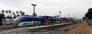
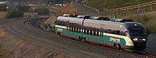
A few recently opened systems in North America use diesel-powered trains, including the Trillium Line in Ottawa (opened in 2001), the River Line in New Jersey (opened in 2004), and the Sprinter in northern San Diego County, California (opened in 2008). Diesel operations are chosen in corridors where lower ridership is expected (and thus do not justify the expense of the electric power infrastructure) or which have an "interurban" nature with stations spaced relatively far apart (electric power provides greater acceleration, making it essential for operations with closely spaced stations). Operations with diesel-powered trains can be an interim measure until ridership growth and the availability of funding allow the system to be upgraded to electric power operations.
Ridership on light rail in North America
The following table lists the twelve light rail systems in North America with the highest riderships in 2016:
| City/Metro Area Served |
Country | Light rail system | Annual Ridership (2016)[9][10] | |
|---|---|---|---|---|
| 1 | Guadalajara | Guadalajara light rail system | 98,269,000 | |
| 2 | Toronto | Toronto streetcar system | 95,761,000 | |
| 3 | Calgary | CTrain | 88,779,200 | |
| 4 | Boston | Massachusetts Bay Transportation Authority | 69,236,700 | |
| 5 | Los Angeles | Los Angeles Metro Rail | 65,829,000 | |
| 6 | San Francisco | Muni Metro | 52,597,300 | |
| 7 | Portland, OR | MAX Light Rail | 40,240,300 | |
| 8 | San Diego | San Diego Trolley | 38,068,600 | |
| 9 | Mexico City | Xochimilco Light Rail | 35,060,000 | |
| 10 | Edmonton | Edmonton Light Rail Transit | 33,891,900 | |
| 11 | Dallas | Dallas Area Rapid Transit (DART) | 29,619,500 | |
| 12 | Philadelphia | SEPTA | 25,127,600 |
Notes
Guadalajara has the highest annual ridership of any light rail system in North America,[10] followed by Canada's (in the case of Toronto, actually streetcar)[9], with Canada's Calgary having the third highest annual ridership. Of the light rail systems in the United States, Boston has the fourth highest annual ridership in North America, followed by Los Angeles with the fifth highest.[9]
In general, ridership on light rail systems in Mexico and Canada tends to be higher than the corresponding ridership on light rail systems in the United States, especially on a boardings per mile basis where the Mexican systems (Guadalajara light rail system and Xochimilco Light Rail) rank first and second, and three Canadian systems (Calgary's CTrain, Edmonton Light Rail Transit and Toronto's streetcars) rank third, fifth and seventh. On a boardings per mile basis, the most ridden light rail systems in the United States are again Boston's MBTA ranked fourth, followed by San Francisco's Muni Metro ranked sixth.
Light rail in Canada
| Location | System | Year Opened | System Length |
Stations | Lines | Year Last Expansion | Type |
|---|---|---|---|---|---|---|---|
| Calgary | CTrain[11] | 1981[12] | 59.9 km (37.2 mi)[11] | 45[11] | 2 | 2014[13] | Light rail |
| Edmonton | Edmonton Light Rail Transit[14] | 1978[14] | 24.3 km (15.1 mi)[14] | 18[14] | 2[14] | 2015[14] | Light rail |
| Ottawa | O-Train[15] | 2001[16] | 8 km (5.0 mi)[15] | 5[15] | 1 | n/a | Diesel light rail |
| Toronto[lower-alpha 1] | Toronto streetcar system[17] | 1861[18] | 82 km (51 mi)[18] | 708[17] | 11 | 2016[19] | Streetcar |
Notes
- ↑ Toronto also has a metro/rapid transit system, in addition to its streetcar system - see the List of metro systems.
In general, Canadian cities have rates of public transit use which are two to three times as high as comparably sized U.S. cities. Census data for 2006 show that 11.0% of Canadians use public transit to commute to work, compared to 4.8% of Americans.[20][21] This means that transportation planners must allow for higher passenger volumes on Canadian transit systems than American ones.
As a result of lower government funding, Canadian cities have to recover a much higher share of their costs out of operating revenues. This lack of funding may explain why there is resistance to the high capital costs of rail systems and there are only a few light rail systems in Canada.
There are a number of LRT proposals in Canada, a few of which are under construction such as in Ottawa, Toronto and Waterloo Region (Ontario). These are described further in the main article.
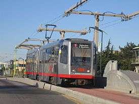
Calgary
Calgary Transit claims that the Calgary CTrain network, which started operation in 1981, has the highest ridership of any modern light rail transit system in North America, carrying over 320,000 passengers per weekday.[22] This is higher than the Toronto streetcar system that began operation in 1861 and is also higher than the Boston Light Rail system, which is the busiest light rail transit system in the United States. At present, there are 45 stations in operation along the 58.7-kilometer (36.5 mi) CTrain light rail system.[11] There are four legs in the system radiating directionally out into the suburbs from the downtown core that are connected by shared tracks along a downtown transit mall. They have been organized into two CTrain lines (identified as the Red Line and the Blue Line on network maps). The legs, as built in chronological order, are the South (1981), the Northeast (1985), the Northwest (1987), and the West (2012). Route 201 (Red Line) connects the South and Northwest lines; Route 202 (Blue Line) connects the Northeast and West lines. The two routes share most of the downtown line on the 7th Avenue South transit mall; the exception is the Downtown West – Kerby station, which serves only Route 202.[11] The planned Route 203 - Green line will add about 40 kilometres (25 mi) and 28 stations to the system by connecting a North leg to a Southeast leg, probably in a tunnel underneath the existing downtown transit mall. Construction on it is expected to start in 2017.[22]
In late 2015 Calgary Transit started running four-car trains to alleviate congestion as the system exceed 300,000 passengers per weekday. The longer trains can carry 800 passengers per train compared to 600 on three-car trains, a 33% increase. This upgrade required rebuilding or relocating all 45 station platforms to accommodate the longer trains, and buying 63 new vehicles to add another car to each train. Trains will be lengthened as more vehicles are delivered from the manufacturer.[23]
Edmonton
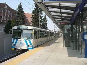
Edmonton was the first city in North America to build a modern (second generation) light rail system.[24][25] The route (today called the Capital Line) first started construction in 1974, and opened its first segment on April 22, 1978, in time for the 1978 Commonwealth Games. The Edmonton Transit System built much of its initial light rail system underground, which meant that it could not afford to lay as much track to the suburbs at the time of its opening. The system has grown incrementally since its opening, and as of 2010 had grown to a 21-kilometer (13 mi) long light rail line serving a total of 15 stations.[14] The system is successful by North American standards, with an average weekday ridership of 93,600 passengers in 2010.[26] The City of Edmonton has focused on LRT expansion plans in recent years. The new Metro Line, a branch of the existing Capital Line, opened in September 2015. The separate Valley Line, currently under construction with its first 13.1-kilometre (8.1 mi) phase due to open in 2020, will use low-floor vehicles.
Ottawa
In 2001, to supplement its Bus Rapid Transit (BRT) system, Ottawa opened a diesel light rail pilot project, (the O-Train), which was relatively inexpensive to construct (C$21 million), due to its single-track route along a little used freight-rail right of way and use of diesel multiple units (DMUs) to avoid the cost of building overhead lines along the tracks.
With the construction of the Confederation Line, the O-Train brand has been extended to both rail transit services and the diesel line has been renamed as the Trillium Line.[27] The Trillium Line is an 8 km (5.0 mi) diesel light rail line running north to south from Bayview Station to Greenboro Station connecting with a transitway at each terminus. There are three passing sidings along the single-track line. The Confederation Line is a light rail line under construction to run east-west from Blair to Tunney's Pasture connecting to a transitway at each terminus and with the Trillium Line at Bayview. The line will run both underground and on the surface. There will be a tunnel downtown with three underground stations.[28]
Toronto
Most of the 11 routes of the Toronto streetcar system operate in mixed traffic, but three of them (509 Harbourfront, 510 Spadina and 512 St. Clair) as well as a 3 km portion of the 501 Queen in the median of The Queensway have similarity to light rail in that there is a high degree of separation from road traffic by using reserved lanes with some track in tunnels.
Light rail in Mexico
| Location | System | Year Opened | System Length |
Stations | Lines | Year Last Expansion | Type |
|---|---|---|---|---|---|---|---|
| Guadalajara | Guadalajara light rail system[29] | 1989[29] | 25.0 km (15.5 mi)[29] | 29[30] | 2 | 1994 | Light rail |
| Mexico City[lower-alpha 1] | Xochimilco Light Rail[31] | 1986 | 12.8 km (8.0 mi) | 18[31] | 1 | 1995 | Light rail |
Notes
- ↑ Mexico City also has a metro/rapid transit system, in addition to its light rail system - see the List of metro systems.

There are two light rail systems in Mexico: Guadalajara's, and Mexico City's Xochimilco Light Rail line (known locally as el Tren Ligero). A third system, Monterrey's Metrorrey also has some characteristics of a light rail system (especially in its use of high-floor light rail vehicles), but runs in a fully grade separated, exclusive right-of-way with high passenger volumes, which are generally the criteria assigned to "metro" or heavy rail systems; thus Metrorrey is considered to be a full metro system by at least the UITP transport organization[32] and so is not included here.
Both of Mexico's light rail systems have among the highest riderships of any North American light rail system. Guadalajara's light rail system, despite being only about 15.5-miles long, transported an average of approximately 268,500 passengers per day in the Fourth Quarter (Q4) of 2013,[10] translating into over 18,000 daily boardings per mile, which is the highest per mile boarding rate of any North American light rail system. The Xochimilco Light Rail line is close behind, seeing almost 11,400 boardings per mile in Q4 2013, the second highest rate of boardings per mile of any North American system.
Light rail in the United States
Overview
The United States has a number of light rail systems in its mid-sized to large cities. As of October 2016, there are 26 modern light rail systems, 11 modern streetcar systems, and approximately 10 heritage streetcar systems (plus the San Francisco cable car system, and Morgantown's light rail-like Personal Rapid Transit system) offering regular year-round transit service, for a total of over 45 operational light rail-type systems in the United States. The United States has a much larger number of "true" light rail systems (i.e. not including streetcar and heritage streetcar systems), by far, compared to any other country in the world (the next largest are Germany with 10 light rail systems, and Japan with 7).[33]
Seven of these systems are vestigial "legacy" first-generation streetcar systems that were spared the fate of the other streetcar systems that were closed in the United States during the 1950s-1970s due to their having some grade separation from other traffic (e.g. subway tunnels) and relatively high ridership.[3] Of these seven surviving streetcar systems, two of these (Muni Metro in San Francisco and Pittsburgh Light Rail) have seen their service substantial revamped and modernized since the 1960s (e.g. by the construction of new subway sections), whereas the other five (Boston, Cleveland, Newark, New Orleans, and Philadelphia) have seen less drastic expansions or modernizations since their earlier eras.
The remaining examples are all second-generation light rail (and streetcar) systems, with the oldest being San Diego's which was opened in 1981. In the 1980s, this system was followed by new light rail installations in Buffalo, Portland, Sacramento, and San Jose, and by a heritage streetcar line in Dallas. Many new systems followed in the 1990s, and approximately 20 more new light rail and streetcar systems have followed since 2000.
Table of United States light rail systems
- Notes
- 1 2 3 4 5 6 7 8 9 10 11 12 This city also has a metro/rapid transit system, in addition to its light rail/streetcar system – see the List of metro systems.
- ↑ While the MBTA Green Line is light rail, the MBTA Blue, Orange, and Red Lines of the system are rapid transit/subways.
- 1 2 "MTBA - About the MTBA - History - The Rapid Transit Commission and the BERY". Massachusetts Bay Transportation Authority. 2013. Retrieved 2013-08-07.
- 1 2 3 4 5 6 "About the T - Financials - Appendix: Statistical Profile" (PDF). Massachusetts Bay Transportation Authority. 2007. Retrieved 2013-07-13.
- ↑ See Green Line Extension
- ↑ This was not a service "extension" per se, but a line renovation.
- ↑ The Ashmont-Mattapan Line is run with historic PCC streetcar rolling stock, but is considered by the MBTA to be a regular light rail line rather than a "heritage streetcar" line.
- ↑ While the Blue and Green Lines are light rail, Cleveland's other transit line, the Red Line, is rapid transit.
- ↑ For light-rail portion (Blue, Expo, Gold and Green Lines) of L.A. Metro only. The Red and Purple Lines of L.A. Metro are rapid transit/subway systems and are not included here.
- ↑ Muni Metro: 33 stations (9 underground; 24 surface), with an additional 87 streetcar-like surface stops.
- 1 2 3 It is debatable whether this system truly qualifies as "light rail" (or as a true "transit" system either), but it is included in the table anyway for completeness.
See also
References
- ↑ Gregory L. Thompson (2003), Defining an Alternative Future: Birth of the Light Rail Movement in North America, Transportation Research Board, http://trb.org/publications/circulars/ec058/03_01_Thompson.pdf
- ↑ Taplin, Michael (1998). "the History of Tramways and Evolution of Light Rail". Light Rail Transit Association.
- 1 2 3 "This Is Light Rail Transit" (pdf). Light Rail Transit Committee. Transportation Research Board. November 2000. p. 7. Retrieved 2014-08-06.
- 1 2 Demery, Jr., Leroy W. (November 2011). "U.S. Urban Rail Transit Lines Opened From 1980" (PDF). publictransit.us. pp. 4–5. Archived from the original (pdf) on 2013-11-04. Retrieved 2014-07-24.
- 1 2 Demery, Jr., Leroy W. (October 25, 2010). "U.S. Urban Rail Transit Lines Opened From 1980: Appendix". publictransit.us. Archived from the original on November 3, 2013. Retrieved 2014-07-24.
- ↑ "Calgary Transit U2 DC LRV Roster". Carsandtrains.com. Retrieved 2010-11-23.
- ↑ "Trolley Fact Sheet". San Diego Metropolitan Transit System. Retrieved 2010-11-23.
- ↑ Bottoms, Glen (2000). Continuing Developments in Light Rail Transit in Western Europe (PDF). 9th Annual Light Rail Transit Conference, Portland, Oregon: Light Rail Transit Association. Retrieved 2007-01-02.
- 1 2 3 "APTA - Transit Ridership Report - Fourth Quarter 2016 - Light Rail" (pdf). American Public Transportation Association. March 3, 2017. pp. 3–4. Retrieved 2017-02-21.
- 1 2 3 "Banco de Información Económica - Instituto Nactional De Estadística Y Geografía - Comunicaciones y transportes". Instituto Nactional De Estadística Y Geografía (INEGI). Retrieved 2014-04-17.
- 1 2 3 4 5 "About Calgary Transit / Facts and Figures / Statistics". Calgary Transit. City of Calgary. 2015. Retrieved 2015-07-17.
- ↑ "About Calgary Transit / Corporate Information / History". Calgary Transit. City of Calgary. 2015. Retrieved 2015-07-17.
- ↑ "Northwest LRT extension to Rocky Ridge/Tuscany Tuscany Station is now open!". Calgary Transit. City of Calgary. 2015. Archived from the original on 2012-08-24. Retrieved 2015-07-17.
- 1 2 3 4 5 6 7 "LRT for Everyone" (PDF). Edmonton Transit System and City of Edmonton. p. 4. Archived from the original (pdf) on 2015-09-10. Retrieved 2014-08-05.
- 1 2 3 "OC Transpo - O-Train". OC Transpo. 2013. Retrieved 2013-07-26.
- ↑ "OC Transpo - History (Looking Back)". OC Transpo. 2013. Retrieved 2013-08-06.
- 1 2 "2012 - TTC Operating Statistics". Toronto Transit Commission. 2013. Retrieved 2013-07-26.
- 1 2 "Toronto's Streetcar Network - Past to Present - History". Toronto Transit Commission. 2013. Retrieved 2013-07-26.
- ↑ "TTC launches new 514 Cherry St. streetcar route - Toronto Star". thestar.com.
- ↑ "Commuting Patterns and Places of Work of Canadians, 2006 Census". Statistics Canada. 2008. Retrieved 2008-07-14.
- ↑ "American Community Survey 2006, Table S0802". U.S. Census. 2008. Archived from the original on 2008-09-16. Retrieved 2008-07-14.
- 1 2 "Vision for Green Line". Calgary Transit. Retrieved May 2, 2016.
- ↑ LeClair, Shannon (October 10, 2015). "Transit relief finally in sight as longer CTrains begin to roll out". Calgary Herald. Retrieved May 7, 2016.
- ↑ Freemark, Yonah (November 12, 2009). "Edmonton, First North American City with Modern Light Rail, Plans Major Expansion". The Transport Politic. Retrieved 2014-08-04.
- ↑ "This Is Light Rail Transit" (pdf). Transportation Research Board. p. 8. Retrieved 2014-08-04.
- ↑ "LRT is the Way We Move". City of Edmonton. February 15, 2011. Retrieved 2011-02-15.
- ↑ "O-Train name approved for Ottawa light rail system". CBC News Network. September 17, 2014. Retrieved December 29, 2014.
- ↑ "Confederation Line". City of Ottawa. 2015. Archived from the original on June 13, 2015. Retrieved June 15, 2015.
- 1 2 3 "Características Tren Eléctrico" [Electric Train Characteristics] (in Spanish). SITEUR. 2013. Archived from the original on 2013-07-28. Retrieved 2013-07-24.
- ↑ "Estaciones Tren Eléctrico" [Stations Electric Train] (in Spanish). SITEUR. 2013. Retrieved 2013-08-06.
- 1 2 "Servicios. - Servicio de Transportes Eléctricos del D.F." [Electrical transport service of the Federal District] (in Spanish). Servicio de Transportes Eléctricos del Distrito Federal. Archived from the original on 2012-07-16. Retrieved 2013-07-07.
- ↑ "Metros: Keeping Pace With 21st Century Cities". International Association of Public Transport (UITP). 2014. Retrieved 2014-06-29.
- ↑ Taplin, Michael. "A world of trams and urban transit". lrta.org. Light Rail Transit Association (LRTA). Retrieved 2014-08-07.
- 1 2 3 4 "A Better Way to Get Around". Atlanta Streetcar. Archived from the original on 2014-10-29. Retrieved 2014-12-30.
- 1 2 3 "Visitors Ride Guide" (PDF). Maryland Transit Administration. Retrieved 2013-07-14 – via http://mta.maryland.gov/content/visitors.
- ↑ "Metro Rail 7 Day Timetable" (PDF). NTFA-Metro. July 2, 2013. Archived from the original (PDF) on October 2, 2013. Retrieved 2013-08-07.
- 1 2 3 "NJ Transit Facts At a Glance Fiscal Year 2014" (pdf). NJ Transit. March 2015. Retrieved 2015-04-02.
- 1 2 "River Line - Light Rail" (PDF). NJ Transit. March 2013. Retrieved 2013-07-14.
- ↑ "LYNX Blue Line Recognizes Ridership Success During Week of Five-Year Anniversary". Charlotte Area Transit System (CATS). November 28, 2012. Retrieved 2013-08-07.
- 1 2 3 "LYNX Home". Charlotte Area Transit System (CATS). Retrieved 2013-08-07.
- 1 2 3 4 "CityLYNX Rail Service Gold Line Gold Line Phase 1". Charlotte Area Transit System (CATS). Retrieved 2015-09-05.
- ↑ Coolidge, Sharon (September 9, 2016). "It's a go: Streetcar finally opens". The Cincinnati Enquirer. Retrieved 2016-09-10.
- 1 2 3 "Design & Route". City of Cincinnati. 2016. Retrieved 2016-09-10.
- ↑ "About RTA: History of Public Transit in Greater Cleveland". Greater Cleveland Regional Transit Authority. 2012. Retrieved 2013-07-21.
- 1 2 3 "2012 Annual Report - Greater Cleveland Regional Transit Authority". Greater Cleveland Regional Transit Authority. December 31, 2012. Retrieved 2013-07-21.
- ↑ "DART.org - DART History". Dallas Area Rapid Transit. 2013. Retrieved 2013-07-23.
- 1 2 "Facts about Dallas Area Rapid Transit (DART)". Dallas Area Rapid Transit (DART). February 26, 2013. Retrieved 2013-07-23.
- ↑ "Orange Line now direct between the airport and downtown DFW Airport Station Connects DART to the World". Dallas Area Rapid Transit (DART). August 18, 2014. Retrieved 2015-01-10.
- ↑ Appleton, Roy (April 14, 2015). "Downtown-Oak Cliff streetcar debuts with speeches, curious riders". The Dallas Morning News. p. 1B. Retrieved 2015-04-15.
- 1 2 3 "Dallas Streetcar". Dallas Area Rapid Transit. 2016. Retrieved 2016-09-10.
- ↑ "Expanded Bishop Arts District Streetcar Service Begins". KTVT. August 29, 2016. Retrieved 2016-09-10.
- ↑ "RTD - Facts & Figures - Central Corridor Light Rail Line". Regional Transportation District. January 2013. Retrieved 2013-07-23.
- 1 2 3 4 "RTD - Facts & Figures". Regional Transportation District. May 24, 2013. Retrieved 2013-07-23.
- ↑ "FY2012 Business Plan & Budget" (PDF). Metropolitan Transit Authority of Harris County, Houston, Texas. 2012. Archived from the original (PDF) on 2013-09-18. Retrieved 2013-08-10.
- 1 2 3 "METRO About Us". Metropolitan Transit Authority of Harris County, Houston, Texas. Archived from the original on 2013-06-24. Retrieved 2013-07-23.
- ↑ "METRORail Rider Guide" (PDF). Metropolitan Transit Authority of Harris County, Houston, Texas. December 22, 2013. Archived from the original (PDF) on March 30, 2014. Retrieved 2014-01-08.
- 1 2 "Hudson-Bergen - Light Rail" (PDF). NJ Transit. March 2013. Retrieved 2013-07-14.
- ↑ Horsley, Lynn (May 6, 2016). "After years of planning, setbacks, hard work, KC celebrates streetcar grand opening". The Kansas City Star. Retrieved 2016-05-07.
- 1 2 3 "Kansas City is on the MOVE with the KC Streetcar". KCStreetcar.org. KC Downtown Streetcar. Retrieved 2016-05-07.
- 1 2 3 4 "Streetcar Route Map" (PDF). Kenosha Streetcars Today. Retrieved 2013-07-14 – via http://www.kenoshastreetcarsociety.org/today.
- 1 2 "River Rail - Central Arkansas Transit Authority". Central Arkansas Transit Authority (CATA). Archived from the original on 2013-09-02. Retrieved 2013-08-18.
- 1 2 "River Rail System Map" (png). Central Arkansas Transit Authority (CATA). 2013. Archived from the original on 2014-01-05. Retrieved 2013-07-14.
- 1 2 3 4 5 "Metro – Facts at a Glance". Los Angeles County Metropolitan Transportation Authority (Metro). November 18, 2016. Retrieved 2017-05-19.
- 1 2 "MATA - Memphis Area Transit Authority - Trolley History". Memphis Area Transit Authority (MATA). 2013. Retrieved 2013-08-18.
- 1 2 "MATA - Memphis Area Transit Authority - Trolley Map". Memphis Area Transit Authority (MATA). 2013. Retrieved 2013-08-18.
- 1 2 3 4 "METRO Blue Line - Facts About Trains and Construction". Metro Transit. 2013. Archived from the original on 2014-02-14. Retrieved 2014-06-15.
- 1 2 3 "Metro Green Line Fact Sheet". Metropolitan Council. 2014. Retrieved 2014-06-15.
- 1 2 "Newark - Light Rail" (PDF). NJ Transit. June 2013. Retrieved 2013-07-14.
- 1 2 3 "New Orleans Streetcars - New Orleans Online". The Official Tourism Site of the City of New Orleans: NewOrleansOnline.com. 2013. Retrieved 2013-07-16.
- ↑ "APTA Streetcar and Heritage Trolley Site - New Orleans Overview". American Public Transportation Association. Retrieved 2013-07-16.
- ↑ "Light Rail Service to Begin August 19, 2011". Hampton Roads Transit. Archived from the original on January 2, 2014. Retrieved 2013-08-10.
- 1 2 3 "The Tide - Hampton Roads Transit". Hampton Roads Transit. 2013. Retrieved 2013-07-15.
- 1 2 3 4 "NCTD Sprinter". North County Transit District (NCTD). 2013. Retrieved 2013-06-30.
- 1 2 Demery, Jr., Leroy W. (November 2011). "U.S. Urban Rail Transit Lines Opened From 1980" (PDF). publictransit.us. pp. 37–40. Archived from the original (pdf) on 2013-11-04. Retrieved 2013-11-02.
- 1 2 3 4 5 6 "SEPTA - Spring 2012 Route Statistics" (PDF). Southeastern Pennsylvania Transportation Authority. 2012. Retrieved 2013-06-28.
- 1 2 3 "Light Rail System 2011 Facts and Figures" (PDF). Valley Metro. August 14, 2012. Archived from the original (PDF) on June 3, 2013. Retrieved 2013-07-15.
- 1 2 3 Valley Metro. "Valley Metro Rail System FY15 Facts and Figures" (PDF). valleymetro.org. Valley Metro. Retrieved 2016-08-26.
- 1 2 3 4 "Port Authority of Allegheny County - Company Info & Projects - Agency Profile". Port Authority of Allegheny County (PAT). 2013. Retrieved 2013-07-15.
- 1 2 3 "Gov. Brown, U.S. Reps. join hundreds for Inaugural Ride as part of MAX Orange Line Grand Opening". September 12, 2015. Retrieved 2015-09-16.
- 1 2 3 4 "Streetcar History | Portland Streetcar". Portland Streetcar, Inc. 2012. Archived from the original on 2013-12-03. Retrieved 2013-06-30.
- 1 2 3 4 5 "Sacramento Regional Transit District: Fact Sheet" (PDF). Sacramento Regional Transit District. May 2016. Retrieved 2016-06-22.
- ↑ "History - The 1990s - MetroLink". Bi-State Development Agency (Metro). 2010. Archived from the original on 2013-08-23. Retrieved 2013-08-11.
- 1 2 3 "Procurement Information". Bi-State Development Agency (Metro). 2010. Archived from the original on 2013-08-18. Retrieved 2013-08-11.
- ↑ "Front Lines 2015 Map" (PDF). Utah Transit Authority. Archived from the original (PDF) on 2013-11-25. Retrieved 2013-07-02.
- 1 2 "TRAX and FrontRunner Map". Utah Transit Authority. April 2013. Archived from the original on 2013-06-20. Retrieved 2013-08-11.
- 1 2 3 4 5 "San Diego Trolley Fact Sheet" (pdf). San Diego Metropolitan Transit System. February 2013. Retrieved 2015-12-30 – via http://www.sdmts.com/about-mts.
- ↑ "San Diego MTS Vintage Trolley". San Diego Metropolitan Transit System. 2013. Retrieved 2013-06-22.
- 1 2 3 4 "San Diego Vintage Trolley". San Diego Vintage Trolley, Inc. 2013. Retrieved 2013-06-22.
- ↑ "San Diego Vintage Trolley - Route and Fares". San Diego Vintage Trolley, Inc. 2013. Archived from the original on 2013-10-16. Retrieved 2013-08-18.
- 1 2 3 4 "Muni Metro Light Rail | SFMTA". San Francisco Municipal Transportation Agency. 2013. Retrieved 2013-06-30.
- 1 2 3 4 5 6 "Rider Information – Market Street Railway". Market Street Railway. Retrieved 2013-08-18.
- 1 2 "Historic of Market Street Railway". San Francisco Municipal Transportation Agency. 2013. Retrieved 2013-06-30.
- ↑ "Historic Streetcars | SFMTA". Market Street Railway. 2013. Retrieved 2013-06-30.
- ↑ "Cable Cars | SFMTA". San Francisco Municipal Transportation Agency. 2013. Retrieved 2013-06-30.
- 1 2 3 4 5 "VTA Facts: Light Rail System Overview" (PDF). Santa Clara Valley Transportation Authority (VTA). November 14, 2012. Archived from the original (PDF) on August 20, 2013. Retrieved 2013-06-30.
- ↑ "Light Rail Service – Santa Clara Valley Transportation Authority". Santa Clara Valley Transportation Authority (VTA). 2013. Retrieved 2013-06-30.
- 1 2 3 4 5 6 "Schedules – SoundTransit". SoundTransit. Retrieved 2016-10-26.
- 1 2 "South Lake Union Streetcar". Seattle Streetcar. Retrieved 2016-02-27.
- ↑ "First Hill StreetCar Construction - Frequently Asked Questions". Seattle Streetcar. Retrieved 2016-02-27.
- 1 2 "Streetcar Routes". Seattle Streetcar. Retrieved 2016-02-27.
- ↑ Lindblom, Mike (January 22, 2016). "Seattle's First Hill Streetcar to open Saturday with free rides". The Seattle Times. Retrieved 2016-01-22.
- 1 2 "TECO Line Streetcar System – Streetcar System". TECOline Streetcar System. 2012. Retrieved 2013-07-02.
- 1 2 "Downtown Network Map" (PDF). Hillsborough Area Transit Authority (HART). February 2013. Retrieved 2013-07-02.
- 1 2 3 "Why do we need a streetcar? – The streetcar route". Sun Link Tucson Streetcar. Retrieved 2014-07-26.
- ↑ Laris, Michael (February 27, 2016). "D.C. streetcar makes its first voyages on H Street. 'Is it really happening?'". Washington Post. Retrieved 2016-02-27.
- 1 2 3 "DC Streetcar - H/Benning". District Department of Transportation (DDOT). 2016. Retrieved 2016-02-27.
External links
- List of Canadian urban rail systems
- American Public Transit Association
- Table of Light Rail Transit Agencies in the United States (from APTA)
- Federal Transit Administration (U.S.)
- Transportation Research Board (TRB) of the U.S. National Research Council
- Commuter Rail, Light Rail & Rail Transit News
- Light Rail & Transit News – current news concerning light rail development and issues
- Light Rail Central photos & news
- A movie of Armour's electric trolley, circa 1897 from Library of Congress