List of Santa Clara VTA Light Rail stations

Routes:
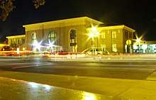
Santa Clara Valley Transportation Authority light rail is a light rail transit system that serves the Santa Clara County in the U.S. state of California. The system has 42.2 miles (67.9 km) of tracks and is operated by the Santa Clara Valley Transportation Authority (VTA), which oversees public transit services in the county.[1] The system serves over 32,000 passengers a day as of fiscal year 2007.[2][3]
The initial segment of the VTA light rail between the Civic Center and Old Ironsides stations began service on December 11, 1987.[3] In 1988 and 1990, the system was extended south of Civic Center to Downtown San Jose and Tamien station.[3] Another 9.7 miles (15.6 km) segment to Santa Teresa and Almaden stations was added to the system in April 1991, completing the entire Guadalupe section.[3][4] In December 1999, the system underwent another extension with the completion of the Tasman West section and began services to Mountain View.[5][6] The system was extended to I-880/Milpitas in 2001 and to Hostetter station in 2004 as part of the Tasman East extension. In the same year, the Capitol extension to Alum Rock station was also finished.[7][8] The latest section, the Vasona extension, was completed in 2005, connecting Campbell to Downtown San Jose.[9]
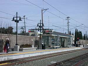
The system currently has 61 stations, of which 37 stations are served by the Mountain View–Winchester line, 36 are served by the Alum Rock–Santa Teresa line, and 3 are served by the Ohlone/Chynoweth–Almaden line. The majority of stations, 41, are located in San Jose. Seven stations are in Sunnyvale and five are in Mountain View. Campbell, Milpitas, and Santa Clara each have three stations.
VTA closed Evelyn station on March 16, 2015 in order to build a second track between Mountain View and Whisman stations.[10]
Stations
Lines

_light_rail_station.jpg)
| ^ | Transfer stations |
| Transfer stations with other rail systems | |
| Line termini | |
| ^ |
Transfer stations/Line termini |
| Transfer stations with other rail systems/Line termini | |
Notes
a All station names are based on the official system map.[13]
b For stations serviced by multiple lines, lines are listed in the order of opening.
c This station's northbound and southbound platforms are located a block apart from each other. The northbound platform is located on 1st Street while the southbound platform is located on 2nd Street.
References
- ↑ "About VTA". vta.org. Santa Clara Valley Transportation Authority. Retrieved November 13, 2008.
- ↑ "Light Rail System Statistics". vta.org. Santa Clara Valley Transportation Authority. Retrieved November 3, 2008.
- 1 2 3 4 "Light Rail System" (PDF). vta.org. Santa Clara Valley Transportation Authority. Archived from the original (PDF) on July 4, 2008. Retrieved November 3, 2008.
- ↑ Middleton, William D. (August 1991). "San Jose goes all the way — has the entire 20-mile Guadalupe Corridor light rail line in service". Railway Age. Retrieved November 3, 2008.
- ↑ "Tasman West Light Rail Extension" (PDF). vta.org. Santa Clara Valley Transportation Authority. Archived from the original (PDF) on July 18, 2008. Retrieved November 3, 2008.
- ↑ "Tasman Corridor West Light Rail Extension". Federal Highway Administration. Archived from the original on November 3, 2008. Retrieved November 3, 2008.
- ↑ "Tasman East Light Rail Project" (PDF). vta.org. Santa Clara Valley Transportation Authority. Archived from the original (PDF) on October 6, 2008. Retrieved November 3, 2008.
- ↑ "Capitol Light Rail Project" (PDF). vta.org. Santa Clara Valley Transportation Authority. Archived from the original (PDF) on July 5, 2008. Retrieved November 3, 2008.
- ↑ "Vasona Light Rail Project" (PDF). vta.org. Santa Clara Valley Transportation Authority. Archived from the original (PDF) on October 6, 2008. Retrieved November 3, 2008.
- ↑ MV light rail station closed, to be demolished
- ↑ "Current Light Rail System Data" (PDF). vta.org. Santa Clara Valley Transportation Authority. Archived from the original (PDF) on October 8, 2013. Retrieved February 26, 2013.
- ↑ Barnacle, Betty (March 24, 1997). "Light Rail Opens New Stop; First Station on Tasman Line to Serve North S.J. High-Tech Firms". San Jose Mercury News.
- ↑ "Interactive Light Rail Map". vta.org. Santa Clara Valley Transportation Authority. Retrieved November 19, 2008.