MetroLink (St. Louis)
MetroLink (reporting mark BSDA) is the light rail transit system in the Greater St. Louis area of Missouri and the Metro East area of Illinois. The system consists of two lines (Red Line and Blue Line) connecting Lambert-St. Louis International Airport and Shrewsbury, Missouri with Scott Air Force Base near Shiloh, Illinois through downtown St. Louis. The system features 38 stations and carries an average of 53,123 people each weekday.[1] As of the first quarter of 2015, it is second only to Minneapolis Metro Transit's Blue and Green lines in the Midwestern United States in terms of ridership, and is the 11th-largest light rail system in the country.[4]
MetroLink is operated by the Bi-State Development Agency, operating as Metro since 2003,[5] in a shared fare system with the MetroBus lines.[6]
History
Construction on the initial MetroLink alignment from Lambert-St. Louis International Airport to the 5th & Missouri station in East St. Louis began in 1990. The initial 17-mile (27 km) segment with 19 stations opened on July 31, 1993 between the North Hanley and 5th & Missouri stations.[2] Service was operated with 31 high-floor light rail vehicles.[7] About 14 miles of the original 17 miles were on existing rail right-of-way. The first phase of MetroLink was complete when the line was extended westward to Lambert Airport Main station on June 25, 1994.[8][9] At that time another station, East Riverfront, was opened in East St. Louis.[10] Four years later, in 1998, the Lambert Airport East station was added.[11] The capital cost to build the initial phase of MetroLink was $465 million. Of that amount, $348 million was supplied by the Federal Transit Administration (FTA).[12]
Construction on the St. Clair County MetroLink extension from the 5th & Missouri station to the College station in Belleville began in 1998 and opened in May 2001. The extension added eight new stations and seven park-ride lots. The total project cost was $339.2 million, with the FTA and St. Clair County Transit District sharing the burden at 72% ($243.9 million) and 28% ($95.2 million), respectively. Local funding was provided by the St. Clair County Transit District as a result of a 1/2 cent sales tax passed in November 1993.[12]
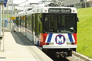
In May 2003, a 3.5-mile (5.6 km) extension from Southwestern Illinois College to Shiloh-Scott station opened. This $75 million project was funded by a $60 million grant from the Illinois FIRST (Fund for Infrastructure, Roads, Schools, and Transit) Program and $15 million from the St. Clair County Transit District.[12]
The Cross County Extension from Forest Park-DeBaliviere station to Shrewsbury-Lansdowne-I-44 station opened to the public on August 26, 2006. This 8-mile (13 km), 9-station extension connected Washington University, Clayton, the popular Saint Louis Galleria shopping center, Maplewood, and Shrewsbury to the system.[13] The entire project was funded by a $430 million Metro bond issue. Metro cited repeated delays and cost overruns as its reasons for firing its general contractor in Summer 2004. Metro sued the Collaborative for $81 million for fraud and mismanagement. The Collaborative counter-sued for $17 million for work that Metrolink hadn't yet paid for. On December 1, 2007, a jury voted in favor of the Cross County Collaborative, awarding them $2.56 million for work as yet unpaid for.
On October 27, 2008, Metro renamed the two MetroLink lines using color designations: the Lambert Airport branch was renamed to the Red Line; the Shrewsbury branch, the Blue Line. Service was also extended on the Blue Line from its former terminus at Emerson Park to Fairview Heights. All trains have a red or blue sign on the front that identify the train as a Red Line or Blue Line train, and all operators make station announcements identifying the Red Line or Blue Line.[7][14]
On September 9, 2014, the United States Department of Transportation announced $10.3 million in funding for a new Metrolink station between the Central West End and Grand stations in the Cortex research district. An additional $5 million in funding was provided by a public-private partnership including Washington University, BJC HealthCare, Great Rivers Greenway and the Cortex Innovation Community. The new Cortex station, located just east of Boyle Avenue, opened to the public on July 31, 2018.
Chronology
Below is a list of dates on which parts of the MetroLink system opened for service.
| Date | Event | Stations | Length |
|---|---|---|---|
| July 31, 1993[15] | Line opens between North Hanley and 5th & Missouri | 16 | 13.9 miles (22 km) |
| May 14, 1994[15] | East Riverfront opens between existing stations | 1 | — |
| June 25, 1994[15] | Extension to Lambert Airport Main opens | 1 | 3.15 miles (5.1 km) |
| December 23, 1998[15] | Lambert Airport East opens between existing stations | 1 | — |
| May 5, 2001[15] | Extension to College opens | 8 | 17.4 miles (28 km) |
| June 23, 2003[15] | Extension to Shiloh-Scott opens | 1 | 3.5 miles (6 km) |
| August 26, 2006[16] | Extension to Shrewsbury-Lansdowne I-44 opens | 9 | 8 miles (13 km) |
| July 31, 2018 | Cortex opens between existing stations | 1 | — |
| Total | 38 | 46 miles (74 km) |
Rail lines
Red Line
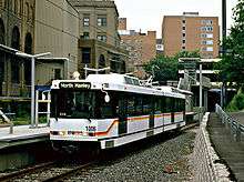
The main Metrolink alignment begins at Lambert St. Louis International Airport, making stops at the main and east terminals. It then proceeds through Berkeley before making a stop at North Hanley north of Bel-Ridge. It then makes two stops (UMSL North & South stations) at the University of Missouri St. Louis campus located in Normandy. After leaving the University of Missouri St. Louis, the line continues along the old Wabash Railroad right-of-way until Grand Avenue.[9][15] Along this right-of-way stops are made in Pagedale at St. Charles Rock Road and in Wellston, before crossing the county line at Skinker Boulevard; and making a stop at Delmar, serving the popular Delmar Loop area that straddles the St. Louis/University City border. It meets up with the Blue Line at the Forest Park-DeBaliviere station. From this station on until the Fairview Heights station, it shares tracks with the Blue Line. The line is a total of 38 miles with 29 stations. For the rest of the Red Line, see "Shared alignment".
Blue Line
The Blue Line starts in Shrewsbury just to the west of River des Peres. It crosses Interstate 44 and then continues northeast till the next 2 stations located in Maplewood, one at the Sunnen Industrial Complex, the other at Manchester Road. From there, it continues north to the Brentwood I-64 station located in Brentwood just south of Interstate 64. It then proceeds underneath Interstate 64, continuing to the Richmond Heights station in Richmond Heights. This station serves the popular St. Louis Galleria shopping center. Following that it proceeds to Clayton station in Clayton, serving the Central Business District of St. Louis County. From here, it continues in a tunnel right under Forest Park Parkway, making stops at Forsyth Boulevard and Big Bend Boulevard in University City, serving Washington University. It then makes a stop at Skinker Boulevard in St. Louis City, before meeting the Red Line at Forest Park DeBaliviere station. It is 24 miles long, with 22 stations. For the rest of the Blue Line, see "Shared alignment".
Shared alignment
Both MetroLink lines meet at the Forest Park-DeBaliviere station and continue for 14 more stations east on shared tracks until the Blue Line terminates at Fairview Heights.[17]

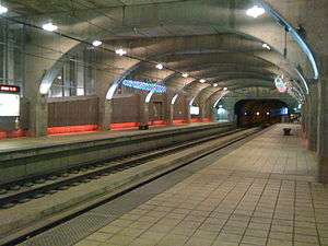
From the Forest Park station, the trains continue to the Central West End station, serving the Barnes-Jewish Hospital complex and the popular Euclid Avenue shopping district. From there, it proceeds to the Grand station under the Grand Boulevard viaduct, which services the St. Louis University complex and hospital. The trains pass under the Jefferson Avenue viaduct before they enter the next station near Union Station, located underneath 18th Street just near the popular Union Station shopping mall. A short distance later, the trains stop at the Civic Center Station, with transfer to the Gateway Transportation Center and the Scottrade Center. The trains then continue to run parallel under the 14th Street and Tucker Boulevard viaducts to the elevated section of Interstate 64 until the Busch Stadium station, originally serving the old, and now the new Busch Stadium. From then on, the line goes underground through a previously abandoned tunnel that had not been in use since 1974,[15] with stations at 8th & Pine streets, and the Convention Center under Washington Avenue and 6th Street, serving the Edward Jones Dome and Convention Center. It then makes stops on both sides of the Eads Bridge at Arch–Laclede's Landing station and at the East Riverfront station in East St. Louis, which serves the Casino Queen Gambling Casino & Hotel. From there, it runs at-grade from the 5th & Missouri station till the Fairview Heights station in Fairview Heights, Illinois. Here, the Blue line trains terminate, and the Red line trains continue until the line terminus at Shiloh-Scott AFB station at the gate to the base in Shiloh, Illinois.
Rolling stock

MetroLink operates a fleet of 87 light-rail vehicles composed of 31 SD-400 and 56 SD-460 vehicles. Each 90-foot (27 m), single articulated vehicle has 4 high platform doors per side and has a capacity of 72 seated and 106 standing passengers.[18][19] The cars are powered by an electric motor which gets its electricity from a catenary wire with a 750 volt supply.[20]
Each car has an enclosed operator cab at each end. This allows the most flexible system for managing operations, but prevents travel between cars except at stations. Each car also has separate doors for station level and track level access. In normal operations the track level doors (equipped with stairs) are unused.
The system also has two different railroad yards along the line for the storage and maintenance of light-rail vehicles: Ewing Yard is located between the Grand and Union Station stops just west of downtown St. Louis; 29th Street Yard is located between the JJK and Washington Park stops in Illinois. In October 2009, Metro had opened a paint booth facility in the Illinois railyard in East St. Louis, Illinois at a cost of $1.1 million.[21]
Roster information
| Unit Type | Year Built | Quantity | Numbers[22] |
|---|---|---|---|
| Siemens SD400 LRV | 1991–1993 | 31 | 1001–1031 |
| Siemens SD460 LRV | 1999 | 10 | 2001–2010 |
| Siemens SD460 LRV | 2000 | 24 | 3001–3024 |
| Siemens SD460 LRV | 2004–2005 | 22 | 4001-4022 |
Fares
.svg.png)
MetroLink uses a proof-of-payment system. Tickets can be purchased at ticket vending machines at the entrance to all stations and must be validated before boarding the train. The tickets are only good for two hours in the direction that a passenger boards.[7] Effective July 1, 2014, the fares are as follows:
- 1 Ride Ticket-$2.50 (reduced fare-$1.25) (rail only)
- 2 Hour Pass-$3 (reduced fare-$1.50) (unlimited use on Metrobus and Rail for 2 hours only)
- 2 Hour Pass from Lambert Airport $4 (unlimited use on MetroBus and Rail)
- One-Day Pass-$7.50 (unlimited use on MetroBus and Rail)
- Weekly Pass-$27 (unlimited use on MetroBus and Rail)
- Monthly Pass-$78 (reduced fare-$39) (unlimited use on MetroBus and Rail)
Reduced fares can be purchased by seniors ages 65+, people with disabilities, and children ages 5–12. Up to three children under 5 may ride free with a fare-paying rider. Proof of age may be requested of all people riding with reduced fares. Other types of passes, such as a Semester Pass for full-time students are also available in addition to the fares listed above.[23]
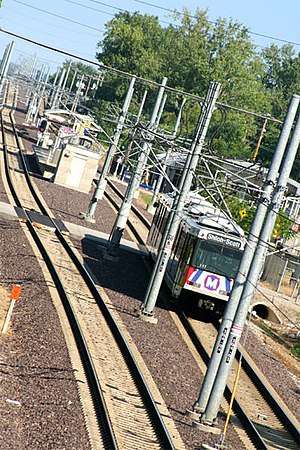
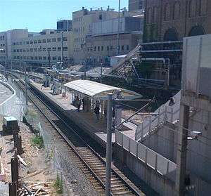
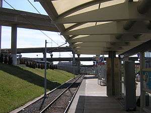
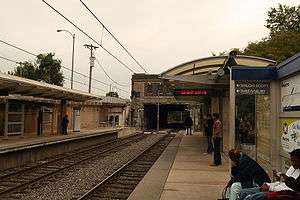
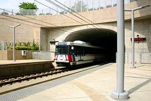
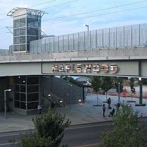
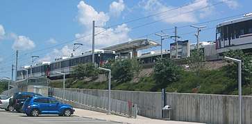
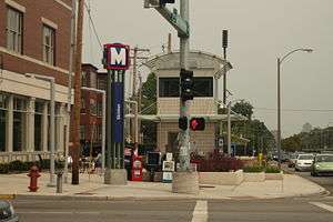
Gallery & List of Stations


Potential plans and extensions
Daniel Boone Corridor
- Daniel Boone Corridor – Clayton to Westport
- A study performed in 2000 recommended a new MetroLink line from Clayton, Missouri to Westport Plaza in Maryland Heights, Missouri. The 8–10-mile (13–16 km) line would run north from the Clayton station along the old Terminal Railroad Association of St. Louis "Central Belt" right-of-way paralleling I-170, then turn west to follow existing Union Pacific Railroad trackage operated by Central Midland Railway to Page where the line would then follow Page Avenue to Westport Plaza.[24][25] This future alignment will add up to six stations between Clayton and Maryland Heights in the I-170-Page Corridor. Metro officials have suggested that this line could be the next MetroLink extension to be built.[26][27]
MetroNorth Corridor
- MetroNorth Corridor – Clayton to Florissant
- This 12-mile (19 km) extension project would extend the current Blue Line from Clayton to North County into Florissant. Like the Daniel Boone line, some of it will follow along the old Terminal Railroad Association of St. Louis "Central Belt" right-of-way paralleling I-170.
MetroSouth Corridor
- MetroSouth Corridor – Shrewsbury to Butler Hill
- This 12-mile (19 km) extension project would extend the current Blue Line from its terminus in Shrewsbury further into South County beyond I-270/I-255 to Butler Hill Road. An environmental impact study was completed in 2004; however, selection of a locally preferred alternative was deferred due to the lack of local funding sources as well as many other factors.[28]
North-South MetroLink Corridor
- NorthSide Corridor- Downtown to Goodfellow & I-70 to St. Louis Community College-Florissant Valley
- [29]
The 12-mile (19 km) extension starts north from Downtown St Louis further northwest to the Florissant Valley Community College. A study for this extension was completed in 2008 and a Locally Preferred Alternative selected.
- SouthSide Corridor – Downtown to Bayless to Butler Hill
- [30] The 9-or-17-mile (14 or 27 km) extension starts from Downtown to the south of St. Louis County to Bayless I-55. A study for this extension was completed in 2008 and a Locally Preferred Alternative selected. The Locally Preferred Alternative begins at the Multi-Modal Transit Center at 14th & Spruce Sts., continues south on 14th St. to Chouteau Ave., travelling west on Chouteau to Jefferson Ave., then travelling south on Jefferson to Meramec St., where it then follows a right-of-way on Interstate Highway 55 to a terminus at Bayless Ave.
See also
Notes
- 1 2 "Comprehensive Annual Financial Report (FY 2013/FY2012)". Bi-State Development Agency. November 22, 2013. p. 149. Archived from the original (PDF) on December 21, 2014. Retrieved June 9, 2014.
- 1 2 "History – The 1990s – MetroLink". Bi-State Development Agency (Metro). 2010. Archived from the original on 2013-08-23. Retrieved 2013-08-11.
- ↑ "Procurement Information". Bi-State Development Agency (Metro). 2010. Archived from the original on 2013-08-18. Retrieved 2013-08-11.
- ↑ APTA Q1 2015 Light Rail Transit Ridership Report
- ↑ "Bi-State Development Agency Adopts "Metro" As New Name" (PDF) (Press release). Metro. 2003-01-24. Archived from the original (PDF) on 2006-09-24. Retrieved 2008-08-08.
- ↑ "Fare Increase 2014". www.metrostlouis.org. Archived from the original on 2016-04-16. Retrieved 2016-04-10.
- 1 2 3 "world.nycsubway.org: St. Louis, Missouri". www.nycsubway.org. Retrieved 2016-04-10.
- ↑ Tipton, Virgil (1994-06-22). "Takeoff: MetroLink Opens Lambert Stop Saturday". St. Louis Post-Dispatch.
- 1 2 Fox, Tim (1995-01-01). Where We Live: A Guide to St. Louis Communities. Missouri History Museum. ISBN 9781883982126.
- ↑ Goodrich, Robert (1994-04-27). "East St. Louis Starring in MetroLink". St. Louis Post-Dispatch.
- ↑ "2nd MetroLink station opens at Lambert". St. Louis Business Journal. 1998-12-23. Retrieved 2008-08-07.
- 1 2 3 "Metro – Inside MetroLink". Metro. Archived from the original on 2008-09-11. Retrieved 2007-10-23.
- ↑ "Metro Announces August 26 Grand Opening Date for Cross County MetroLink Extension" (PDF) (Press release). Metro. 7 August 2006. Archived from the original (PDF) on 9 October 2007. Retrieved 2007-06-07.
- ↑ "Service Changes Effective October 27, 2008" (PDF) (Press release). Metro. Retrieved 2008-10-24.
- 1 2 3 4 5 6 7 8 "UrbanRail.Net > North America > USA > Missouri > St. Louis Metrolink". www.urbanrail.net. Retrieved 2016-04-10.
- ↑ "St. Louis Metro to Launch MetroLink Extension August 26". www.apta.com. Retrieved 2016-04-10.
- ↑ "MetroLink Schematic Map Saint Louis" (PDF). metrostlouis.org. Metro. Archived from the original (PDF) on March 28, 2016. Retrieved April 10, 2016.
- ↑ "Siemens AG – Projects – Rolling Stock". Siemens AG. Archived from the original on 2007-02-07. Retrieved 2007-01-23.
- ↑ "SD460 High-Floor Light Rail Vehicle – St. Louis, Missouri" (PDF). Siemens AG. Retrieved 2015-02-10.
- ↑ "The St. Louis Streetcar and MetroLink: Compatibility Issues to Address Before Expansion – nextSTL". nextSTL. Retrieved 2016-04-10.
- ↑ "Capital Projects Update: Illinois Paint Booth | NextStop STL | Saint Louis, Missouri". www.nextstopstl.org. Retrieved 2016-04-10.
- ↑ Modern Urban Rail Systems Archived 2012-07-11 at Archive.is Bi-State Transit Info & Roster
- ↑ "Fare Chart". Metro. Retrieved 1 June 2014.
- ↑ "MetroLink Planning – Daniel Boone". East-West Gateway. Archived from the original on March 20, 2007. Retrieved 2007-06-01.
- ↑ http://railsandtrails.com/Maps/StLouis/index.htm
- ↑ Hilligand, Terry; Bryant, Tim (2008-07-29). "Commuters in St. Charles, Madison counties still waiting for the train". St. Louis Post-Dispatch. Archived from the original on 2009-03-25. Retrieved 2008-10-30.
- ↑ Leiser, Ken (2008-10-30). "St. Louis County MetroLink expansion: West Port Ho!". St. Louis Post-Dispatch. Archived from the original on 2009-03-25. Retrieved 2008-10-30.
- ↑ "East-West Gateway Board Defers Selection of MetroLink Alternative for Metro South Study Area" (PDF). East-West Gateway. 3 November 2004. Archived from the original (PDF) on 15 May 2013. Retrieved 29 September 2010.
- ↑ "MetroLink Planning – Northside". East-West Gateway. Archived from the original on August 3, 2008. Retrieved 2008-10-30.
- ↑ "MetroLink Planning – Southside". East-West Gateway. Archived from the original on March 26, 2009. Retrieved 2008-10-30.
References
- Tuzik, Robert (August 1990). "What's different about St. Louis light rail – its low cost per track mile". Railway Age. Retrieved 2007-05-18.
- "MetroLink: the long ride from concept to reality". West End Word. 2006-08-30. Archived from the original on 2007-05-09. Retrieved 2007-06-07.
- Garrison, Chad (2008-08-20). "Out-of-control shoplifting at the St. Louis Galleria. Violent attacks in the Delmar Loop. Is MetroLink a vehicle for crime?". The Riverfront Times. Retrieved 2010-02-25.
External links
| Wikimedia Commons has media related to St. Louis MetroLink. |
Route map:
|
| |
|
| |
|
|
- Official website
- Official blog website
- East West Gateway – St. Louis MPO: MetroLink planning page
- Cross County Extension – Official project website
- Metro South Study – Official study website
- Citizens for Modern Transit – St. Louis transit advocacy group
- Moving Transit Forward
- St. Louis Transit Alliance Website
- MetroLink Expansion Options
| Lines | ||
|---|---|---|
| Infrastructure | ||
| Rolling Stock | ||
| Rail yards | ||
| Connections | ||
| Connecting services | ||
| Proposed expansions | ||
| Operators | ||
Italic denote lines or services which are proposed and planned. | ||
| Common carriers |  | |
|---|---|---|
| Passenger carriers | ||
| Private carriers | ||
| Former carriers | ||
See also: List of United States railroads by political division | ||