La Plata, Maryland
| La Plata, Maryland | |
|---|---|
| Town | |
.jpg) Charles County Courthouse | |
 Location of La Plata, Maryland | |
 La Plata Location of La Plata, Maryland  La Plata La Plata (the US) | |
| Coordinates: 38°32′3″N 76°58′24″W / 38.53417°N 76.97333°WCoordinates: 38°32′3″N 76°58′24″W / 38.53417°N 76.97333°W | |
| Country | United States |
| State | Maryland |
| County | Charles |
| Incorporated | 1888[1] |
| Founded by | Colonel Samuel Chapman |
| Named for | Río de la Plata |
| Area[2] | |
| • Total | 7.45 sq mi (19.30 km2) |
| • Land | 7.40 sq mi (19.17 km2) |
| • Water | 0.05 sq mi (0.13 km2) |
| Elevation | 190 ft (58 m) |
| Population (2010)[3] | |
| • Total | 8,753 |
| • Estimate (2016)[4] | 9,239 |
| • Density | 1,200/sq mi (450/km2) |
| Time zone | UTC-5 (Eastern (EST)) |
| • Summer (DST) | UTC-4 (EDT) |
| ZIP code | 20646 |
| Area code(s) | 301 |
| FIPS code | 24-45750 |
| GNIS feature ID | 0585340 |
| Website |
www |
La Plata /ləˈpleɪtə/ ()[5] is a town in Charles County, Maryland, United States. The population was 8,753 at the 2010 census.[6] It is the county seat of Charles County.[7]
History
According to an unconfirmed local story, the town was named by one Colonel Samuel Chapman, whose family owned 6,000 acres (24 km2) of land in Charles County. The Colonel traveled to South America with his son George, who had contracted tuberculosis, in search of a cure. In his travels, the Colonel had apparently encountered the Río de la Plata, which flows through Argentina and Uruguay, thus naming a portion of his property "La Plata."[8]
In the 1870s, a section of the Pennsylvania Railroad had been constructed through the town of La Plata, leading to its 1888 incorporation.[9]
The La Plata courthouse had been built soon after the 1819 Port Tobacco courthouse caught fire in 1895 under suspicious circumstances.[10] In 1904, the historic Christ Episcopal Church in Port Tobacco, which dates to 1683 and was reconstructed in 1884, was dismantled and its stones were then transported by oxen and cart to its current lot in La Plata.[11]
In 1940, the opening of the then Potomac River Bridge (later, the Governor Harry W. Nice Memorial Bridge), which carries U.S. Route 301 over the Potomac River, provided a link to King George, Virginia and brought long-distance east coast traffic through the town as an alternative to U.S. 1 and, later, Interstate 95.
Geography
La Plata is located at 38°32′3″N 76°58′24″W / 38.53417°N 76.97333°W (38.534258, -76.973377).[12]
According to the United States Census Bureau, the town has a total area of 7.45 square miles (19.30 km2), of which, 7.40 square miles (19.17 km2) is land and 0.05 square miles (0.13 km2) is water.[2]
Climate
The climate in this area is characterized by hot, humid summers and generally mild to cool winters. According to the Köppen Climate Classification system, La Plata has a humid subtropical climate, abbreviated "Cfa" on climate maps.[13]
Demographics
| Historical population | |||
|---|---|---|---|
| Census | Pop. | %± | |
| 1890 | 116 | — | |
| 1910 | 269 | — | |
| 1920 | 300 | 11.5% | |
| 1930 | 332 | 10.7% | |
| 1940 | 488 | 47.0% | |
| 1950 | 780 | 59.8% | |
| 1960 | 1,214 | 55.6% | |
| 1970 | 1,561 | 28.6% | |
| 1980 | 2,484 | 59.1% | |
| 1990 | 5,841 | 135.1% | |
| 2000 | 6,551 | 12.2% | |
| 2010 | 8,753 | 33.6% | |
| Est. 2016 | 9,239 | [4] | 5.6% |
| U.S. Decennial Census[14] | |||
The median income for a household in the town was $56,490, and the median income for a family was $66,288. Males had a median income of $42,492 versus $32,125 for females. The per capita income for the town was $24,669. About 8.3% of families and 10.1% of the population were below the poverty line, including 12.0% of those under age 18 and 18.1% of those age 65 or over.
2010 census
As of the census[3] of 2010, there were 8,753 people, 3,062 households, and 2,091 families residing in the town. The population density was 1,182.8 inhabitants per square mile (456.7/km2). There were 3,234 housing units at an average density of 437.0 per square mile (168.7/km2). The racial makeup of the town was 66.3% White, 26.7% African American, 0.5% Native American, 2.7% Asian, 0.1% Pacific Islander, 0.7% from other races, and 3.0% from two or more races. Hispanic or Latino of any race were 3.2% of the population.
There were 3,062 households of which 38.0% had children under the age of 18 living with them, 48.6% were married couples living together, 15.9% had a female householder with no husband present, 3.8% had a male householder with no wife present, and 31.7% were non-families. 26.0% of all households were made up of individuals and 11.3% had someone living alone who was 65 years of age or older. The average household size was 2.62 and the average family size was 3.17.
The median age in the town was 38.4 years. 24.4% of residents were under the age of 18; 8.9% were between the ages of 18 and 24; 27% were from 25 to 44; 26.4% were from 45 to 64; and 13.4% were 65 years of age or older. The gender makeup of the town was 48.3% male and 51.7% female.
Attractions
La Plata is largely a residential community. Some residents work for the Charles County government, while others commute to Waldorf or the Washington, D.C. and Baltimore areas for work, including to Andrews Air Force Base and Naval Air Station Patuxent River. The town is experiencing a transformation into a thriving business and commercial center, thanks to development of office buildings and the town's recent reconstruction.
Historic Mount Carmel (1790), a Catholic convent, is just outside La Plata, near the main campus of the College of Southern Maryland.[15]
La Plata has county offices, University of Maryland Charles Regional Medical Center (recently enlarged), the main campus of the College of Southern Maryland, a community theater (Port Tobacco Players), a large outdoor athletic complex, a large construction business, two nursing homes, and a host of stores and restaurants, in addition to a twice-weekly farmers' market.[16] At the north edge of town are Walmart and Target department stores, three supermarkets, a Lowe's home-improvement store, and two all-night drugstores.[17] Rosewick Road is connected with St. Charles Parkway to adjacent Waldorf, providing drivers an alternative to using U.S. Route 301.
Public schools in La Plata include La Plata High School, Milton Somers Middle School, Walter Mitchell Elementary, and Mary Matula Elementary.
Tornado history
La Plata has been affected by two major tornadoes in its history.
The first occurred on November 9, 1926. This tornado killed 16 people, thirteen of them in the La Plata Elementary School, which was destroyed.[18] It was estimated to have been an F3 on the Fujita scale.[19]
On April 28, 2002, an F4 tornado cut a 24-mile-long (39 km) swath through Charles County, with areas around La Plata damaged most severely. This tornado caused four deaths. Local officials credited federal- and state-assisted new construction efforts with helping them to remodel the downtown area following the tornado,[20] as several new public buildings replaced some of those damaged there. A new La Plata Town Hall, for example, became Southern Maryland's first LEED certified building,[21] and an old building considered historic by local residents, which housed a CVS Pharmacy store at the time of the tornado, was rebuilt in a new location after the storm. In the days after the tornado, help was provided by twenty-seven different jurisdictions, as well as the nearby Amish community in St. Mary's County.[22]
For details on the tornado outbreak of which the 2002 tornado was a part, see the information on the Midwest to Mid-Atlantic United States tornado outbreak of 2002.
Mayors
1963-1967 Lowell E. Hawthorne
1967-1973 Raymond T. Tilghman
1973-1983 Victor B. Bowling, Jr.
1983-2005 William F. Eckman
2005-2008 Eugene Ambrogio
2008-2017 Roy G. Hale
2017- Jeannine Elizabeth James
Notable people
- Tim Drummond, former Major League Baseball player
- Steve Farr, former Major League Baseball player
- Ryan Hackett, NASCAR driver
- Shane Halter, former Major League Baseball player
- Larry Johnson, NFL former football player
- Don Money, former Major League Baseball player
- Buzz Nutter, former NFL football player
- Daryl Thompson, Major League Baseball player
References
- ↑ Maryland Manual http://msa.maryland.gov/msa/mdmanual/37mun/laplata/html/l.html. Retrieved 25 June 2017. Missing or empty
|title=(help) - 1 2 "US Gazetteer files 2010". United States Census Bureau. Archived from the original on 2012-01-24. Retrieved 2013-01-25.
- 1 2 "American FactFinder". United States Census Bureau. Retrieved 2013-01-25.
- 1 2 "Population and Housing Unit Estimates". Retrieved June 9, 2017.
- ↑ Pronounced unlike the river in Argentina
- ↑ "Profile of General Population and Housing Characteristics: 2010 Demographic Profile Data (DP-1): La Plata town, Maryland". U.S. Census Bureau, American Factfinder. Retrieved August 3, 2012.
- ↑ "Find a County". National Association of Counties. Retrieved 2011-06-07.
- ↑ Winkler, Wayne (February–March 2007). "How La Plata Got Its Name" (PDF). Town Notes: News from La Plata Town Hall. Retrieved 2007-02-02.
- ↑ "Welcome to the Town of La Plata". The Town of La Plata. Retrieved 20 September 2017.
- ↑ Meyer, Eugene L. (6 September 2003). "Port Tobacco: Where a Visitor Is a Crowd". Washington Post. The Washington Post. Retrieved 20 September 2017.
- ↑ "History". christchurchlaplata.org. Christ Church of La Plata. Retrieved 20 September 2017.
- ↑ "US Gazetteer files: 2010, 2000, and 1990". United States Census Bureau. 2011-02-12. Retrieved 2011-04-23.
- ↑ "La Plata, Maryland Köppen Climate Classification (Weatherbase)". Retrieved 20 July 2016.
- ↑ "Census of Population and Housing". Census.gov. Retrieved June 4, 2015.
- ↑ "Carmel of Port Tobacco". Retrieved 20 July 2016.
- ↑ "La Plata Farmers Market - La Plata, MD - Local-Farmers-Markets.Com". Retrieved 20 July 2016.
- ↑ McConaty, Nancy Bromley (April 16, 2008). "La Plata's retail boom continues with eateries". The Independent. Archived from the original on January 22, 2013. Retrieved 2008-04-17.
- ↑ Thomas R. Brooks (November 1926). "The Tornado in Southern Maryland, November 3, 1926". Monthly Weather Review. American Meteorological Society. 54, 11 (11): 462–462. doi:10.1175/1520-0493(1926)54<462:TTISMN>2.0.CO;2. ISSN 1520-0493.
- ↑ Gazulis, Thomas P. (1993). Significant Tornadoes 1680-1991. A Chronology and Analysis of Events. St. Johnsbury, Vermont: Environmental Films. p. 804. ISBN 1-879362-03-1.
- ↑ "Rebuilding La Plata after the storm". University of Maryland College of Journalism. 2002. Retrieved 2009-06-30.
- ↑ Rucker, Philip (August 16, 2007). "La Plata Town Hall Is First 'Green' Building in S.Md". The Washington Post. p. SM01. Retrieved 2008-05-02.
- ↑ Eckman, William. "After the Storm Passed By" (PDF). Town of La Plata.
External links
| Wikimedia Commons has media related to La Plata, Maryland. |
| Wikivoyage has a travel guide for La Plata, Maryland. |

Tornado-related
Annapolis (capital) | |
| Topics |
|
| Society | |
| Regions | |
| Cities | |
| Towns | |
| CDPs |
|
| Counties | |
Municipalities and communities of Charles County, Maryland, United States | ||
|---|---|---|
| Towns | 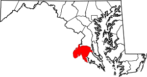 | |
| CDPs | ||
| Other communities | ||
| Principal cities |
|   | ||||||
|---|---|---|---|---|---|---|---|---|
| Counties and county equivalents* |
| |||||||
The District of Columbia itself, and Virginia's incorporated cities, are county equivalents. Virginia's incorporated cities are listed under their surrounding county. The incorporated cities bordering more than one county (Alexandria, Falls Church and Fredericksburg) are listed under the county they were part of before incorporation as a city. | ||||||||