L'Abergement-de-Cuisery
| L'Abergement-de-Cuisery | |
|---|---|
| Commune | |
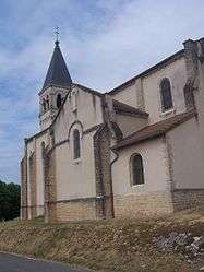 The church in L'Abergement-de-Cuisery | |
 L'Abergement-de-Cuisery Location within Bourgogne-Franche-Comté region  L'Abergement-de-Cuisery | |
| Coordinates: 46°34′44″N 4°57′39″E / 46.5789°N 4.9608°ECoordinates: 46°34′44″N 4°57′39″E / 46.5789°N 4.9608°E | |
| Country | France |
| Region | Bourgogne-Franche-Comté |
| Department | Saône-et-Loire |
| Arrondissement | Louhans |
| Canton | Cuiseaux |
| Intercommunality | Saône et Seille |
| Government | |
| • Mayor (2014–2020) | Thierry Colin |
| Area1 | 7.96 km2 (3.07 sq mi) |
| Population (2012)2 | 753 |
| • Density | 95/km2 (250/sq mi) |
| Time zone | UTC+1 (CET) |
| • Summer (DST) | UTC+2 (CEST) |
| INSEE/Postal code | 71001 /71290 |
| Elevation |
171–212 m (561–696 ft) (avg. 350 m or 1,150 ft) |
|
1 French Land Register data, which excludes lakes, ponds, glaciers > 1 km2 (0.386 sq mi or 247 acres) and river estuaries. 2 Population without double counting: residents of multiple communes (e.g., students and military personnel) only counted once. | |
L'Abergement-de-Cuisery is a commune in the Saône-et-Loire department in Bourgogne-Franche-Comté in eastern France.
Geography
The commune lies in the south of the department in the Saône valley, not far from Mâcon, the capital of the department.
Population
| Historical population | ||
|---|---|---|
| Year | Pop. | ±% |
| 1793 | 1,073 | — |
| 1806 | 992 | −7.5% |
| 1821 | 1,103 | +11.2% |
| 1831 | 1,137 | +3.1% |
| 1841 | 1,013 | −10.9% |
| 1851 | 1,007 | −0.6% |
| 1861 | 958 | −4.9% |
| 1872 | 936 | −2.3% |
| 1881 | 888 | −5.1% |
| 1891 | 831 | −6.4% |
| 1901 | 856 | +3.0% |
| 1911 | 734 | −14.3% |
| 1921 | 651 | −11.3% |
| 1931 | 627 | −3.7% |
| 1946 | 633 | +1.0% |
| 1954 | 622 | −1.7% |
| 1962 | 603 | −3.1% |
| 1968 | 609 | +1.0% |
| 1975 | 590 | −3.1% |
| 1982 | 584 | −1.0% |
| 1990 | 652 | +11.6% |
| 1999 | 640 | −1.8% |
| 2006 | 694 | +8.4% |
| 2012 | 753 | +8.5% |
See also
References
| Wikimedia Commons has media related to L'Abergement-de-Cuisery. |
This article is issued from
Wikipedia.
The text is licensed under Creative Commons - Attribution - Sharealike.
Additional terms may apply for the media files.